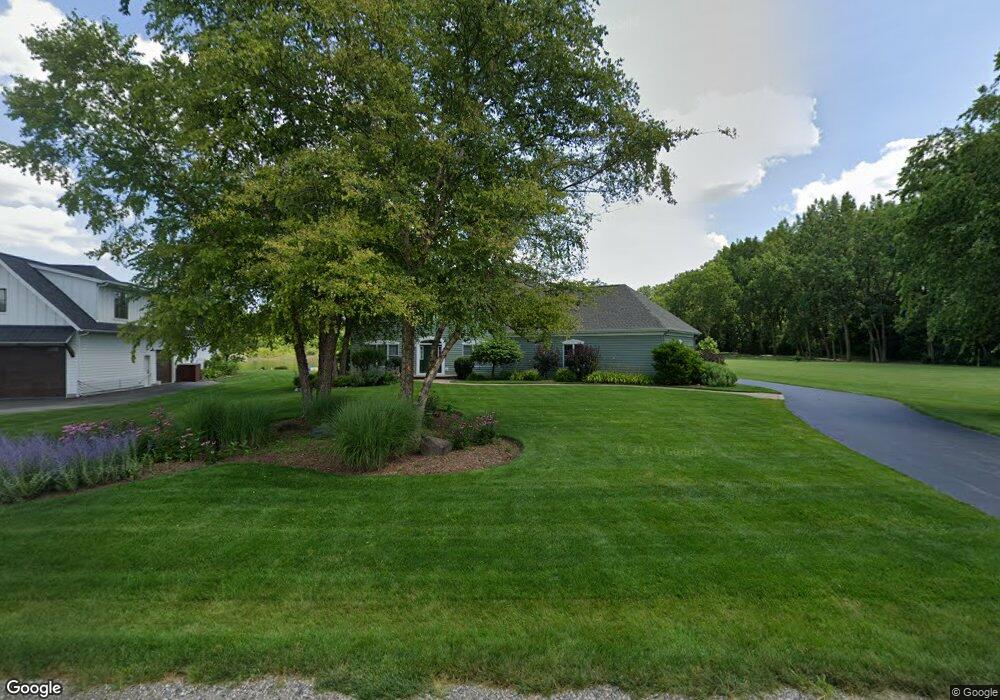
2014 Stone Dr McHenry, IL 60051
Estimated Value: $745,000 - $831,000
4
Beds
5
Baths
3,864
Sq Ft
$200/Sq Ft
Est. Value
About This Home
This home is located at 2014 Stone Dr, McHenry, IL 60051 and is currently estimated at $772,763, approximately $199 per square foot. 2014 Stone Dr is a home located in McHenry County with nearby schools including Chauncey H Duker School, Hilltop Elementary School, and Mchenry Middle School.
Ownership History
Date
Name
Owned For
Owner Type
Purchase Details
Closed on
Nov 30, 2017
Sold by
Sherman Jeanne B and Heanne B Sherman Trust
Bought by
Sherman David A and David A Sherman Trust
Current Estimated Value
Purchase Details
Closed on
Sep 1, 2004
Sold by
Bruns Nicholas J and Bruns Jane V
Bought by
Sherman Jeanne B
Home Financials for this Owner
Home Financials are based on the most recent Mortgage that was taken out on this home.
Original Mortgage
$420,000
Outstanding Balance
$188,700
Interest Rate
4.5%
Mortgage Type
Credit Line Revolving
Estimated Equity
$584,063
Purchase Details
Closed on
Oct 9, 1998
Sold by
Dream Development Corp
Bought by
Bruns Nicholas J and Bruns Jane
Home Financials for this Owner
Home Financials are based on the most recent Mortgage that was taken out on this home.
Original Mortgage
$106,200
Interest Rate
6.78%
Create a Home Valuation Report for This Property
The Home Valuation Report is an in-depth analysis detailing your home's value as well as a comparison with similar homes in the area
Home Values in the Area
Average Home Value in this Area
Purchase History
| Date | Buyer | Sale Price | Title Company |
|---|---|---|---|
| Sherman David A | -- | None Available | |
| Sherman Jeanne B | $440,000 | Ht | |
| Bruns Nicholas J | $105,000 | -- |
Source: Public Records
Mortgage History
| Date | Status | Borrower | Loan Amount |
|---|---|---|---|
| Open | Sherman Jeanne B | $420,000 | |
| Previous Owner | Bruns Nicholas J | $106,200 |
Source: Public Records
Tax History
| Year | Tax Paid | Tax Assessment Tax Assessment Total Assessment is a certain percentage of the fair market value that is determined by local assessors to be the total taxable value of land and additions on the property. | Land | Improvement |
|---|---|---|---|---|
| 2024 | $17,796 | $231,109 | $70,381 | $160,728 |
| 2023 | $17,358 | $207,254 | $63,116 | $144,138 |
| 2022 | $16,424 | $189,532 | $57,719 | $131,813 |
| 2021 | $15,785 | $177,697 | $54,115 | $123,582 |
| 2020 | $15,673 | $172,371 | $52,493 | $119,878 |
| 2019 | $15,294 | $163,882 | $49,908 | $113,974 |
| 2018 | $15,962 | $153,938 | $46,880 | $107,058 |
| 2017 | $15,716 | $147,479 | $44,913 | $102,566 |
| 2016 | $15,507 | $140,711 | $42,852 | $97,859 |
| 2013 | -- | $113,193 | $40,783 | $72,410 |
Source: Public Records
Map
Nearby Homes
- 2165 Walnut Glen Blvd
- 2110 Silver Leaf Dr
- 2009 Mayfair Dr
- 720 Tulip Cir
- 411 S Lily Lake Rd
- n/a S Lily Lake Rd
- Lot 8 & 9 S Lily Lake Rd
- 244 Red Oak Ct
- Lot 20 Holiday Dr
- LOT 8 W Plum St
- LOT 7 W Plum St
- Lot 5 Tower Dr
- 727 Nantucket Way Unit 1
- 640 Pleasant Place Unit 2
- lot 23 Park Dr
- 3203 S Bergman Dr
- 1807 Fargo Ave
- 3323 Charles Ct
- 610 W Wegner Rd
- 000 Carman Ave S
- 2010 Stone Dr
- 2004 Stone Dr
- 2018 Stone Dr
- 2013 Stone Dr
- 1920 Stone Dr
- 2009 Stone Dr
- 2005 Stone Dr
- 2001 Stone Dr
- 2020 Stone Dr
- 1918 Stone Dr
- 1917 Stone Dr
- 1913 Stone Dr
- 1908 Stone Dr
- 1909 Stone Dr
- 1913 Highwood Rd
- 1907 Highwood Rd
- 2117 Highwood Rd Unit 2
- 2110 Highwood Rd
- 2007 Highwood Rd
- 2115 Highwood Rd
Your Personal Tour Guide
Ask me questions while you tour the home.