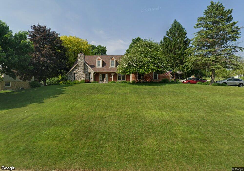
20140 Independence Dr Brookfield, WI 53045
Estimated Value: $575,613 - $624,000
4
Beds
3
Baths
1,399
Sq Ft
$435/Sq Ft
Est. Value
About This Home
This home is located at 20140 Independence Dr, Brookfield, WI 53045 and is currently estimated at $607,903, approximately $434 per square foot. 20140 Independence Dr is a home located in Waukesha County with nearby schools including Brookfield Elementary School, Wisconsin Hills Middle School, and Brookfield Central High School.
Ownership History
Date
Name
Owned For
Owner Type
Purchase Details
Closed on
Nov 12, 2024
Sold by
Nell Paul A and Nell Karen A
Bought by
Paul And Karen Nell Joint Trust and Nell
Current Estimated Value
Purchase Details
Closed on
Feb 8, 2002
Sold by
Mantone Anthony and Mantone Deborah R
Bought by
Nell Paul A and Nell Karen A
Home Financials for this Owner
Home Financials are based on the most recent Mortgage that was taken out on this home.
Original Mortgage
$150,000
Interest Rate
7.24%
Mortgage Type
Purchase Money Mortgage
Purchase Details
Closed on
Sep 24, 1997
Sold by
Allen Robert M and Allen Linda L
Bought by
Mantone Anthony and Mantone Deborah R
Home Financials for this Owner
Home Financials are based on the most recent Mortgage that was taken out on this home.
Original Mortgage
$159,920
Interest Rate
7.65%
Mortgage Type
Purchase Money Mortgage
Create a Home Valuation Report for This Property
The Home Valuation Report is an in-depth analysis detailing your home's value as well as a comparison with similar homes in the area
Home Values in the Area
Average Home Value in this Area
Purchase History
| Date | Buyer | Sale Price | Title Company |
|---|---|---|---|
| Paul And Karen Nell Joint Trust | -- | None Listed On Document | |
| Paul And Karen Nell Joint Trust | -- | None Listed On Document | |
| Nell Paul A | $244,000 | -- | |
| Mantone Anthony | $199,900 | -- |
Source: Public Records
Mortgage History
| Date | Status | Borrower | Loan Amount |
|---|---|---|---|
| Previous Owner | Nell Paul A | $150,000 | |
| Previous Owner | Mantone Anthony | $159,920 |
Source: Public Records
Tax History
| Year | Tax Paid | Tax Assessment Tax Assessment Total Assessment is a certain percentage of the fair market value that is determined by local assessors to be the total taxable value of land and additions on the property. | Land | Improvement |
|---|---|---|---|---|
| 2024 | $4,909 | $441,900 | $135,000 | $306,900 |
| 2023 | $4,908 | $441,900 | $135,000 | $306,900 |
| 2022 | $5,283 | $370,900 | $130,000 | $240,900 |
| 2021 | $5,594 | $370,900 | $130,000 | $240,900 |
| 2020 | $5,840 | $370,900 | $130,000 | $240,900 |
| 2019 | $5,608 | $370,900 | $130,000 | $240,900 |
Source: Public Records
Map
Nearby Homes
- 1775 Derrin Ln
- 1825 Derrin Ln
- 19775 Trilby Ct
- 850 Janacek Rd
- Lt0 Russet Dr
- 2000 Kathlynn Ct
- 1040 Lansdowne Ct Unit V6
- 18865 Tanala Dr
- 18825 Madeline Ln Unit D
- 1930 Cotton Tail Ln
- 2423 Kossow Rd
- 20305 Downing Ct
- 18775 Brookfield Lake Dr Unit 8
- 18500 Brookfield Lake Dr Unit 74
- 165 Aerie Cir Unit 105
- 18925 Eagle Dr Unit 101
- 18925 Eagle Dr Unit 102
- 18925 Eagle Dr Unit 202
- 18925 Eagle Dr Unit 201
- 18275 Brookfield Lake Dr Unit 93
- 1290 Washington Ct
- 1305 Washington Ct
- 20180 Independence Dr
- 20060 Independence Dr
- 1325 Washington Ct
- 1330 Centennial Ct
- 20125 Independence Dr
- 1310 Centennial Ct
- 20085 Independence Dr
- 1350 Washington Ct
- 1320 Washington Ct
- 20215 Independence Dr A
- 20045 Independence Dr
- 1315 Independence Dr
- 1350 Centennial Ct
- 20095 Freedom Ct
- 20185 Independence Dr Unit A
- 20185 Independence Dr Unit B
- 20155 Independence Dr Unit D
- 20155 Independence Dr Unit A
Your Personal Tour Guide
Ask me questions while you tour the home.