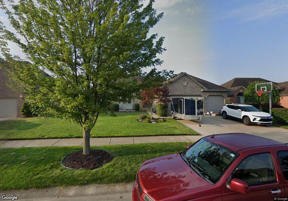
20142 Bannister Dr Macomb, MI 48044
Estimated Value: $441,000 - $519,000
Studio
1
Bath
2,198
Sq Ft
$218/Sq Ft
Est. Value
About This Home
This home is located at 20142 Bannister Dr, Macomb, MI 48044 and is currently estimated at $478,397, approximately $217 per square foot. 20142 Bannister Dr is a home located in Macomb County with nearby schools including Cheyenne Elementary School, Seneca Middle School, and Dakota High School.
Ownership History
Date
Name
Owned For
Owner Type
Purchase Details
Closed on
Dec 2, 2014
Sold by
Lusky Alan D and Lusky Alan
Bought by
Lusky Alan and Lusky Kathleen
Current Estimated Value
Home Financials for this Owner
Home Financials are based on the most recent Mortgage that was taken out on this home.
Original Mortgage
$228,000
Outstanding Balance
$127,845
Interest Rate
3.97%
Mortgage Type
New Conventional
Estimated Equity
$350,552
Purchase Details
Closed on
Sep 30, 2003
Sold by
Majestic Home Builders Inc
Bought by
Lusky Alan D
Create a Home Valuation Report for This Property
The Home Valuation Report is an in-depth analysis detailing your home's value as well as a comparison with similar homes in the area
Home Values in the Area
Average Home Value in this Area
Purchase History
| Date | Buyer | Sale Price | Title Company |
|---|---|---|---|
| Lusky Alan | -- | Sterling Title Agency | |
| Lusky Alan D | $265,463 | Metropolitan Title Company |
Source: Public Records
Mortgage History
| Date | Status | Borrower | Loan Amount |
|---|---|---|---|
| Open | Lusky Alan | $228,000 |
Source: Public Records
Tax History
| Year | Tax Paid | Tax Assessment Tax Assessment Total Assessment is a certain percentage of the fair market value that is determined by local assessors to be the total taxable value of land and additions on the property. | Land | Improvement |
|---|---|---|---|---|
| 2025 | $3,966 | $225,900 | $0 | $0 |
| 2024 | $39 | $223,300 | $0 | $0 |
| 2023 | $3,657 | $205,900 | $0 | $0 |
| 2022 | $4,587 | $183,500 | $0 | $0 |
| 2021 | $4,462 | $174,000 | $0 | $0 |
| 2020 | $3,355 | $169,000 | $0 | $0 |
| 2019 | $4,130 | $158,700 | $0 | $0 |
| 2018 | $4,026 | $153,300 | $0 | $0 |
| 2017 | $3,963 | $146,750 | $34,500 | $112,250 |
| 2016 | $3,761 | $146,750 | $0 | $0 |
| 2015 | $3,711 | $136,850 | $0 | $0 |
| 2014 | $3,711 | $123,870 | $23,500 | $100,370 |
| 2011 | $747 | $119,530 | $20,500 | $99,030 |
Source: Public Records
Map
Nearby Homes
- 20379 Bannister Dr
- 19732 Fillmore Dr
- 20350 Hummingbird Ln
- 48498 Beacon Square Dr
- 20776 Wexford Dr
- 20580 21 Mile Rd
- 21122 Summerfield Dr
- 47983 Sage Dr
- 48767 Brittany Parc Dr
- 19424 Norway Pine Dr
- 21220 Briar Rose Dr
- 21258 Fairfield Dr
- 50675-50811 Romeo Plank Rd
- 19389 Lakeland Dr
- 19852 Keats Ct
- 46569 Cheylade Dr
- 46856 Jewel Unit 8
- 18894 Via Firenze
- 21123 Chateau Thierry Dr N
- 21254 Clayton Dr
- 20170 Bannister Dr
- 20114 Bannister Dr
- 20169 Ramblewood Dr
- 20189 Ramblewood Dr
- 20198 Bannister Dr
- 20141 Ramblewood Dr
- 20086 Bannister Dr
- 47851 Dakota Dr
- 20207 Ramblewood Dr
- 20103 Ramblewood Dr
- 20226 Bannister Dr
- 20211 Bannister Dr
- 20225 Ramblewood Dr
- 20075 Ramblewood Dr
- 20058 Bannister Dr
- 47883 Dakota Dr
- 20254 Bannister Dr
- 20239 Bannister Dr
- 20243 Ramblewood Dr
- 20164 Ramblewood Dr
Your Personal Tour Guide
Ask me questions while you tour the home.