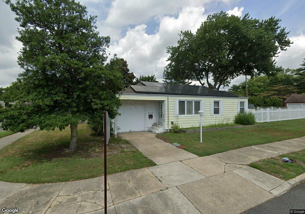
2015 Amherst Ave Northfield, NJ 08225
Estimated Value: $332,679 - $358,000
--
Bed
--
Bath
1,175
Sq Ft
$294/Sq Ft
Est. Value
About This Home
This home is located at 2015 Amherst Ave, Northfield, NJ 08225 and is currently estimated at $345,420, approximately $293 per square foot. 2015 Amherst Ave is a home located in Atlantic County with nearby schools including Northfield Community Elementary School, Northfield Community Middle School, and Mainland Regional High School.
Ownership History
Date
Name
Owned For
Owner Type
Purchase Details
Closed on
Oct 19, 2001
Sold by
Fortner Patricia
Bought by
Desale Jennifer M
Current Estimated Value
Home Financials for this Owner
Home Financials are based on the most recent Mortgage that was taken out on this home.
Original Mortgage
$117,800
Interest Rate
6.82%
Purchase Details
Closed on
Nov 30, 1999
Sold by
Drury Michael and Drury Alicia
Bought by
Fortner Patricia
Home Financials for this Owner
Home Financials are based on the most recent Mortgage that was taken out on this home.
Original Mortgage
$97,546
Interest Rate
7.9%
Mortgage Type
FHA
Create a Home Valuation Report for This Property
The Home Valuation Report is an in-depth analysis detailing your home's value as well as a comparison with similar homes in the area
Home Values in the Area
Average Home Value in this Area
Purchase History
| Date | Buyer | Sale Price | Title Company |
|---|---|---|---|
| Desale Jennifer M | $124,000 | -- | |
| Fortner Patricia | $106,000 | Commonwealth Land Title Ins |
Source: Public Records
Mortgage History
| Date | Status | Borrower | Loan Amount |
|---|---|---|---|
| Previous Owner | Desale Jennifer M | $117,800 | |
| Previous Owner | Fortner Patricia | $97,546 |
Source: Public Records
Tax History Compared to Growth
Tax History
| Year | Tax Paid | Tax Assessment Tax Assessment Total Assessment is a certain percentage of the fair market value that is determined by local assessors to be the total taxable value of land and additions on the property. | Land | Improvement |
|---|---|---|---|---|
| 2025 | $5,938 | $165,300 | $62,200 | $103,100 |
| 2024 | $5,938 | $165,300 | $62,200 | $103,100 |
| 2023 | $5,772 | $165,300 | $62,200 | $103,100 |
| 2022 | $5,772 | $165,300 | $62,200 | $103,100 |
| 2021 | $5,711 | $165,300 | $62,200 | $103,100 |
| 2020 | $5,733 | $165,300 | $62,200 | $103,100 |
| 2019 | $5,635 | $165,300 | $62,200 | $103,100 |
| 2018 | $5,534 | $165,300 | $62,200 | $103,100 |
| 2017 | $5,351 | $165,300 | $62,200 | $103,100 |
| 2016 | $5,138 | $165,300 | $62,200 | $103,100 |
| 2015 | $5,066 | $165,300 | $62,200 | $103,100 |
| 2014 | $4,790 | $165,300 | $62,200 | $103,100 |
Source: Public Records
Map
Nearby Homes
- 100 E Rosedale Ave
- 1611 Shore Rd
- 2510 Shore Rd
- 102 E Glencove Ave
- 12 Oakview Dr
- 19 Locust Dr
- 41 E Vernon Ave
- 108 E Vernon Ave
- 309 Clark Place
- 15 Northfield Ave
- 219 Northfield Ave
- 221 Northfield Ave
- 1202 Shore Rd
- 413 W Oakcrest Ave
- 11 Roosevelt Ave
- 2 Jenny Lynn Dr
- 2024 Zion Rd
- 301 Wabash Ave
- 603 Banning Ave
- 607 Herzel Ave
- 9 Surrey Ave
- 2014 Amherst Ave
- 20 Steelman Ave
- 2101 Amherst Ave
- 6 Surrey Ave
- 109 Surrey Ave
- 12 Steelman Ave
- 2100 Amherst Ave
- 4 E Surrey Ave
- 4 Surrey Ave
- 102 Steelman Ave
- 3 Surrey Ave
- 2 Surrey Ave
- 108 Surrey Ave
- 113 Surrey Ave
- 108 Steelman Ave
- 17 E Steelman Ave
- 15 E Yorkshire Ave
- 2110 Amherst Ave
- 21 Steelman Ave