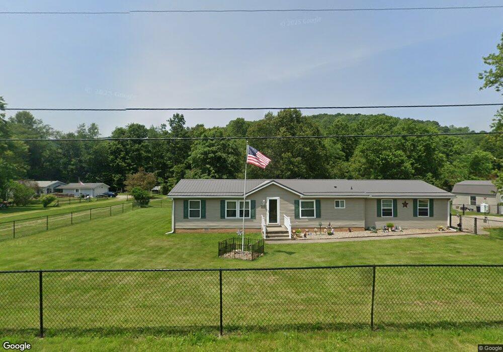
2015 Barnhill Rd SE New Philadelphia, OH 44663
Estimated Value: $145,000 - $183,180
3
Beds
2
Baths
1,144
Sq Ft
$148/Sq Ft
Est. Value
About This Home
This home is located at 2015 Barnhill Rd SE, New Philadelphia, OH 44663 and is currently estimated at $169,045, approximately $147 per square foot. 2015 Barnhill Rd SE is a home located in Tuscarawas County with nearby schools including Midvale Elementary School, Tuscarawas Middle School, and Indian Valley High School.
Ownership History
Date
Name
Owned For
Owner Type
Purchase Details
Closed on
Aug 15, 2008
Sold by
Swinderman James L and Swinderman Mary L
Bought by
Crall Ronald E and Crall Karen R
Current Estimated Value
Home Financials for this Owner
Home Financials are based on the most recent Mortgage that was taken out on this home.
Original Mortgage
$85,655
Outstanding Balance
$56,383
Interest Rate
6.39%
Mortgage Type
FHA
Estimated Equity
$112,662
Purchase Details
Closed on
Jul 29, 2004
Sold by
Gianfrancesco Rachel S
Bought by
Swinderman James L and Swinderman Mary L
Home Financials for this Owner
Home Financials are based on the most recent Mortgage that was taken out on this home.
Original Mortgage
$68,900
Interest Rate
5.74%
Mortgage Type
Purchase Money Mortgage
Purchase Details
Closed on
Oct 1, 2002
Sold by
Deardorff Timmie L
Bought by
Gianfrancesco Rachel S
Create a Home Valuation Report for This Property
The Home Valuation Report is an in-depth analysis detailing your home's value as well as a comparison with similar homes in the area
Home Values in the Area
Average Home Value in this Area
Purchase History
| Date | Buyer | Sale Price | Title Company |
|---|---|---|---|
| Crall Ronald E | $87,000 | Tusc Title | |
| Swinderman James L | $177,800 | -- | |
| Gianfrancesco Rachel S | $89,000 | -- |
Source: Public Records
Mortgage History
| Date | Status | Borrower | Loan Amount |
|---|---|---|---|
| Open | Crall Ronald E | $85,655 | |
| Closed | Swinderman James L | $68,900 |
Source: Public Records
Tax History Compared to Growth
Tax History
| Year | Tax Paid | Tax Assessment Tax Assessment Total Assessment is a certain percentage of the fair market value that is determined by local assessors to be the total taxable value of land and additions on the property. | Land | Improvement |
|---|---|---|---|---|
| 2024 | $1,375 | $36,760 | $6,830 | $29,930 |
| 2023 | $1,375 | $105,000 | $19,500 | $85,500 |
| 2022 | $1,201 | $36,750 | $6,825 | $29,925 |
| 2021 | $1,180 | $34,426 | $5,824 | $28,602 |
| 2020 | $1,289 | $34,426 | $5,824 | $28,602 |
| 2019 | $1,298 | $34,426 | $5,824 | $28,602 |
| 2018 | $1,159 | $29,050 | $4,910 | $24,140 |
| 2017 | $1,161 | $29,050 | $4,910 | $24,140 |
| 2016 | $1,172 | $29,050 | $4,910 | $24,140 |
| 2014 | $1,141 | $27,170 | $4,100 | $23,070 |
| 2013 | $1,126 | $27,170 | $4,100 | $23,070 |
Source: Public Records
Map
Nearby Homes
- 4711 Broadway
- 0 Royal St
- 0 Vernon St Unit 5009296
- 973 Baltzley Valley Rd SE
- 2923 Brightwood Rd SE
- 2993 Brightwood Rd SE
- 3264 Simpson Rd SE
- 5920 Main St SE
- 5876 Main St SE
- 5785 Main St SE
- 2025 N Water Street Extension
- 4161 Indian Hill Rd SE
- 2163 E High Ave
- 1508 Roanoke Ave
- 377 Schoenbrunn Dr NE
- 247 Kent Cir NE
- 0 Irish Run Rd SE
- 1221 Eastport Ave
- 1000 N 2nd St
- 934 Parrish St
- 2015 Barnhill Rd
- 2020 Barnhill Rd
- 2000 Barnhill Rd
- 2030 Barnhill Rd
- 1976 Barnhill Rd
- 2030 Barnhill Rd SE
- 1942 Roxford St
- 1948 Roxford St
- 1956 Barnhill Rd
- 1912 Roxford St
- 1928 Roxford St
- 2068 Barnhill Rd
- 1892 Roxford St
- 1974 Reynolds Ln
- 2124 Barnhill Rd
- 1923 Barnhill Rd
- 1843 Roxford St
- 1866 Barnhill Rd
- 1826 Roxford St
- 2154 Barnhill Rd