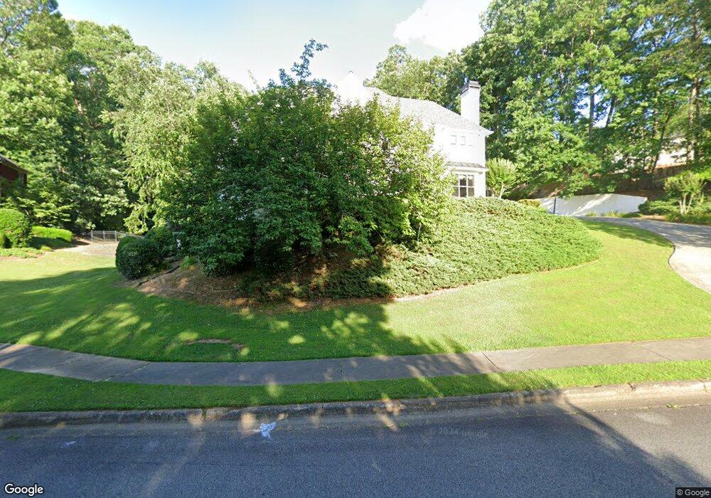
2015 Brassfield Way Unit 23 Roswell, GA 30075
Brookfield West NeighborhoodEstimated Value: $897,000 - $1,259,000
4
Beds
4
Baths
4,715
Sq Ft
$225/Sq Ft
Est. Value
About This Home
This home is located at 2015 Brassfield Way Unit 23, Roswell, GA 30075 and is currently estimated at $1,059,110, approximately $224 per square foot. 2015 Brassfield Way Unit 23 is a home located in Fulton County with nearby schools including Mountain Park Elementary School, Crabapple Middle School, and Roswell High School.
Ownership History
Date
Name
Owned For
Owner Type
Purchase Details
Closed on
Jan 8, 2001
Sold by
Barrett David E
Bought by
Barrett Denise C
Current Estimated Value
Purchase Details
Closed on
Nov 29, 1995
Sold by
Rochlin Steven A Susan E
Bought by
Barrett David E Denise C
Create a Home Valuation Report for This Property
The Home Valuation Report is an in-depth analysis detailing your home's value as well as a comparison with similar homes in the area
Home Values in the Area
Average Home Value in this Area
Purchase History
| Date | Buyer | Sale Price | Title Company |
|---|---|---|---|
| Barrett Denise C | -- | -- | |
| Barrett David E Denise C | $443,700 | -- |
Source: Public Records
Mortgage History
| Date | Status | Borrower | Loan Amount |
|---|---|---|---|
| Closed | Barrett David E Denise C | $0 |
Source: Public Records
Tax History Compared to Growth
Tax History
| Year | Tax Paid | Tax Assessment Tax Assessment Total Assessment is a certain percentage of the fair market value that is determined by local assessors to be the total taxable value of land and additions on the property. | Land | Improvement |
|---|---|---|---|---|
| 2025 | $1,231 | $386,000 | $51,680 | $334,320 |
| 2023 | $1,231 | $336,920 | $81,320 | $255,600 |
| 2022 | $5,516 | $315,320 | $33,680 | $281,640 |
| 2021 | $6,470 | $220,760 | $29,320 | $191,440 |
| 2020 | $6,422 | $206,160 | $34,040 | $172,120 |
| 2019 | $1,011 | $214,240 | $35,520 | $178,720 |
| 2018 | $5,563 | $209,200 | $34,680 | $174,520 |
| 2017 | $5,349 | $195,280 | $22,920 | $172,360 |
| 2016 | $5,348 | $195,280 | $22,920 | $172,360 |
| 2015 | $6,435 | $195,280 | $22,920 | $172,360 |
| 2014 | $4,724 | $166,840 | $29,600 | $137,240 |
Source: Public Records
Map
Nearby Homes
- 1005 Hedgerose Ln
- 865 Ferncroft Ct
- 1090 Oakhaven Dr
- 5407 Waters Edge Trail
- 3412 Waters Edge Trail
- 680 Brookfield Pkwy Unit 1
- 4405 Village Green Dr
- 4201 Village Green Dr
- 1460 Lakemist Ct
- 2010 Stonehedge Rd
- 715 Winterwind Way
- 1065 Laurian Park Dr
- 105 Beech Tree Ln
- 475 Laurian View Ct
- 11115 Bowen Rd
- 140 E Lake Dr
- 345 Chaffin Ridge Ct
- 11850 Chaffin Rd
- 112 Cherry 0 Cherry St
- 1515 Elgaen Place Dr
- 2025 Brassfield Way
- 1075 Brooksglen Dr
- 1065 Brooksglen Dr
- 1085 Brooksglen Dr Unit 23
- 2035 Brassfield Way Unit 23
- 2030 Brassfield Way
- 620 Ridgebrook Point Unit 18
- 2040 Brassfield Way
- 2020 Brassfield Way
- 1050 Brooksglen Dr
- 2000 Brassfield Way
- 2000 Brassfield Way Unit Un 23
- 2045 Brassfield Way Unit 23
- 1060 Brooksglen Dr
- 1055 Brooksglen Dr
- 2050 Brassfield Way
- 1040 Brooksglen Dr
- 2010 Brassfield Way
- 615 Ridgebrook Point
- 610 Ridgebrook Point Unit 18