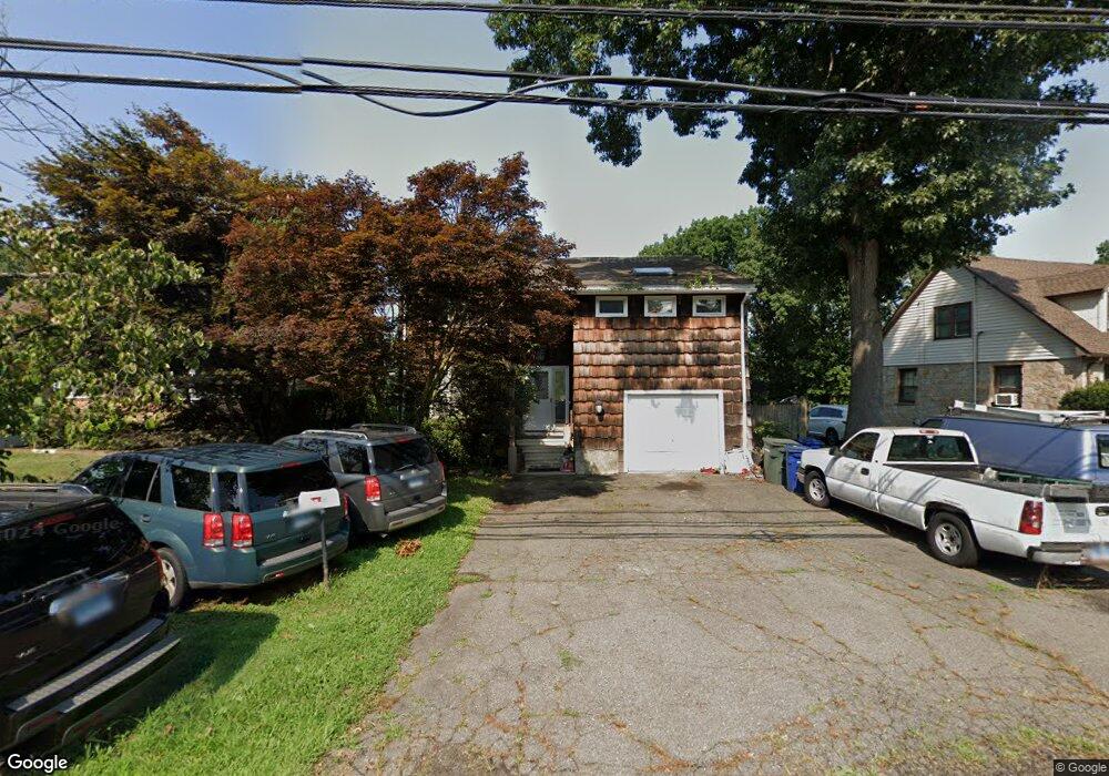
2015 Chopsey Hill Rd Bridgeport, CT 06606
North End NeighborhoodEstimated Value: $480,000 - $537,000
4
Beds
3
Baths
2,106
Sq Ft
$243/Sq Ft
Est. Value
About This Home
This home is located at 2015 Chopsey Hill Rd, Bridgeport, CT 06606 and is currently estimated at $510,875, approximately $242 per square foot. 2015 Chopsey Hill Rd is a home located in Fairfield County with nearby schools including Wilbur L. Cross Elementary School, Central High School, and Northeastern Adventist Academy - Fairfield County.
Ownership History
Date
Name
Owned For
Owner Type
Purchase Details
Closed on
Sep 29, 2020
Sold by
Mcdowell Michael D
Bought by
Mcdowell Michael D and Mcdowell Gabrielle
Current Estimated Value
Purchase Details
Closed on
Sep 15, 1978
Bought by
Mcdowell Michael D
Create a Home Valuation Report for This Property
The Home Valuation Report is an in-depth analysis detailing your home's value as well as a comparison with similar homes in the area
Home Values in the Area
Average Home Value in this Area
Purchase History
| Date | Buyer | Sale Price | Title Company |
|---|---|---|---|
| Mcdowell Michael D | -- | None Available | |
| Mcdowell Michael D | -- | None Available | |
| Mcdowell Michael D | -- | -- |
Source: Public Records
Mortgage History
| Date | Status | Borrower | Loan Amount |
|---|---|---|---|
| Previous Owner | Mcdowell Michael D | $160,000 | |
| Previous Owner | Mcdowell Michael D | $115,600 |
Source: Public Records
Tax History Compared to Growth
Tax History
| Year | Tax Paid | Tax Assessment Tax Assessment Total Assessment is a certain percentage of the fair market value that is determined by local assessors to be the total taxable value of land and additions on the property. | Land | Improvement |
|---|---|---|---|---|
| 2025 | $8,167 | $187,962 | $72,052 | $115,910 |
| 2024 | $8,167 | $187,962 | $72,052 | $115,910 |
| 2023 | $8,167 | $187,962 | $72,052 | $115,910 |
| 2022 | $8,167 | $187,962 | $72,052 | $115,910 |
| 2021 | $8,167 | $187,962 | $72,052 | $115,910 |
| 2020 | $8,948 | $165,730 | $56,490 | $109,240 |
| 2019 | $8,948 | $165,730 | $56,490 | $109,240 |
| 2018 | $9,011 | $165,730 | $56,490 | $109,240 |
| 2017 | $9,011 | $165,730 | $56,490 | $109,240 |
| 2016 | $9,011 | $165,730 | $56,490 | $109,240 |
| 2015 | $8,155 | $193,250 | $55,570 | $137,680 |
| 2014 | $8,155 | $193,250 | $55,570 | $137,680 |
Source: Public Records
Map
Nearby Homes
- 1675 Old Town Rd
- 1800 Chopsey Hill Rd
- 45 Rogerson Cir
- 135 Grey Rock Rd
- 715 Frenchtown Rd Unit 31
- 32 Karen Ct Unit b
- 26 Karen Ct Unit A
- 165 Yaremich Dr
- 238 Griffin Ave
- 182 Trumbull Ave
- 65 Clearview Dr
- 291 Frenchtown Rd
- 7 Stone Ridge Rd
- 90 Sequoia Rd
- 181 Cityview Ave
- 539 Old Town Rd
- 142 Chatham Terrace
- 365 Platt St
- 36 Platt St
- 54 Agnes St
- 2005 Chopsey Hill Rd
- 1503 Old Town Rd
- 1995 Chopsey Hill Rd
- 1993 Chopsey Hill Rd
- 1509 Old Town Rd
- 230 Village Ln
- 220 Village Ln
- 1975 Chopsey Hill Rd
- 250 Village Ln
- 1515 Old Town Rd
- 1535 Old Town Rd
- 1465 Old Town Rd
- 2006 Chopsey Hill Rd
- 212 Village Ln
- 1965 Chopsey Hill Rd
- 1990 Chopsey Hill Rd
- 285 Village Ln
- 1980 Chopsey Hill Rd
- 235 Village Ln
- 1978 Chopsey Hill Rd