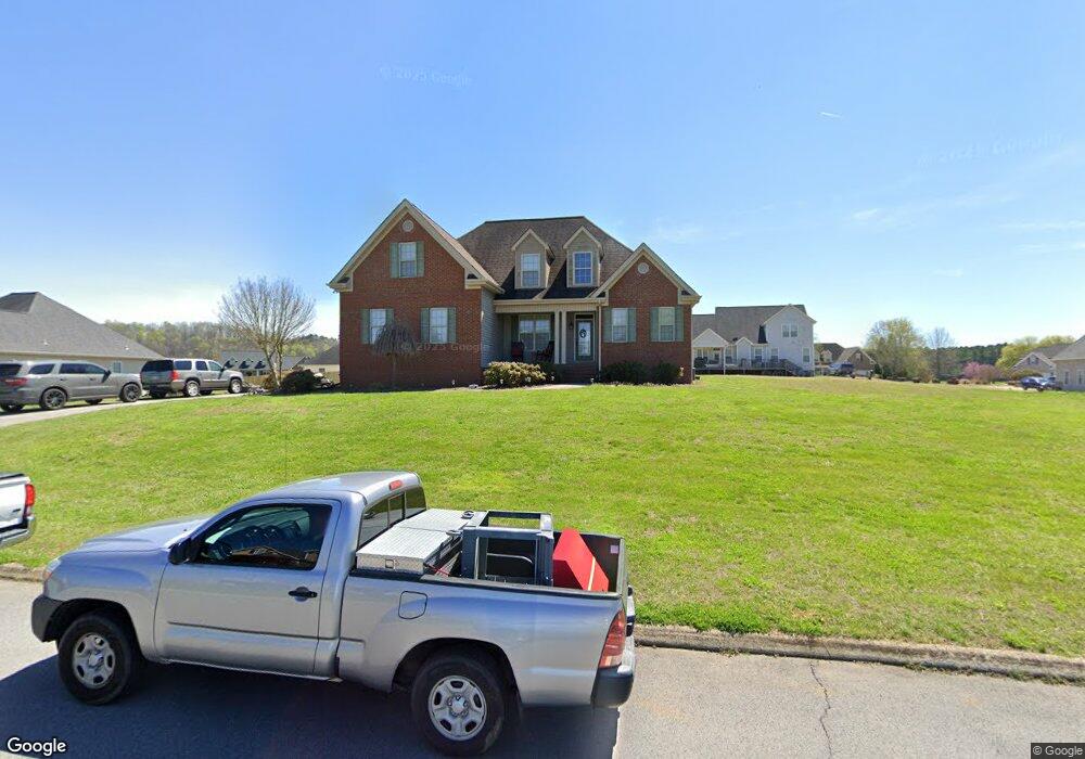
2015 Dove Ln Rocky Face, GA 30740
Estimated Value: $348,809 - $430,000
3
Beds
3
Baths
2,007
Sq Ft
$197/Sq Ft
Est. Value
About This Home
This home is located at 2015 Dove Ln, Rocky Face, GA 30740 and is currently estimated at $395,952, approximately $197 per square foot. 2015 Dove Ln is a home located in Whitfield County with nearby schools including Westside Elementary School, Westside Middle School, and Northwest Whitfield County High School.
Ownership History
Date
Name
Owned For
Owner Type
Purchase Details
Closed on
Mar 31, 2009
Sold by
Vinyard Marvin A
Bought by
Addis Daniel
Current Estimated Value
Home Financials for this Owner
Home Financials are based on the most recent Mortgage that was taken out on this home.
Original Mortgage
$182,700
Outstanding Balance
$116,976
Interest Rate
5.18%
Mortgage Type
New Conventional
Estimated Equity
$278,976
Purchase Details
Closed on
Apr 21, 2006
Sold by
Not Provided
Bought by
Addis Daniel and Addis Ethel
Create a Home Valuation Report for This Property
The Home Valuation Report is an in-depth analysis detailing your home's value as well as a comparison with similar homes in the area
Home Values in the Area
Average Home Value in this Area
Purchase History
| Date | Buyer | Sale Price | Title Company |
|---|---|---|---|
| Addis Daniel | $203,000 | -- | |
| Addis Daniel | $32,000 | -- |
Source: Public Records
Mortgage History
| Date | Status | Borrower | Loan Amount |
|---|---|---|---|
| Open | Addis Daniel | $182,700 |
Source: Public Records
Tax History Compared to Growth
Tax History
| Year | Tax Paid | Tax Assessment Tax Assessment Total Assessment is a certain percentage of the fair market value that is determined by local assessors to be the total taxable value of land and additions on the property. | Land | Improvement |
|---|---|---|---|---|
| 2024 | $2,907 | $132,892 | $18,000 | $114,892 |
| 2023 | $2,907 | $104,054 | $13,440 | $90,614 |
| 2022 | $2,292 | $86,258 | $13,440 | $72,818 |
| 2021 | $2,304 | $86,636 | $13,440 | $73,196 |
| 2020 | $2,370 | $86,636 | $13,440 | $73,196 |
| 2019 | $2,292 | $83,042 | $13,440 | $69,602 |
| 2018 | $2,324 | $83,042 | $13,440 | $69,602 |
| 2017 | $2,325 | $83,042 | $13,440 | $69,602 |
| 2016 | $2,058 | $76,744 | $13,440 | $63,304 |
| 2014 | $1,867 | $76,744 | $13,440 | $63,304 |
| 2013 | -- | $76,744 | $13,440 | $63,304 |
Source: Public Records
Map
Nearby Homes
- 1005 Robin Way
- 1446 Lafayette Rd
- Tract 1 A & B I-75 Beavers Rd
- 4125 Dunnagan Rd
- 35 acres Lafayette Rd
- 0 Lafayette Unit 131389
- 0 Freeman Springs Rd Unit 121469
- 35 Acres Lafayette Rd
- 110 Windy Hill Dr
- 2335 Coley Farm Rd
- 967 Lafayette Rd
- 2950 Davis Rd
- 2906 Davis Rd
- 2386 Utility Rd
- 257 Old Babb Rd
- 0 Quarles Rd Unit 1523297
- 4744 N Jimmy Dr
- 2015 Westin Way
- 4177 S Jimmy Dr
- 1461 Houston Valley Rd
- 1090 Robin Way
- 2025 Dove Ln
- 2005 Dove Ln
- 1060 Robin Way
- 2010 Dove Ln
- 2030 Dove Ln
- 1100 Robin Way
- 1010 Robin Way
- 2020 Dove Ln
- Lot 8 Robin Way
- Lot 10 Robin Way
- Lot 19 Dove Ln
- 1085 Robin Way
- 1095 Robin Way
- 1075 Robin Way
- 2505 2505 Dug Gap Battle Rd Rd
- 34 Highland Cir
- 0 Valley Way Unit 5269447
- 0 Valley Way Unit 103268
- 0 Valley Way Unit 104160