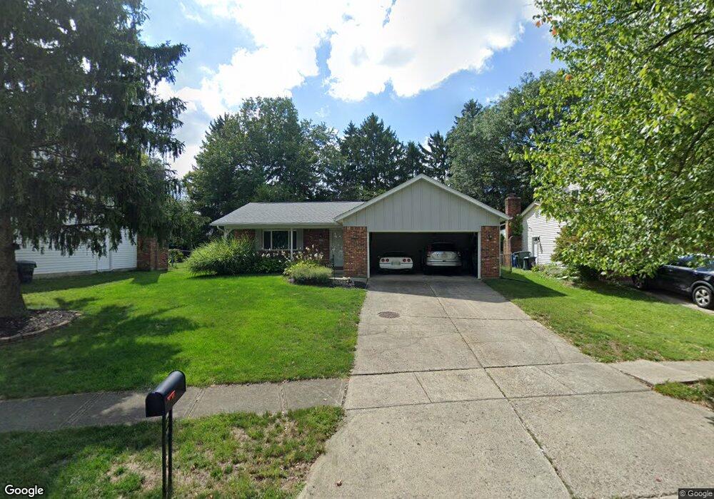
2015 Fincastle Ct Columbus, OH 43235
Brookside Colony NeighborhoodEstimated Value: $296,000 - $397,000
3
Beds
2
Baths
1,196
Sq Ft
$298/Sq Ft
Est. Value
About This Home
This home is located at 2015 Fincastle Ct, Columbus, OH 43235 and is currently estimated at $355,938, approximately $297 per square foot. 2015 Fincastle Ct is a home located in Franklin County with nearby schools including Granby Elementary School, McCord Middle School, and Worthington Kilbourne High School.
Ownership History
Date
Name
Owned For
Owner Type
Purchase Details
Closed on
Oct 8, 2008
Sold by
Draudt Jo Ann and Simmons Jo Ann
Bought by
Draudt Terry A
Current Estimated Value
Home Financials for this Owner
Home Financials are based on the most recent Mortgage that was taken out on this home.
Original Mortgage
$99,500
Outstanding Balance
$63,901
Interest Rate
5.73%
Mortgage Type
Purchase Money Mortgage
Estimated Equity
$292,037
Purchase Details
Closed on
Feb 2, 1976
Bought by
Draudt Terry A and Draudt Joann
Create a Home Valuation Report for This Property
The Home Valuation Report is an in-depth analysis detailing your home's value as well as a comparison with similar homes in the area
Home Values in the Area
Average Home Value in this Area
Purchase History
| Date | Buyer | Sale Price | Title Company |
|---|---|---|---|
| Draudt Terry A | -- | Attorney | |
| Draudt Terry A | -- | -- |
Source: Public Records
Mortgage History
| Date | Status | Borrower | Loan Amount |
|---|---|---|---|
| Open | Draudt Terry A | $99,500 |
Source: Public Records
Tax History Compared to Growth
Tax History
| Year | Tax Paid | Tax Assessment Tax Assessment Total Assessment is a certain percentage of the fair market value that is determined by local assessors to be the total taxable value of land and additions on the property. | Land | Improvement |
|---|---|---|---|---|
| 2024 | $6,281 | $112,110 | $25,380 | $86,730 |
| 2023 | $6,044 | $112,105 | $25,375 | $86,730 |
| 2022 | $5,545 | $83,690 | $17,850 | $65,840 |
| 2021 | $5,115 | $83,690 | $17,850 | $65,840 |
| 2020 | $4,927 | $83,690 | $17,850 | $65,840 |
| 2019 | $3,599 | $58,140 | $14,880 | $43,260 |
| 2018 | $3,302 | $54,710 | $14,880 | $39,830 |
| 2017 | $3,001 | $54,710 | $14,880 | $39,830 |
| 2016 | $3,360 | $56,070 | $13,230 | $42,840 |
| 2015 | $3,360 | $56,070 | $13,230 | $42,840 |
| 2014 | $3,359 | $56,070 | $13,230 | $42,840 |
| 2013 | $1,671 | $56,070 | $13,230 | $42,840 |
Source: Public Records
Map
Nearby Homes
- 2056 Fincastle Ct
- 6921 Spruce Pine Dr
- 1930 Shallowford Ave
- 2161 Heatherfield Ave
- 7456 Mapleleaf Ct
- 1889 Slaton Ct Unit 1889
- 2001 Sawbury Blvd Unit 2001
- 1721 Worthington Run Dr Unit 1721-1731
- 7373 Palmleaf Ln
- 1637 Park Row Dr Unit F
- 1828 Gardenstone Dr
- 1620 Park Row Dr Unit A
- 2687 Snouffer Rd
- 2220 Surreygate Dr
- 2392 Dunsworth Dr
- 2074 Hard Rd
- 7680 Foxboro Ln
- 7734 Henry David Ct
- 2456 Sanford Dr
- 2469 Sandstrom Dr
- 2007 Fincastle Ct
- 2023 Fincastle Ct
- 6990 Spruce Pine Dr
- 2031 Fincastle Ct
- 1999 Queensbridge Dr
- 7000 Spruce Pine Dr
- 6982 Spruce Pine Dr
- 2009 Queensbridge Dr
- 1991 Queensbridge Dr
- 6976 Spruce Pine Dr
- 2039 Fincastle Ct
- 2030 Fincastle Ct
- 6955 Pine Bark Ln
- 2017 Queensbridge Dr
- 1983 Queensbridge Dr
- 2047 Fincastle Ct
- 2040 Fincastle Ct
- 2056 Flanders Ct
- 6943 Pine Bark Ln
- 2023 Queensbridge Dr