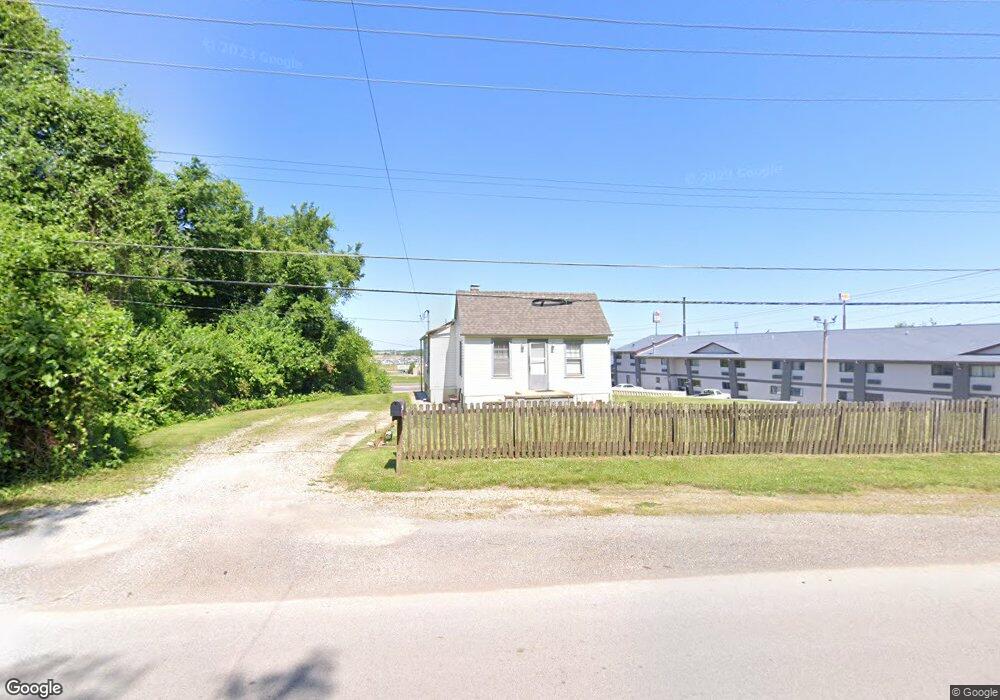
2015 N 89th St Caseyville, IL 62232
Estimated Value: $65,000 - $107,000
2
Beds
1
Bath
953
Sq Ft
$91/Sq Ft
Est. Value
About This Home
This home is located at 2015 N 89th St, Caseyville, IL 62232 and is currently estimated at $87,037, approximately $91 per square foot. 2015 N 89th St is a home located in St. Clair County with nearby schools including Mason/Clark Middle School, James Avant Elementary School, and East St Louis Senior High School.
Ownership History
Date
Name
Owned For
Owner Type
Purchase Details
Closed on
Oct 14, 2019
Sold by
Kumar Hiven and Kumar Potatlal
Bought by
Patel Tejusviben Hirenkumar
Current Estimated Value
Purchase Details
Closed on
Dec 7, 2017
Sold by
Hp Management Group Inc
Bought by
Patel Hirenkumar Popatial
Purchase Details
Closed on
Sep 15, 2014
Sold by
Pmsah Inc
Bought by
Hp Management Group Inc
Purchase Details
Closed on
Apr 9, 2010
Sold by
Patel Popatlal S
Bought by
Pmsah Inc
Purchase Details
Closed on
Jun 18, 2001
Sold by
Brahmani Investment Inc
Bought by
Patel Popatlal S
Create a Home Valuation Report for This Property
The Home Valuation Report is an in-depth analysis detailing your home's value as well as a comparison with similar homes in the area
Home Values in the Area
Average Home Value in this Area
Purchase History
| Date | Buyer | Sale Price | Title Company |
|---|---|---|---|
| Patel Tejusviben Hirenkumar | -- | None Available | |
| Patel Hirenkumar Popatial | -- | None Available | |
| Hp Management Group Inc | -- | None Available | |
| Pmsah Inc | -- | None Available | |
| Patel Popatlal S | -- | -- |
Source: Public Records
Tax History Compared to Growth
Tax History
| Year | Tax Paid | Tax Assessment Tax Assessment Total Assessment is a certain percentage of the fair market value that is determined by local assessors to be the total taxable value of land and additions on the property. | Land | Improvement |
|---|---|---|---|---|
| 2024 | $2,556 | $18,607 | $2,163 | $16,444 |
| 2023 | $2,585 | $18,134 | $2,108 | $16,026 |
| 2022 | $2,357 | $16,664 | $1,937 | $14,727 |
| 2021 | $1,948 | $13,369 | $1,930 | $11,439 |
| 2020 | $2,024 | $13,438 | $1,940 | $11,498 |
| 2019 | $2,194 | $13,438 | $1,940 | $11,498 |
| 2018 | $2,323 | $13,641 | $1,969 | $11,672 |
| 2017 | $2,240 | $12,945 | $1,887 | $11,058 |
| 2016 | $2,220 | $13,027 | $1,899 | $11,128 |
| 2014 | $2,242 | $13,027 | $1,899 | $11,128 |
| 2013 | $2,310 | $19,836 | $10,648 | $9,188 |
Source: Public Records
Map
Nearby Homes
- 22 Kassing Dr
- 2510 N 89th St
- 1619 Pontiac Rd
- 9058 Crest Dr
- 9017 Crest Dr
- 9019 Crest Dr
- 9021 Crest Dr
- 23 Enterprise Rd
- 1428 1st Ave
- 9153 Basswood Dr
- 9157 Basswood Dr
- 9134 Basswood Dr
- 9149 Basswood Dr
- 9129 Basswood Dr
- 9130 Basswood Dr
- 113 Barkwood Dr
- 9138 Basswood Dr
- 9142 Basswood Dr
- 9145 Basswood Dr
- 9146 Basswood Dr