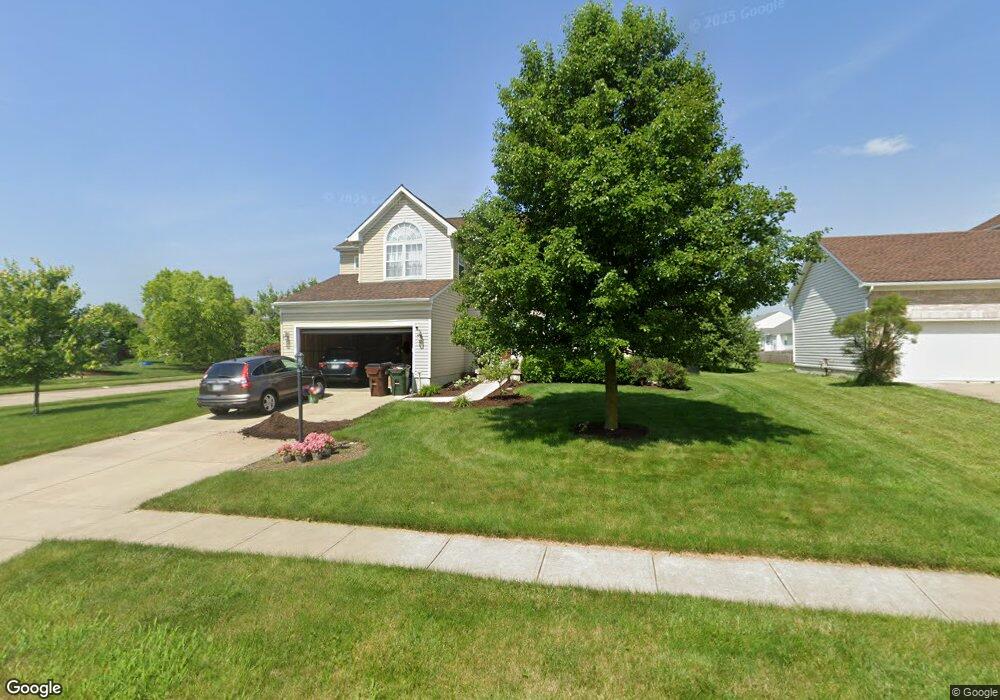
2015 Pacer Trail Beavercreek Township, OH 45434
Estimated Value: $428,763 - $464,000
4
Beds
3
Baths
2,330
Sq Ft
$192/Sq Ft
Est. Value
About This Home
This home is located at 2015 Pacer Trail, Beavercreek Township, OH 45434 and is currently estimated at $447,191, approximately $191 per square foot. 2015 Pacer Trail is a home located in Greene County with nearby schools including Trebein Elementary School, Jacob Coy Middle School, and Beavercreek High School.
Ownership History
Date
Name
Owned For
Owner Type
Purchase Details
Closed on
Jun 20, 2017
Sold by
Johnson Robert D and Johnson Lisa R
Bought by
Raterman Kyle and Raterman Melissa
Current Estimated Value
Home Financials for this Owner
Home Financials are based on the most recent Mortgage that was taken out on this home.
Original Mortgage
$202,500
Outstanding Balance
$168,576
Interest Rate
4.05%
Mortgage Type
New Conventional
Estimated Equity
$278,615
Purchase Details
Closed on
Oct 16, 2003
Sold by
Nvr Inc
Bought by
Johnson Robert D and Johnson Lisa R
Home Financials for this Owner
Home Financials are based on the most recent Mortgage that was taken out on this home.
Original Mortgage
$201,329
Interest Rate
6.04%
Mortgage Type
Unknown
Purchase Details
Closed on
Jul 23, 2003
Sold by
Ajv Development Llc
Bought by
Nvr Inc
Create a Home Valuation Report for This Property
The Home Valuation Report is an in-depth analysis detailing your home's value as well as a comparison with similar homes in the area
Home Values in the Area
Average Home Value in this Area
Purchase History
| Date | Buyer | Sale Price | Title Company |
|---|---|---|---|
| Raterman Kyle | $277,500 | None Available | |
| Johnson Robert D | $413,000 | First Title Agency Inc | |
| Nvr Inc | $42,000 | -- |
Source: Public Records
Mortgage History
| Date | Status | Borrower | Loan Amount |
|---|---|---|---|
| Open | Raterman Kyle | $202,500 | |
| Previous Owner | Johnson Robert D | $201,329 |
Source: Public Records
Tax History Compared to Growth
Tax History
| Year | Tax Paid | Tax Assessment Tax Assessment Total Assessment is a certain percentage of the fair market value that is determined by local assessors to be the total taxable value of land and additions on the property. | Land | Improvement |
|---|---|---|---|---|
| 2024 | $7,098 | $126,210 | $24,090 | $102,120 |
| 2023 | $7,098 | $126,210 | $24,090 | $102,120 |
| 2022 | $6,476 | $98,870 | $19,270 | $79,600 |
| 2021 | $6,541 | $98,870 | $19,270 | $79,600 |
| 2020 | $6,572 | $98,870 | $19,270 | $79,600 |
| 2019 | $6,344 | $87,650 | $15,040 | $72,610 |
| 2018 | $5,547 | $80,310 | $15,040 | $65,270 |
| 2017 | $4,841 | $80,310 | $15,040 | $65,270 |
| 2016 | $4,774 | $76,220 | $15,040 | $61,180 |
| 2015 | $4,804 | $76,220 | $15,040 | $61,180 |
| 2014 | $4,692 | $76,220 | $15,040 | $61,180 |
Source: Public Records
Map
Nearby Homes
- 1535 Stretch Dr
- 2073 Lincolnshire Dr
- 1360 Backridge Ct
- 2154 Sulky Trail
- 2162 Sulky Trail
- 2245 Tourney Trail
- 2331 Eastwind Dr
- 1361 Obetz Dr Unit A
- 1238 Freedom Point
- 2507 Obetz Dr
- 1210 Lomeda Ln
- 1156 Westover Rd
- 887 Shady Ln
- 1678 Fairground Rd
- 1051 Forest Dr
- 1590 Windham Ln
- 895 Alpha Rd
- 1589 Stonebury Ct
- 2170 Schmidt Dr N
- 1482 Fudge Dr
- 2025 Pacer Trail
- 1412 Red Barn Way
- 2005 Pacer Trail
- 2035 Pacer Trail
- 2075 Bandit Trail
- 2014 Pacer Trail
- 1416 Red Barn Way
- 1411 Red Barn Way
- 2008 Pacer Trail
- 2024 Pacer Trail
- 1995 Pacer Trail
- 2081 Bandit Trail
- 2036 Pacer Trail
- 1417 Red Barn Way
- 1420 Red Barn Way
- 1994 Pacer Trail
- 2040 Pacer Trail
- 2089 Bandit Trail
- 1372 Bareback Trail
- 1376 Bareback Trail