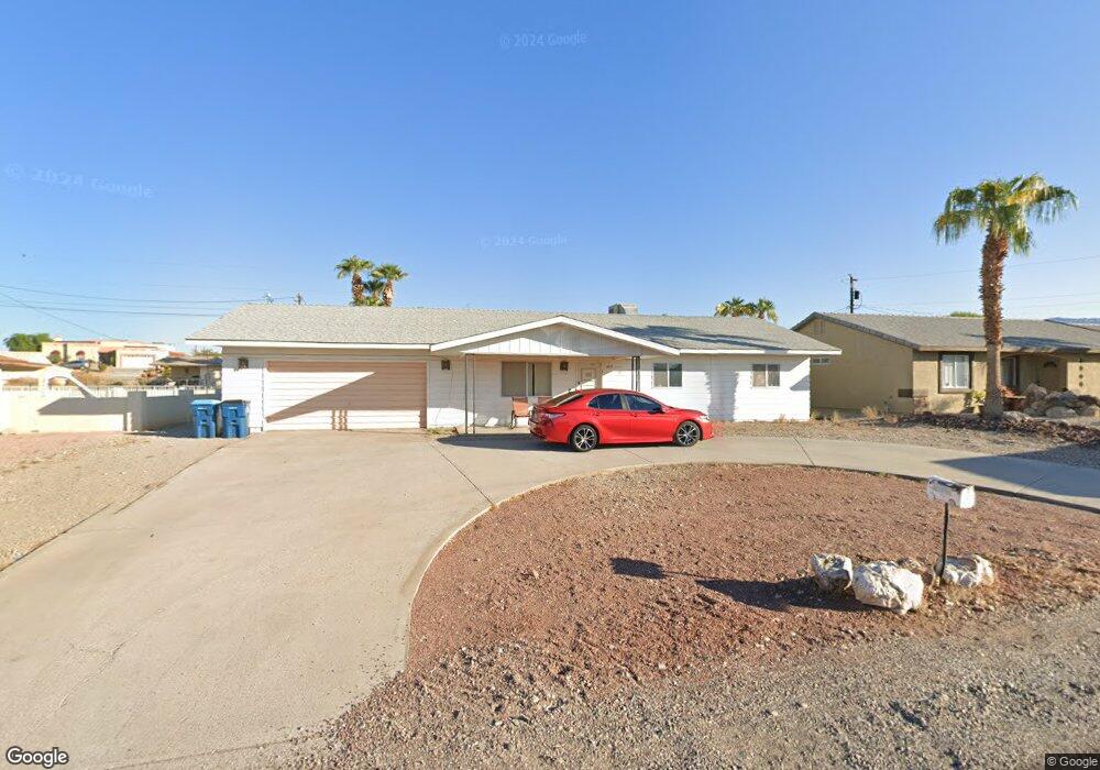
2015 Polaris Dr Lake Havasu City, AZ 86403
Estimated Value: $319,702 - $415,000
3
Beds
1
Bath
1,478
Sq Ft
$246/Sq Ft
Est. Value
About This Home
This home is located at 2015 Polaris Dr, Lake Havasu City, AZ 86403 and is currently estimated at $363,926, approximately $246 per square foot. 2015 Polaris Dr is a home located in Mohave County with nearby schools including Smoketree Elementary School, Thunderbolt Middle School, and Lake Havasu High School.
Ownership History
Date
Name
Owned For
Owner Type
Purchase Details
Closed on
Jun 25, 2001
Sold by
Janoff Michael and Janoff Arlene C
Bought by
Janoff Michael and Janoff Michael Thomas
Current Estimated Value
Create a Home Valuation Report for This Property
The Home Valuation Report is an in-depth analysis detailing your home's value as well as a comparison with similar homes in the area
Home Values in the Area
Average Home Value in this Area
Purchase History
| Date | Buyer | Sale Price | Title Company |
|---|---|---|---|
| Janoff Michael | -- | -- |
Source: Public Records
Tax History Compared to Growth
Tax History
| Year | Tax Paid | Tax Assessment Tax Assessment Total Assessment is a certain percentage of the fair market value that is determined by local assessors to be the total taxable value of land and additions on the property. | Land | Improvement |
|---|---|---|---|---|
| 2026 | -- | -- | -- | -- |
| 2025 | $1,060 | $26,771 | $0 | $0 |
| 2024 | $1,075 | $29,282 | $0 | $0 |
| 2023 | $1,075 | $24,220 | $0 | $0 |
| 2022 | $1,028 | $17,290 | $0 | $0 |
| 2021 | $1,186 | $15,813 | $0 | $0 |
| 2019 | $1,129 | $12,220 | $0 | $0 |
| 2018 | $1,093 | $11,573 | $0 | $0 |
| 2017 | $1,083 | $10,459 | $0 | $0 |
| 2016 | $986 | $9,726 | $0 | $0 |
| 2015 | $947 | $8,858 | $0 | $0 |
Source: Public Records
Map
Nearby Homes
- 1960 Pirate Ln
- 1986 Bahama Ave
- 583 Robin Ln
- 2021 Industrial
- 640 Acoma Blvd N
- 2200 Clarke Dr
- 1790 Rainbow Ave S
- 1930 Bahama Ave
- 320 Chipeta Ln
- 532 Acoma Blvd N
- 1796 Bahama Ave Unit C
- 1795 Bimini Ln Unit B4
- 2100 Chaparral Dr
- 1775 Bimini Ln Unit E1
- 2301 Sahara Dr
- 310 Pascaul Ln
- 260 Lava Ln
- 2090 San Juan Dr
- 675 Knobhill Ln
- 287 Pascaul Dr
- 2021 Polaris Dr
- 2011 Polaris Dr
- 2028 Rainbow Ave N
- 2020 Rainbow Ave N
- 2031 Polaris Dr
- 2002 Rainbow Ave N
- 2044 Rainbow Ave N
- 2016 Polaris Dr
- 2020 Polaris Dr
- 2014 Polaris Dr
- 2041 Polaris Dr
- 2030 Polaris Dr
- 2052 Rainbow Ave N
- 2010 Polaris Dr
- 2004 Polaris Dr
- 2008 Polaris Dr
- 2040 Polaris Dr
- 2051 Polaris Dr
- 2060 Rainbow Ave N
- 2039 Rainbow Ave N