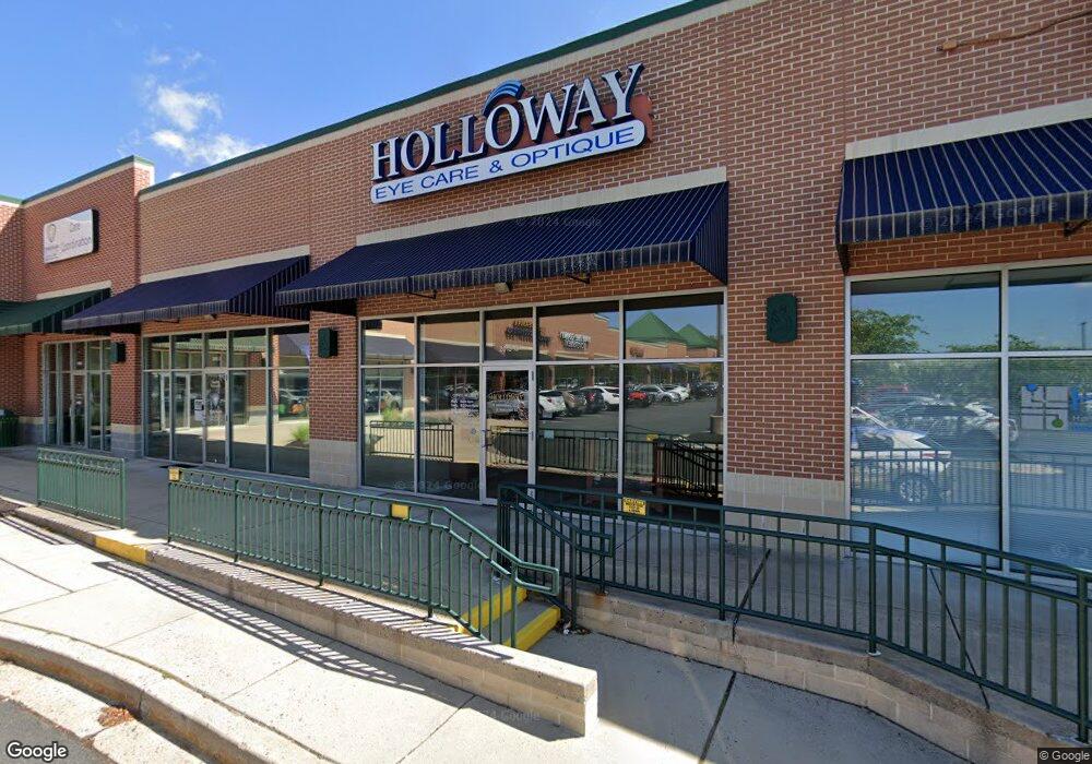
2015 Pulaski Hwy Havre de Grace, MD 21078
--
Bed
--
Bath
29,700
Sq Ft
9.51
Acres
About This Home
This home is located at 2015 Pulaski Hwy, Havre de Grace, MD 21078. 2015 Pulaski Hwy is a home located in Harford County with nearby schools including Roye-Williams Elementary School, Aberdeen Middle School, and Aberdeen High School.
Ownership History
Date
Name
Owned For
Owner Type
Purchase Details
Closed on
Mar 11, 2005
Sold by
Aberdeen Holdings Lp
Bought by
Rock Glenn Commercial Llc
Purchase Details
Closed on
Oct 17, 2001
Sold by
Aberdeen Holdings Lp
Bought by
Aberdeen Holdings Lp and Gbr Aberdeen Limited Liability Co
Purchase Details
Closed on
Nov 16, 1998
Sold by
Baker Nelson J
Bought by
Aberdeen Holdings Lp
Purchase Details
Closed on
Aug 14, 1998
Sold by
Grossman Loomis J
Bought by
Baker Richard A
Create a Home Valuation Report for This Property
The Home Valuation Report is an in-depth analysis detailing your home's value as well as a comparison with similar homes in the area
Home Values in the Area
Average Home Value in this Area
Purchase History
| Date | Buyer | Sale Price | Title Company |
|---|---|---|---|
| Rock Glenn Commercial Llc | $1,900,000 | -- | |
| Aberdeen Holdings Lp | -- | -- | |
| Aberdeen Holdings Lp | -- | -- | |
| Baker Richard A | -- | -- |
Source: Public Records
Tax History Compared to Growth
Tax History
| Year | Tax Paid | Tax Assessment Tax Assessment Total Assessment is a certain percentage of the fair market value that is determined by local assessors to be the total taxable value of land and additions on the property. | Land | Improvement |
|---|---|---|---|---|
| 2025 | $161,718 | $17,330,800 | $0 | $0 |
| 2024 | $161,718 | $14,837,900 | $2,853,000 | $11,984,900 |
| 2023 | $171,232 | $15,710,800 | $2,853,000 | $12,857,800 |
| 2022 | $179,077 | $17,526,000 | $0 | $0 |
| 2021 | $192,612 | $17,307,500 | $2,853,000 | $14,454,500 |
| 2020 | $192,612 | $16,690,833 | $0 | $0 |
| 2019 | $185,496 | $16,074,167 | $0 | $0 |
| 2018 | $176,769 | $15,457,500 | $2,853,000 | $12,604,500 |
| 2017 | $170,009 | $15,457,500 | $0 | $0 |
| 2016 | $11,746 | $14,275,300 | $0 | $0 |
| 2015 | $130,136 | $13,684,200 | $0 | $0 |
| 2014 | $130,136 | $12,585,900 | $0 | $0 |
Source: Public Records
Map
Nearby Homes
- 2245 Argonne Dr
- 20 Rock Glenn Rd
- 40 Telestar Way
- 148 Correri St
- 225 Correri St
- 239 Correri St
- 241 Correri St
- 226 Correri St
- 1748 Lawder Cir
- 142 Martha Lewis Blvd
- 1744 Lawder Cir
- 1740 Lawder Cir
- Crofton Plan at Greenway Farm
- REGENT Plan at Greenway Farm
- ANDREWS Plan at Greenway Farm
- 1698 Oneida St
- 1747 Lawder Cir
- 1802 Rankokus Dr
- 1690 Oneida St
- 1686 Oneida St
- 2505 Karen Ct
- 2503 Karen Ct
- 2232 Argonne Dr
- 2226 Argonne Dr
- 2230 Argonne Dr
- 2224 Argonne Dr
- 2228 Argonne Dr
- 2501 Karen Ct
- 2504 Karen Ct
- 2234 Argonne Dr
- 2502 Karen Ct
- 2236 Argonne Dr
- 1921 Pulaski Hwy
- 2238 Argonne Dr
- 2006 Pulaski Hwy
- 2106 Pulaski Hwy
- 2253 Argonne Dr
- 2405 Layne Ct
- 2500 Karen Ct
- 2247 Argonne Dr
