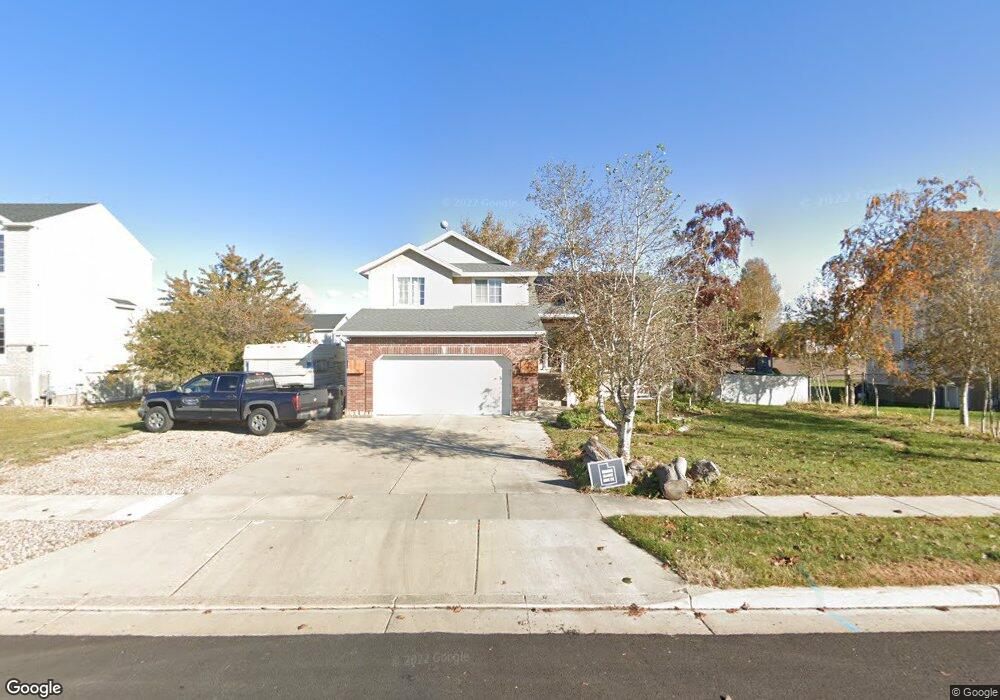
2015 S 1900 W Syracuse, UT 84075
Estimated Value: $483,000 - $541,000
3
Beds
3
Baths
2,352
Sq Ft
$221/Sq Ft
Est. Value
About This Home
This home is located at 2015 S 1900 W, Syracuse, UT 84075 and is currently estimated at $518,778, approximately $220 per square foot. 2015 S 1900 W is a home located in Davis County with nearby schools including Syracuse Elementary School, Syracuse Junior High School, and Syracuse High School.
Ownership History
Date
Name
Owned For
Owner Type
Purchase Details
Closed on
Aug 31, 2005
Sold by
Sheets Michael W and Sheets Jennifer
Bought by
Maxfield Darren S and Maxfield Marinda
Current Estimated Value
Home Financials for this Owner
Home Financials are based on the most recent Mortgage that was taken out on this home.
Original Mortgage
$142,000
Outstanding Balance
$74,499
Interest Rate
5.64%
Mortgage Type
Fannie Mae Freddie Mac
Estimated Equity
$444,279
Purchase Details
Closed on
Oct 1, 1997
Sold by
Sheets John W and Sheets Barbara
Bought by
Sheets Michael W and Sheets Jennifer
Purchase Details
Closed on
Jul 10, 1997
Sold by
Independence Subdivision Llc
Bought by
Sheets John W and Sheets Barbara
Create a Home Valuation Report for This Property
The Home Valuation Report is an in-depth analysis detailing your home's value as well as a comparison with similar homes in the area
Home Values in the Area
Average Home Value in this Area
Purchase History
| Date | Buyer | Sale Price | Title Company |
|---|---|---|---|
| Maxfield Darren S | -- | Bonneville Title Company | |
| Sheets Michael W | -- | Blacks Title Inc | |
| Sheets John W | -- | Bonneville Title Company Inc |
Source: Public Records
Mortgage History
| Date | Status | Borrower | Loan Amount |
|---|---|---|---|
| Open | Maxfield Darren S | $142,000 |
Source: Public Records
Tax History
| Year | Tax Paid | Tax Assessment Tax Assessment Total Assessment is a certain percentage of the fair market value that is determined by local assessors to be the total taxable value of land and additions on the property. | Land | Improvement |
|---|---|---|---|---|
| 2025 | $2,719 | $262,350 | $124,377 | $137,973 |
| 2024 | $2,605 | $253,000 | $102,310 | $150,690 |
| 2023 | $2,418 | $428,000 | $142,589 | $285,411 |
| 2022 | $2,607 | $253,000 | $82,156 | $170,844 |
| 2021 | $2,324 | $349,000 | $121,346 | $227,654 |
| 2020 | $1,953 | $284,000 | $105,986 | $178,014 |
| 2019 | $1,881 | $270,000 | $103,253 | $166,747 |
| 2018 | $1,747 | $249,000 | $99,905 | $149,095 |
| 2016 | $1,579 | $117,975 | $38,358 | $79,617 |
| 2015 | $1,508 | $107,305 | $38,358 | $68,947 |
| 2014 | $1,473 | $106,836 | $38,358 | $68,478 |
| 2013 | -- | $100,648 | $32,054 | $68,594 |
Source: Public Records
Map
Nearby Homes
- 1996 S 1675 W
- 2138 Craig Ln
- 1826 W 2350 S
- 2013 S 1575 W
- 1782 W 1700 S
- 1876 W 2400 S
- 1686 W 2425 S
- 4344 W 1825 S Unit 102
- 4354 W 1825 S Unit 104
- 2329 W 1700 S
- 1720 W 1400 S
- 2475 Craig Ln
- 1876 S 1230 W
- 2356 S 1230 W
- 1653 W 2700 S Unit 218
- 2366 S 1230 W
- 1643 W 2700 S Unit 216
- 2742 S Allison Way Unit 212
- 1196 W 2325 S
- 1705 W 2770 S
- 2039 S 1900 W
- 1997 S 1900 W
- 2085 S 1900 W
- 2018 S 1840 W
- 2034 S 1840 W
- 2030 S 1900 W
- 1916 W 2025 S
- 2057 S 1900 W
- 2101 S 1900 W Unit 206
- 2101 S 1900 W Unit 102
- 2050 S 1840 W
- 1986 S 1840 W
- 2046 S 1900 W
- 1932 W 2025 S
- 2075 S 1900 W
- 2075 S 1900 W Unit 2
- 2066 S 1840 W
- 2068 S 1900 W
- 1941 W 2025 S
- 2019 S 1840 W
Your Personal Tour Guide
Ask me questions while you tour the home.