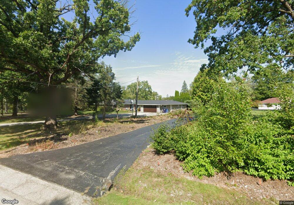
2015 Saunders Rd Riverwoods, IL 60015
Indian Trail Estates NeighborhoodEstimated Value: $811,848 - $1,174,000
4
Beds
3
Baths
3,645
Sq Ft
$257/Sq Ft
Est. Value
About This Home
This home is located at 2015 Saunders Rd, Riverwoods, IL 60015 and is currently estimated at $935,212, approximately $256 per square foot. 2015 Saunders Rd is a home located in Lake County with nearby schools including Bannockburn School, Deerfield High School, and Riverwoods Montessori School.
Ownership History
Date
Name
Owned For
Owner Type
Purchase Details
Closed on
Aug 12, 2004
Sold by
Rubin Mark J and Rubin Amy L
Bought by
Danielewicz Michael J and Danielewicz Sara A
Current Estimated Value
Home Financials for this Owner
Home Financials are based on the most recent Mortgage that was taken out on this home.
Original Mortgage
$460,000
Outstanding Balance
$194,737
Interest Rate
3.83%
Mortgage Type
Unknown
Estimated Equity
$740,475
Purchase Details
Closed on
Apr 23, 1999
Sold by
Rentsch Hans Juergen and Rentsch Doris Marie
Bought by
Rubin Mark J and Rubin Amy L
Home Financials for this Owner
Home Financials are based on the most recent Mortgage that was taken out on this home.
Original Mortgage
$240,000
Interest Rate
5.75%
Create a Home Valuation Report for This Property
The Home Valuation Report is an in-depth analysis detailing your home's value as well as a comparison with similar homes in the area
Home Values in the Area
Average Home Value in this Area
Purchase History
| Date | Buyer | Sale Price | Title Company |
|---|---|---|---|
| Danielewicz Michael J | $575,000 | Multiple | |
| Rubin Mark J | $362,500 | Chicago Title Insurance Co |
Source: Public Records
Mortgage History
| Date | Status | Borrower | Loan Amount |
|---|---|---|---|
| Open | Danielewicz Michael J | $460,000 | |
| Previous Owner | Rubin Mark J | $240,000 |
Source: Public Records
Tax History
| Year | Tax Paid | Tax Assessment Tax Assessment Total Assessment is a certain percentage of the fair market value that is determined by local assessors to be the total taxable value of land and additions on the property. | Land | Improvement |
|---|---|---|---|---|
| 2024 | $10,059 | $160,095 | $85,746 | $74,349 |
| 2023 | $9,139 | $153,642 | $82,290 | $71,352 |
| 2022 | $9,139 | $134,944 | $62,753 | $72,191 |
| 2021 | $8,645 | $130,104 | $60,502 | $69,602 |
| 2020 | $8,354 | $130,377 | $60,629 | $69,748 |
| 2019 | $8,062 | $130,156 | $60,526 | $69,630 |
| 2018 | $9,755 | $154,506 | $64,152 | $90,354 |
| 2017 | $9,854 | $154,013 | $63,947 | $90,066 |
| 2016 | $9,802 | $148,189 | $61,529 | $86,660 |
| 2015 | $9,529 | $139,236 | $57,812 | $81,424 |
| 2014 | $11,142 | $155,800 | $58,226 | $97,574 |
| 2012 | $10,942 | $154,425 | $57,712 | $96,713 |
Source: Public Records
Map
Nearby Homes
- 851 Sutton Ct
- 11 Wellington Ct
- 1890 Robinwood Ln
- 41 Canterbury Rd
- 30 Regent Ln
- 1690 Landy Ln
- 3031 Farner Ct
- 2655 Crestwood Ln
- 2580 Crestwood Ln
- 1285 Montgomery Dr
- 1478 Shawnee Trail
- 5 Bridle Ln
- 11 Lakewood Dr
- 1380 Valley Rd
- 1959 Windridge Dr
- 1335 Wilmot Rd
- 5 Dunsinane Ln
- 1800 Telegraph Rd
- 1525 Hawthorne Place
- 2640 Forest Glen Trail
- 2265 Saunders Rd
- 1995 Saunders Rd
- 2000 Saunders Rd
- 2280 Duffy Ln
- 1965 Saunders Rd
- 2320 Duffy Ln
- 2401 Duffy Ln
- 1960 Saunders Rd
- 2360 Duffy Ln
- 1920 Saunders Rd
- 1917 Saunders Rd
- 6 Windlake Terrace
- 2 Woodland Ln N
- 1980 Saunders Rd
- 2 Windlake Terrace
- 2351 Woodland Ln N
- 1 Woodland Ln N
- 5 Windlake Terrace
- 2425 Duffy Ln
- 2287 Woodland Ln N
Your Personal Tour Guide
Ask me questions while you tour the home.