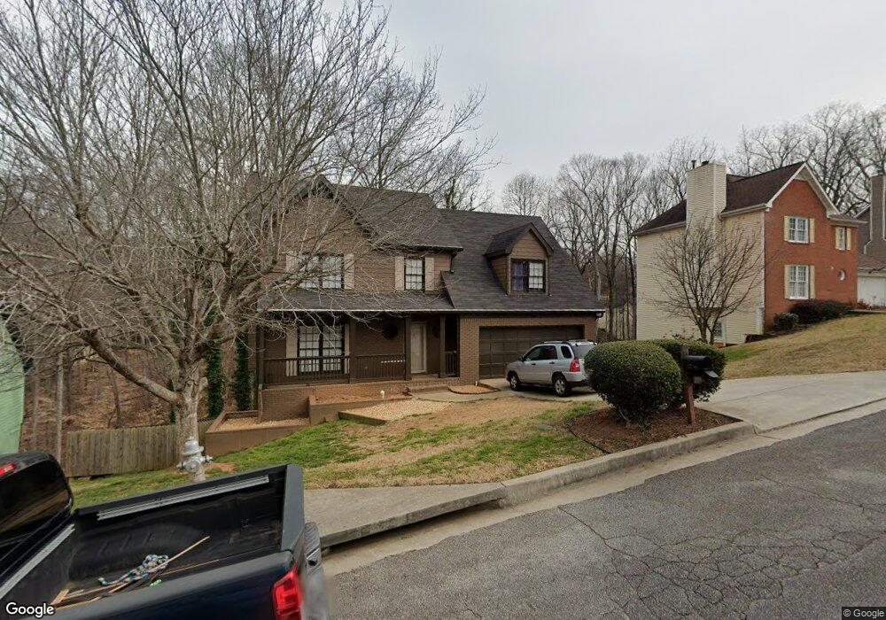
2015 Tyler Trace Lawrenceville, GA 30043
Estimated Value: $394,000 - $429,000
4
Beds
3
Baths
2,284
Sq Ft
$178/Sq Ft
Est. Value
About This Home
This home is located at 2015 Tyler Trace, Lawrenceville, GA 30043 and is currently estimated at $406,020, approximately $177 per square foot. 2015 Tyler Trace is a home located in Gwinnett County with nearby schools including Taylor Elementary School, Creekland Middle School, and Collins Hill High School.
Ownership History
Date
Name
Owned For
Owner Type
Purchase Details
Closed on
Jul 15, 2002
Sold by
Maldonado Jose
Bought by
Maldonado Jose
Current Estimated Value
Home Financials for this Owner
Home Financials are based on the most recent Mortgage that was taken out on this home.
Original Mortgage
$160,558
Outstanding Balance
$67,871
Interest Rate
6.67%
Mortgage Type
FHA
Estimated Equity
$338,149
Purchase Details
Closed on
Jul 27, 1999
Sold by
Wilson Jon E and Wilson Amy B
Bought by
Harper Christopher T
Home Financials for this Owner
Home Financials are based on the most recent Mortgage that was taken out on this home.
Original Mortgage
$110,000
Interest Rate
7.66%
Mortgage Type
New Conventional
Purchase Details
Closed on
May 9, 1996
Sold by
Bryan Edward P Kristin B
Bought by
Wilson Jon E Amy B
Create a Home Valuation Report for This Property
The Home Valuation Report is an in-depth analysis detailing your home's value as well as a comparison with similar homes in the area
Home Values in the Area
Average Home Value in this Area
Purchase History
| Date | Buyer | Sale Price | Title Company |
|---|---|---|---|
| Maldonado Jose | -- | -- | |
| Maldonado Jose | $161,900 | -- | |
| Harper Christopher T | $145,000 | -- | |
| Wilson Jon E Amy B | $127,000 | -- |
Source: Public Records
Mortgage History
| Date | Status | Borrower | Loan Amount |
|---|---|---|---|
| Open | Maldonado Jose | $160,558 | |
| Previous Owner | Harper Christopher T | $110,000 | |
| Closed | Wilson Jon E Amy B | $0 |
Source: Public Records
Tax History Compared to Growth
Tax History
| Year | Tax Paid | Tax Assessment Tax Assessment Total Assessment is a certain percentage of the fair market value that is determined by local assessors to be the total taxable value of land and additions on the property. | Land | Improvement |
|---|---|---|---|---|
| 2024 | $5,722 | $157,640 | $32,800 | $124,840 |
| 2023 | $5,722 | $156,800 | $32,800 | $124,000 |
| 2022 | $5,643 | $149,800 | $32,800 | $117,000 |
| 2021 | $3,542 | $89,200 | $17,600 | $71,600 |
| 2020 | $3,561 | $89,200 | $17,600 | $71,600 |
| 2019 | $3,207 | $82,800 | $14,400 | $68,400 |
| 2018 | $3,208 | $82,800 | $14,400 | $68,400 |
| 2016 | $2,822 | $71,280 | $12,400 | $58,880 |
| 2015 | $2,852 | $71,280 | $12,400 | $58,880 |
| 2014 | -- | $71,280 | $12,400 | $58,880 |
Source: Public Records
Map
Nearby Homes
- 2135 Saint Thomas Way
- 2012 Little River Dr Unit 1
- 1870 Wildcat Trace Cir
- 260 Wildcat Lake Dr
- 2167 Merrymount Dr
- 1930 Collins Hill Rd
- 2050 Fortuna St
- 1955 Watson Falls Ct
- 1832 Shores Ridge Ct
- 1931 Abinger Way
- 83 Russell Rd
- 12 Jacobs Farm Ln Unit 6
- 340 Rosedown Way
- 205 Camden Creek Ct
- 1932 Riverton Dr
- 81 Russell Rd
- 1833 Riverton Dr NW
- 2005 Tyler Trace
- 2005 Tyler Trace Unit Basement
- 2025 Tyler Trace
- 2000 Stone Forest Dr
- 1985 Tyler Trace
- 2035 Tyler Trace
- 1990 Stone Forest Dr
- 2014 Tyler Trace
- 2010 Stone Forest Dr
- 2004 Tyler Trace
- 1975 Tyler Trace
- 1994 Tyler Trace
- 15 Karen Camile Dr
- 1980 Stone Forest Dr
- 1984 Tyler Trace
- 2020 Stone Forest Dr
- 1965 Tyler Trace
- 25 Karen Camille Dr NW
- 25 Karen Camile Dr
- 1974 Tyler Trace