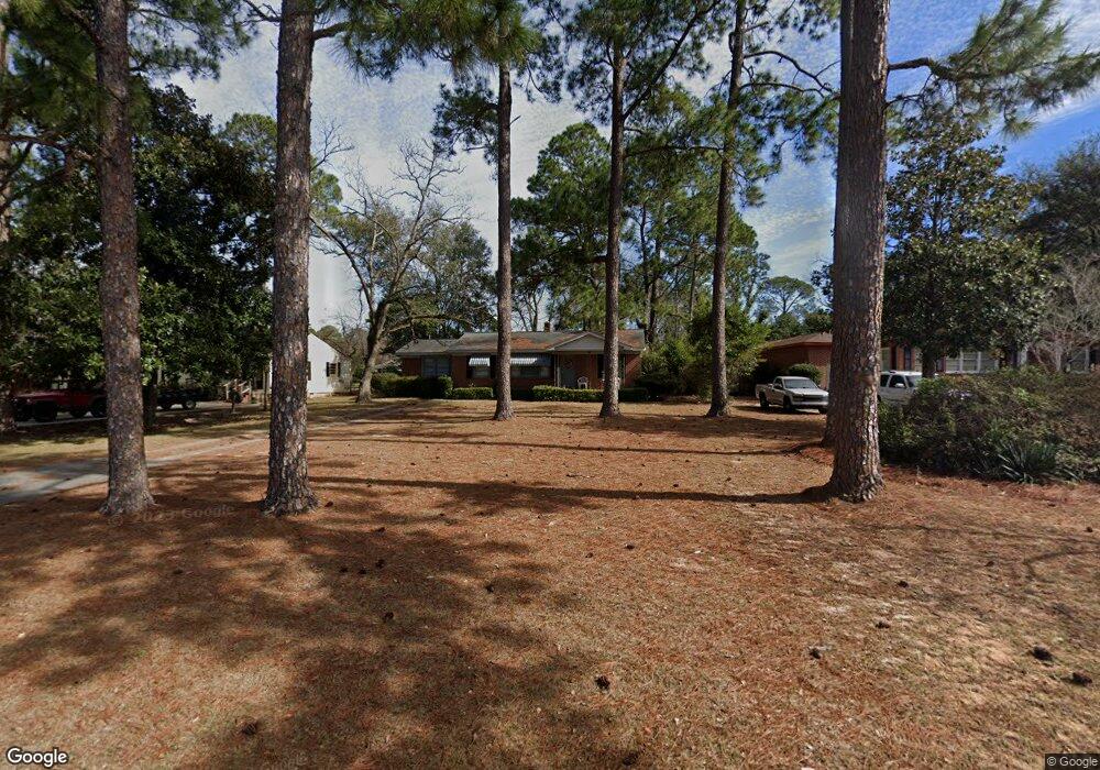
2015 W Broad Ave Albany, GA 31707
Estimated Value: $80,733 - $84,000
3
Beds
1
Bath
1,380
Sq Ft
$59/Sq Ft
Est. Value
About This Home
This home is located at 2015 W Broad Ave, Albany, GA 31707 and is currently estimated at $81,933, approximately $59 per square foot. 2015 W Broad Ave is a home located in Dougherty County with nearby schools including Live Oak Elementary School, Merry Acres Middle School, and Westover High School.
Ownership History
Date
Name
Owned For
Owner Type
Purchase Details
Closed on
Mar 23, 2011
Sold by
J Wiggins Inc
Bought by
B&M Properties Llc
Current Estimated Value
Home Financials for this Owner
Home Financials are based on the most recent Mortgage that was taken out on this home.
Original Mortgage
$29,405
Interest Rate
4.99%
Mortgage Type
Purchase Money Mortgage
Purchase Details
Closed on
Jan 6, 2011
Sold by
Bank Of America
Bought by
J Wiggins Inc
Purchase Details
Closed on
Jul 6, 2010
Sold by
Harris Willie and Harris Denise
Bought by
Bank Of America
Purchase Details
Closed on
Jun 23, 2000
Sold by
Faircloth Eric
Bought by
Harris Willie and Harris Denise
Purchase Details
Closed on
Mar 13, 2000
Sold by
Bank Of New York
Bought by
Faircloth Eric
Purchase Details
Closed on
Dec 2, 1972
Sold by
Thornton Jack
Bought by
Hasty Jack
Create a Home Valuation Report for This Property
The Home Valuation Report is an in-depth analysis detailing your home's value as well as a comparison with similar homes in the area
Home Values in the Area
Average Home Value in this Area
Purchase History
| Date | Buyer | Sale Price | Title Company |
|---|---|---|---|
| B&M Properties Llc | $33,800 | -- | |
| J Wiggins Inc | $27,500 | -- | |
| Bank Of America | $44,100 | -- | |
| Harris Willie | $60,000 | -- | |
| Faircloth Eric | $42,000 | -- | |
| Hasty Jack | -- | -- |
Source: Public Records
Mortgage History
| Date | Status | Borrower | Loan Amount |
|---|---|---|---|
| Closed | B&M Properties Llc | $29,405 |
Source: Public Records
Tax History Compared to Growth
Tax History
| Year | Tax Paid | Tax Assessment Tax Assessment Total Assessment is a certain percentage of the fair market value that is determined by local assessors to be the total taxable value of land and additions on the property. | Land | Improvement |
|---|---|---|---|---|
| 2024 | $950 | $19,920 | $3,600 | $16,320 |
| 2023 | $928 | $19,920 | $3,600 | $16,320 |
| 2022 | $932 | $19,920 | $3,600 | $16,320 |
| 2021 | $864 | $19,920 | $3,600 | $16,320 |
| 2020 | $866 | $19,920 | $3,600 | $16,320 |
| 2019 | $869 | $19,920 | $3,600 | $16,320 |
| 2018 | $873 | $19,920 | $3,600 | $16,320 |
| 2017 | $813 | $19,920 | $3,600 | $16,320 |
| 2016 | $813 | $19,920 | $3,600 | $16,320 |
| 2015 | $816 | $19,920 | $3,600 | $16,320 |
| 2014 | $813 | $20,120 | $3,800 | $16,320 |
Source: Public Records
Map
Nearby Homes
- 2021 W Broad Ave
- 2009 W Broad Ave
- 2026 Melrose Dr
- 200 N Ingleside Dr
- 100 N Ingleside Dr
- 1916 W Broad Ave
- 1926 W Oglethorpe Ave
- 1821 Samford Ave
- 2200 Gillionville Rd
- 00 Gillionville Rd
- 612 Russell Rd
- 608 Russell Rd
- 1906 W Whitney Ave
- 1810 Edgerly Ave
- 1711 Parker Ave
- 1710 Myrtle Rd
- 410 Endicott Ln
- 1703 W Oglethorpe Ave
- 1640 N Valencia Dr
- 501 Endicott Ln
- 2017 W Broad Ave
- 2013 W Broad Ave
- 2019 W Broad Ave
- 2011 W Broad Ave
- 2008 Melrose Dr
- 2012 Melrose Dr
- 2006 Melrose Dr
- 2014 Melrose Dr
- 2023 W Broad Ave
- 2007 W Broad Ave
- 2005 Melrose Dr
- 2025 W Broad Ave
- 2016 Melrose Dr
- 2005 W Broad Ave
- 2110 Lennox St Unit 18
- 2015 Melrose Dr
- 2027 W Broad Ave
- 2018 Melrose Dr
- 2010 W Broad Ave
- 2017 Melrose Dr