

2015 W Mansfield Ave Spokane, WA 99205
Emerson Garfield NeighborhoodEstimated payment $1,953/month
Highlights
- Fenced Yard
- Wood Frame Window
- Garden
- North Central High School Rated A-
- 2 Car Detached Garage
- Forced Air Heating System
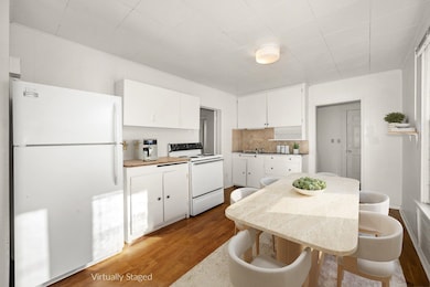
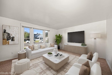
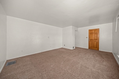
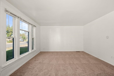
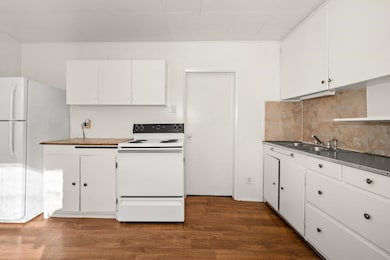
About This Home
Duplex with Owner Financing Available! Strong income history and recent updates. Live in one unit and let the other offset your mortgage. Most recent gross rental income is $2,375/month (garage not included in that gross). New roof, new garage siding, newer gas furnace and windows in the upper unit, exterior paint. Main-level (vacant, last rented at $1,375/mo) offers 2 bedrooms, 1 bath, a spacious layout, and main-floor laundry with washer and dryer included. The upper unit is 1 Bed, 1 bath ($1,000/mo) is occupied. Rent is discounted in exchange for groundskeeping tasks. The lease expires 12/31/25, with tenants expressing interest in staying if desired. Detached 2-car garage (rental potential $300–$400/month), alley access, off-street parking, and a fenced yard with raised bed gardens. Situated in an established neighborhood near Audubon Park, close to schools, shopping, restaurants, and the Centennial Trail. Downtown Spokane and Kendall Yards are just minutes away, offering entertainment, coffee shops,
Property Details
Home Type
- Multi-Family
Est. Annual Taxes
- $2,881
Year Built
- Built in 1909
Lot Details
- 6,960 Sq Ft Lot
- Fenced Yard
- Level Lot
- Garden
Parking
- 2 Car Detached Garage
- Alley Access
- Off-Site Parking
Interior Spaces
- 1,877 Sq Ft Home
- 1.5-Story Property
- Vinyl Clad Windows
- Wood Frame Window
- Utility Room
- Dishwasher
- Partially Finished Basement
Bedrooms and Bathrooms
- 3 Bedrooms
- 2 Bathrooms
Laundry
- Dryer
- Washer
Schools
- North Central High School
Utilities
- Forced Air Heating System
Community Details
- 2 Units
Listing and Financial Details
- Assessor Parcel Number 25124.4403
Map
Home Values in the Area
Average Home Value in this Area
Tax History
| Year | Tax Paid | Tax Assessment Tax Assessment Total Assessment is a certain percentage of the fair market value that is determined by local assessors to be the total taxable value of land and additions on the property. | Land | Improvement |
|---|---|---|---|---|
| 2025 | $2,882 | $288,900 | $75,000 | $213,900 |
| 2024 | $2,882 | $290,100 | $66,000 | $224,100 |
| 2023 | $2,684 | $284,100 | $60,000 | $224,100 |
| 2022 | $2,262 | $274,100 | $50,000 | $224,100 |
| 2021 | $1,840 | $154,200 | $30,000 | $124,200 |
| 2020 | $1,705 | $137,600 | $24,500 | $113,100 |
| 2019 | $1,498 | $125,000 | $20,000 | $105,000 |
| 2018 | $1,678 | $120,400 | $18,000 | $102,400 |
| 2017 | $1,435 | $104,800 | $18,000 | $86,800 |
| 2016 | $1,458 | $104,200 | $18,000 | $86,200 |
| 2015 | $1,422 | $99,400 | $18,000 | $81,400 |
| 2014 | -- | $103,000 | $18,000 | $85,000 |
| 2013 | -- | $0 | $0 | $0 |
Property History
| Date | Event | Price | List to Sale | Price per Sq Ft |
|---|---|---|---|---|
| 09/27/2025 09/27/25 | For Sale | $325,000 | -- | $173 / Sq Ft |
Purchase History
| Date | Type | Sale Price | Title Company |
|---|---|---|---|
| Interfamily Deed Transfer | -- | None Available | |
| Warranty Deed | $20,738 | Transamerica Title Ins Svcs |
Source: Spokane Association of REALTORS®
MLS Number: 202524705
APN: 25124.4403
Disclaimer: Certain information contained herein is derived from information provided by parties other than Homes.com. All information provided is deemed reliable, but is not guaranteed to be accurate and should be independently verified.
![]() IDX information is provided exclusively for personal, non-commercial use, and may not be used for any purpose other than to identify prospective properties consumers may be interested in purchasing.
IDX information is provided exclusively for personal, non-commercial use, and may not be used for any purpose other than to identify prospective properties consumers may be interested in purchasing.
Information is deemed reliable but not guaranteed.
- 2118 N Hemlock St
- 1903 W Knox Ave
- 2109 W Shannon Ave
- 1924 W Indiana Ave
- 1707 W Mansfield Ave
- 1708 W Mansfield Ave
- 1812 W Nora Ave
- 1808 W Augusta Ave
- 1804 W Augusta Ave
- 1715 N West Point Rd
- 1704 W York Ave
- 1727 W Spofford Ave
- 1529 W Nora Ave
- 1912 - 1918 W Buckeye Ave
- 1813 W Mission Ave
- 1609 W Augusta Ave
- 1912 W Buckeye Ave
- 1912 W Buckeye Ave Unit C
- 1912 W Buckeye Ave Unit D
- 1912 W Buckeye Ave Unit B
- 2865 W Elliott Dr
- 2002 N Monroe St
- 1310 W College Ave
- 1335 W Summit Pkwy
- 707 N Monroe St
- 1102 W Summit Pkwy
- 3817 W Whistalks Way
- 1620 River Ridge Blvd
- 2136 W Riverside Ave
- 2014 W Riverside Ave
- 1812 W Riverside Ave
- 951 W Walton Ave
- 930 N Washington St
- 2115 W Riverside Ave
- 1224 W Riverside Ave
- 2124 W 1st Ave
- 1020 W Lacrosse Ave
- 3909 N Wall St
- 1605 N River Ridge Blvd
- 2009 W Pacific Ave
