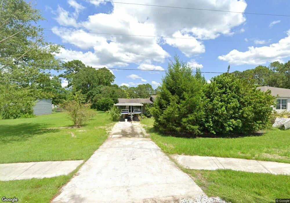
2015 West Pkwy Deland, FL 32724
Estimated Value: $125,000 - $272,000
3
Beds
2
Baths
1,638
Sq Ft
$111/Sq Ft
Est. Value
About This Home
This home is located at 2015 West Pkwy, Deland, FL 32724 and is currently estimated at $181,906, approximately $111 per square foot. 2015 West Pkwy is a home located in Volusia County with nearby schools including Deland High School, George W. Marks Elementary School, and Deland Middle School.
Ownership History
Date
Name
Owned For
Owner Type
Purchase Details
Closed on
Sep 30, 2020
Sold by
Willis George T and Willis Gail E
Bought by
Ppad 1 Llc
Current Estimated Value
Home Financials for this Owner
Home Financials are based on the most recent Mortgage that was taken out on this home.
Original Mortgage
$62,930
Outstanding Balance
$55,973
Interest Rate
2.9%
Mortgage Type
New Conventional
Estimated Equity
$125,933
Purchase Details
Closed on
Feb 22, 2013
Sold by
Hudson Percival G and Hudson Mauvalin
Bought by
Willis George T and Willis Gail E
Purchase Details
Closed on
May 31, 2002
Sold by
Myles Delores M and Myles Harry C
Bought by
Hudson Percival G
Home Financials for this Owner
Home Financials are based on the most recent Mortgage that was taken out on this home.
Original Mortgage
$60,057
Interest Rate
6.79%
Mortgage Type
FHA
Create a Home Valuation Report for This Property
The Home Valuation Report is an in-depth analysis detailing your home's value as well as a comparison with similar homes in the area
Home Values in the Area
Average Home Value in this Area
Purchase History
| Date | Buyer | Sale Price | Title Company |
|---|---|---|---|
| Ppad 1 Llc | $89,900 | Southeast Professional Ttl L | |
| Willis George T | $62,000 | Westside Title Services Inc | |
| Hudson Percival G | $61,000 | -- |
Source: Public Records
Mortgage History
| Date | Status | Borrower | Loan Amount |
|---|---|---|---|
| Open | Ppad 1 Llc | $62,930 | |
| Previous Owner | Hudson Percival G | $60,057 |
Source: Public Records
Tax History Compared to Growth
Tax History
| Year | Tax Paid | Tax Assessment Tax Assessment Total Assessment is a certain percentage of the fair market value that is determined by local assessors to be the total taxable value of land and additions on the property. | Land | Improvement |
|---|---|---|---|---|
| 2025 | $2,285 | $121,757 | $26,250 | $95,507 |
| 2024 | $2,285 | $121,698 | $26,250 | $95,448 |
| 2023 | $2,285 | $113,647 | $24,750 | $88,897 |
| 2022 | $2,128 | $103,366 | $19,125 | $84,241 |
| 2021 | $2,059 | $87,534 | $13,500 | $74,034 |
| 2020 | $1,929 | $81,132 | $7,875 | $73,257 |
| 2019 | $1,892 | $75,118 | $7,875 | $67,243 |
| 2018 | $1,764 | $67,036 | $5,625 | $61,411 |
| 2017 | $1,659 | $61,426 | $4,500 | $56,926 |
| 2016 | $1,499 | $57,125 | $0 | $0 |
| 2015 | $1,422 | $52,149 | $0 | $0 |
| 2014 | $1,302 | $45,727 | $0 | $0 |
Source: Public Records
Map
Nearby Homes
- 1976 5th Ave
- 2051 3rd Ave
- 2000 6th Ave
- 1948 6th Ave
- 1972 3rd Ave
- 904 Azalea Walk Cir
- 1965 2nd Ave
- 2008 Central Pkwy
- 1875 2nd Ave
- Drexel Plan at Andover Ridge
- Magnolia Plan at Andover Ridge
- Lancaster Plan at Andover Ridge
- Miramar Plan at Andover Ridge
- Vista Plan at Andover Ridge
- 2030 1st Ave
- 1465 5th Ave
- 0 5th Ave Unit MFRV4940662
- 2046 8th Ave
- 1785 6th Ave
- 2225 Central Pkwy