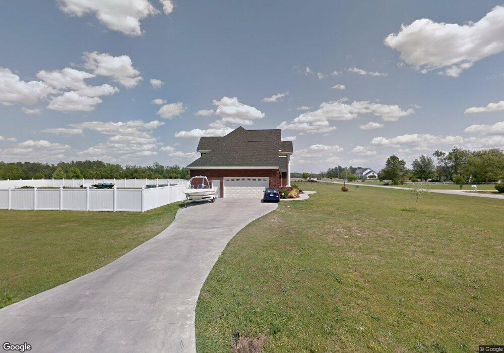
2015 Wolf Ln Kinston, NC 28501
Estimated Value: $524,000 - $627,000
4
Beds
4
Baths
3,856
Sq Ft
$149/Sq Ft
Est. Value
About This Home
This home is located at 2015 Wolf Ln, Kinston, NC 28501 and is currently estimated at $572,946, approximately $148 per square foot. 2015 Wolf Ln is a home located in Lenoir County with nearby schools including Contentnea-Savannah School, North Lenoir High School, and Children's Village Academy.
Ownership History
Date
Name
Owned For
Owner Type
Purchase Details
Closed on
Nov 7, 2019
Sold by
Mangel Carl L
Bought by
Mangel Moore
Current Estimated Value
Home Financials for this Owner
Home Financials are based on the most recent Mortgage that was taken out on this home.
Original Mortgage
$179,500
Interest Rate
3.74%
Mortgage Type
New Conventional
Purchase Details
Closed on
Jan 16, 2008
Sold by
Conway Mark I
Bought by
Mangel Carl L and Mangel Connie Sue
Create a Home Valuation Report for This Property
The Home Valuation Report is an in-depth analysis detailing your home's value as well as a comparison with similar homes in the area
Home Values in the Area
Average Home Value in this Area
Purchase History
| Date | Buyer | Sale Price | Title Company |
|---|---|---|---|
| Mangel Moore | -- | None Available | |
| Mangel Carl L | $55,000 | None Available |
Source: Public Records
Mortgage History
| Date | Status | Borrower | Loan Amount |
|---|---|---|---|
| Previous Owner | Mangel Moore | $179,500 |
Source: Public Records
Tax History
| Year | Tax Paid | Tax Assessment Tax Assessment Total Assessment is a certain percentage of the fair market value that is determined by local assessors to be the total taxable value of land and additions on the property. | Land | Improvement |
|---|---|---|---|---|
| 2025 | $3,989 | $539,261 | $47,304 | $491,957 |
| 2024 | $2,793 | $298,673 | $41,500 | $257,173 |
| 2023 | $2,793 | $298,673 | $41,500 | $257,173 |
| 2022 | $2,793 | $298,673 | $41,500 | $257,173 |
| 2021 | $2,793 | $298,673 | $41,500 | $257,173 |
| 2020 | $2,793 | $298,673 | $41,500 | $257,173 |
| 2019 | $2,793 | $298,673 | $41,500 | $257,173 |
| 2018 | $2,748 | $298,673 | $41,500 | $257,173 |
| 2017 | $2,727 | $298,673 | $41,500 | $257,173 |
| 2014 | $2,828 | $313,560 | $41,500 | $272,060 |
| 2013 | -- | $313,560 | $41,500 | $272,060 |
| 2011 | -- | $313,560 | $41,500 | $272,060 |
Source: Public Records
Map
Nearby Homes
- 2141 Autumn Dr
- 2050 Briarwood Dr
- 1403 Lockwood Rd
- 911 Cunningham Rd
- 1210 Ferndale Ln
- 1123 Candlewood Dr
- 1117 Candlewood Dr
- 901 Candlewood Dr
- 8 Cathy Dr
- 2105 Marsha Ave
- 402 Marcella Dr
- 704 Dixon St
- 504 Jackson Ln
- 1904 Northwood Dr
- Lot 13 Darby Ave
- 1510 Hyman Ave
- 1405 Centennial Trail
- 0 E Highland East Ave Unit 100546974
- 2 Boy Scout Blvd
- 902 Rosanne Dr
- 2035 Wolf Ln
- 309 Briary Run Rd
- 327 Briary Run Rd
- 355 Briary Run Rd
- 2055 Wolf Ln
- 0 Wolf Ln
- 283 Briary Run Rd
- 2329 Autumn Dr
- 375 Briary Run Rd
- 300 Briary Run Rd
- 0 Twinwood Rd
- 2326 Autumn Dr
- 262 Briary Run Rd
- 390 Briary Run Rd
- 2311 Autumn Dr
- 389 Briary Run Rd
- 225 Twinwood Rd
- 237 Twinwood Rd
- 2310 Autumn Dr
- 1 Wolf Ln
Your Personal Tour Guide
Ask me questions while you tour the home.