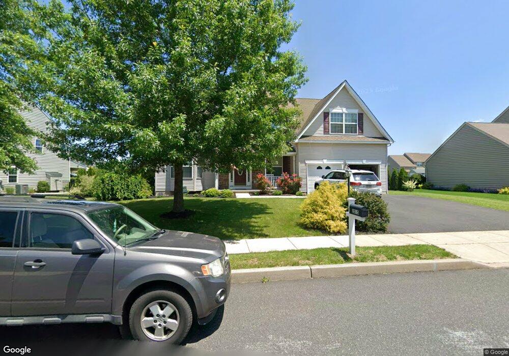
2015 Woodbridge Ln Pennsburg, PA 18073
Estimated Value: $598,000 - $706,000
4
Beds
3
Baths
3,926
Sq Ft
$170/Sq Ft
Est. Value
About This Home
This home is located at 2015 Woodbridge Ln, Pennsburg, PA 18073 and is currently estimated at $666,857, approximately $169 per square foot. 2015 Woodbridge Ln is a home located in Montgomery County with nearby schools including Upper Perkiomen 4th & 5th Grade Center, Upper Perkiomen Middle School, and Upper Perkiomen High School.
Ownership History
Date
Name
Owned For
Owner Type
Purchase Details
Closed on
Oct 13, 2015
Sold by
Reserve At Macoby Run Planned Community and Davis Pres Phyllis A
Bought by
Pres Sal Lapio and Lapio Sal Inc
Current Estimated Value
Purchase Details
Closed on
Dec 17, 2007
Sold by
Lapio Sal Inc
Bought by
Jones Kimberly and Jones Mark A
Home Financials for this Owner
Home Financials are based on the most recent Mortgage that was taken out on this home.
Original Mortgage
$265,000
Interest Rate
5.76%
Create a Home Valuation Report for This Property
The Home Valuation Report is an in-depth analysis detailing your home's value as well as a comparison with similar homes in the area
Home Values in the Area
Average Home Value in this Area
Purchase History
| Date | Buyer | Sale Price | Title Company |
|---|---|---|---|
| Pres Sal Lapio | -- | None Available | |
| Jones Kimberly | $395,846 | None Available |
Source: Public Records
Mortgage History
| Date | Status | Borrower | Loan Amount |
|---|---|---|---|
| Previous Owner | Jones Kimberly | $265,000 |
Source: Public Records
Tax History Compared to Growth
Tax History
| Year | Tax Paid | Tax Assessment Tax Assessment Total Assessment is a certain percentage of the fair market value that is determined by local assessors to be the total taxable value of land and additions on the property. | Land | Improvement |
|---|---|---|---|---|
| 2025 | $7,610 | $227,000 | -- | -- |
| 2024 | $7,610 | $227,000 | -- | -- |
| 2023 | $7,250 | $227,000 | $0 | $0 |
| 2022 | $6,816 | $216,420 | $0 | $0 |
| 2021 | $6,644 | $216,420 | $0 | $0 |
| 2020 | $6,607 | $216,420 | $0 | $0 |
| 2019 | $6,458 | $216,420 | $0 | $0 |
| 2018 | $6,458 | $216,420 | $0 | $0 |
| 2017 | $6,263 | $216,420 | $0 | $0 |
| 2016 | $6,179 | $216,420 | $0 | $0 |
| 2015 | $6,054 | $216,420 | $0 | $0 |
| 2014 | $5,830 | $216,420 | $0 | $0 |
Source: Public Records
Map
Nearby Homes
- 104 Watercrest Dr
- 1033 Bayberry Dr
- 884 Main St Unit 16
- 1127 Burgundy Cir
- 2190 E Buck Rd
- 772 Main St
- 1030 Burgundy Cir
- 872 Peaceful Ln
- 689 Mimosa Ct
- 1030 Walt Rd
- 406 Mimosa Ct
- 765 Fawn Way
- 249 W 4th St
- 1000 Smyth Ln Unit DEVONSHIRE
- 1000 Smyth Ln Unit NOTTINGHAM
- 1000 Smyth Ln Unit MAGNOLIA
- 1000 Smyth Ln Unit ANDREWS
- 1000 Smyth Ln Unit HAWTHORNE
- 1000 Smyth Ln Unit AUGUSTA
- 2013 Sunnyvale Dr
- 2017 Woodbridge Ln
- 2016 Woodbridge Ln
- 0 Railroad Ave Unit 696128
- 2013 Woodbridge Ln
- 2014 Woodbridge Ln
- 2018 Woodbridge Ln
- 1008 Brookview Dr
- 2011 Woodbridge Ln
- 2012 Woodbridge Ln
- 1006 Brookview Dr Unit 84
- 1006 Brookview Dr
- 1065 E 11th St
- 1065 E 11th St Unit 28
- 1063 E 11th St
- 1014 Brookview Dr
- 1010 Brookview Dr
- 1061 E 11th St
- 2000 Deer Run Rd
- 2009 Woodbridge Ln
- 2010 Woodbridge Ln