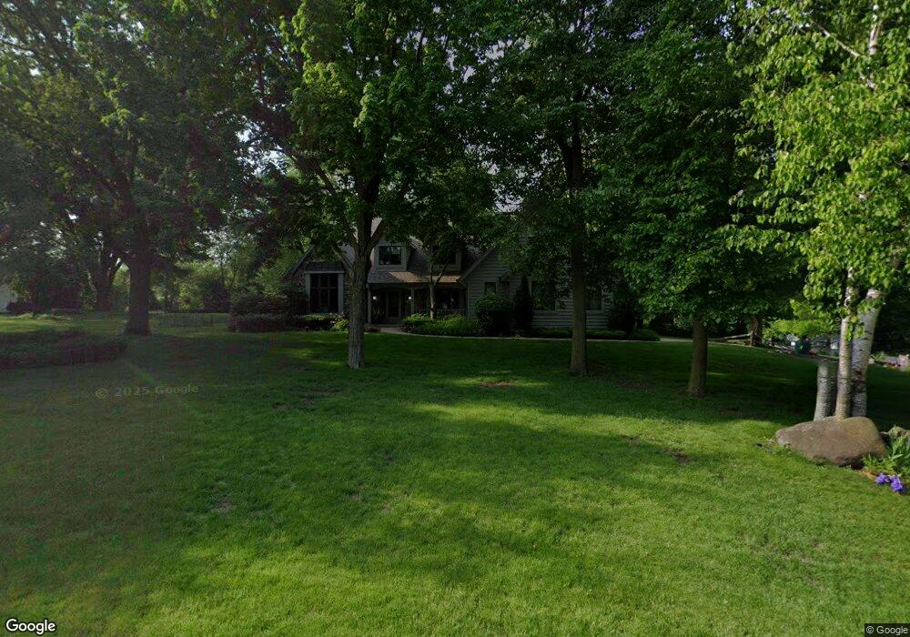
20150 Davidson Rd Brookfield, WI 53045
Brookfield Town NeighborhoodEstimated Value: $512,000 - $758,000
--
Bed
--
Bath
--
Sq Ft
0.56
Acres
About This Home
This home is located at 20150 Davidson Rd, Brookfield, WI 53045 and is currently estimated at $636,580. 20150 Davidson Rd is a home located in Waukesha County with nearby schools including Hillcrest Elementary School, Horning Middle School, and South High School.
Ownership History
Date
Name
Owned For
Owner Type
Purchase Details
Closed on
Jul 17, 1996
Sold by
Broman Donald E and Broman Jean L
Bought by
Caravella Michael J and Caravella Bonnie
Current Estimated Value
Home Financials for this Owner
Home Financials are based on the most recent Mortgage that was taken out on this home.
Original Mortgage
$168,000
Interest Rate
7.93%
Mortgage Type
Purchase Money Mortgage
Create a Home Valuation Report for This Property
The Home Valuation Report is an in-depth analysis detailing your home's value as well as a comparison with similar homes in the area
Home Values in the Area
Average Home Value in this Area
Purchase History
| Date | Buyer | Sale Price | Title Company |
|---|---|---|---|
| Caravella Michael J | $293,000 | -- |
Source: Public Records
Mortgage History
| Date | Status | Borrower | Loan Amount |
|---|---|---|---|
| Previous Owner | Caravella Michael J | $168,000 |
Source: Public Records
Tax History Compared to Growth
Tax History
| Year | Tax Paid | Tax Assessment Tax Assessment Total Assessment is a certain percentage of the fair market value that is determined by local assessors to be the total taxable value of land and additions on the property. | Land | Improvement |
|---|---|---|---|---|
| 2024 | $5,730 | $591,700 | $81,100 | $510,600 |
| 2023 | $5,792 | $591,700 | $81,100 | $510,600 |
| 2022 | $6,093 | $591,700 | $81,100 | $510,600 |
| 2021 | $6,008 | $481,900 | $67,600 | $414,300 |
| 2020 | $6,166 | $481,900 | $67,600 | $414,300 |
| 2019 | $6,283 | $481,900 | $67,600 | $414,300 |
| 2018 | $5,472 | $424,200 | $64,400 | $359,800 |
| 2017 | $5,465 | $424,200 | $64,400 | $359,800 |
| 2016 | $5,605 | $410,800 | $64,400 | $346,400 |
| 2015 | $5,665 | $410,800 | $64,400 | $346,400 |
| 2014 | $5,778 | $410,800 | $64,400 | $346,400 |
| 2013 | $5,778 | $384,700 | $64,400 | $320,300 |
Source: Public Records
Map
Nearby Homes
- Lt1 Davidson Rd
- 935 Auburn Ct
- 745 Hi Ridge Ave
- 1405 S Westwoods Rd
- 19125 Hi View Dr Unit 125
- 655 Mac Henry Cir Unit B
- 21525 Belgren Rd
- 1701 S Lilly Ln
- 165 Aerie Cir Unit 104
- 165 Aerie Cir Unit 105
- 165 Aerie Cir Unit 102
- 18625 Emerald Cir Unit G
- 18740 Emerald Cir Unit E
- 18525 Emerald Cir
- Lt2 Downie Rd
- 18705 Follett Dr
- 2423 Kossow Rd
- 18290 Prairie Falcon Ln
- 18600 Brookfield Lake Dr Unit 53
- 18575 Brookfield Lake Dr Unit 61
- 655 Poplar Creek Dr
- 20165 Davidson Rd
- 20190 Davidson Rd
- 625 Poplar Creek Dr
- 650 Poplar Creek Dr
- 20195 Linden Ln
- 20235 Linden Ln
- 20095 Davidson Rd
- 20195 Davidson Rd
- 20175 Linden Ln
- 20275 Linden Ln
- 735 Poplar Creek Dr
- 620 Poplar Creek Dr
- 595 Poplar Creek Dr
- 20225 Davidson Rd
- Lt1 Davidson Rd Unit Lt1
- 600 Poplar Creek Dr
- 765 Poplar Creek Dr
- 740 Linden Ln
- 20200 Linden Ln