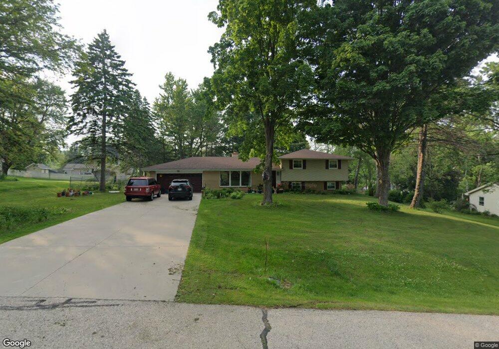
20150 Linden Ln Brookfield, WI 53045
Brookfield Town NeighborhoodEstimated Value: $383,267 - $493,000
--
Bed
--
Bath
--
Sq Ft
0.59
Acres
About This Home
This home is located at 20150 Linden Ln, Brookfield, WI 53045 and is currently estimated at $456,317. 20150 Linden Ln is a home located in Waukesha County with nearby schools including Hillcrest Elementary School, Horning Middle School, and South High School.
Ownership History
Date
Name
Owned For
Owner Type
Purchase Details
Closed on
Feb 23, 2018
Sold by
Affeldt Steven A
Bought by
Schmitt Richard A and Schmitt Ludy S
Current Estimated Value
Home Financials for this Owner
Home Financials are based on the most recent Mortgage that was taken out on this home.
Original Mortgage
$133,000
Outstanding Balance
$75,753
Interest Rate
4.04%
Mortgage Type
New Conventional
Estimated Equity
$380,564
Create a Home Valuation Report for This Property
The Home Valuation Report is an in-depth analysis detailing your home's value as well as a comparison with similar homes in the area
Home Values in the Area
Average Home Value in this Area
Purchase History
| Date | Buyer | Sale Price | Title Company |
|---|---|---|---|
| Schmitt Richard A | $168,000 | None Available |
Source: Public Records
Mortgage History
| Date | Status | Borrower | Loan Amount |
|---|---|---|---|
| Open | Schmitt Richard A | $133,000 |
Source: Public Records
Tax History Compared to Growth
Tax History
| Year | Tax Paid | Tax Assessment Tax Assessment Total Assessment is a certain percentage of the fair market value that is determined by local assessors to be the total taxable value of land and additions on the property. | Land | Improvement |
|---|---|---|---|---|
| 2024 | $2,937 | $313,200 | $88,200 | $225,000 |
| 2023 | $2,953 | $313,200 | $88,200 | $225,000 |
| 2022 | $3,123 | $313,200 | $88,200 | $225,000 |
| 2021 | $3,072 | $256,000 | $73,500 | $182,500 |
| 2020 | $3,183 | $256,000 | $73,500 | $182,500 |
| 2019 | $3,235 | $256,000 | $73,500 | $182,500 |
| 2018 | $3,012 | $229,900 | $70,000 | $159,900 |
| 2017 | $3,376 | $229,900 | $70,000 | $159,900 |
| 2016 | $3,021 | $226,900 | $70,000 | $156,900 |
| 2015 | $3,060 | $226,900 | $70,000 | $156,900 |
| 2014 | $3,160 | $226,900 | $70,000 | $156,900 |
| 2013 | $3,160 | $215,000 | $70,000 | $145,000 |
Source: Public Records
Map
Nearby Homes
- Lt1 Davidson Rd
- 935 Auburn Ct
- 745 Hi Ridge Ave
- 19125 Hi View Dr Unit 125
- 1405 S Westwoods Rd
- 655 Mac Henry Cir Unit B
- 21525 Belgren Rd
- 165 Aerie Cir Unit 104
- 165 Aerie Cir Unit 105
- 165 Aerie Cir Unit 102
- 2423 Kossow Rd
- 18625 Emerald Cir Unit G
- 18740 Emerald Cir Unit E
- 18525 Emerald Cir
- 18705 Follett Dr
- 1701 S Lilly Ln
- Lt2 Downie Rd
- 18600 Brookfield Lake Dr Unit 53
- 950 N Barker Rd
- 18290 Prairie Falcon Ln
- 20190 Linden Ln
- 20110 Linden Ln
- 20205 Scarlet Hawthorne Rd
- 20165 Scarlet Hawthorne Rd
- 20175 Linden Ln
- 20235 Scarlet Hawthorne Rd
- 20125 Scarlet Hawthorne Rd
- 20200 Linden Ln
- 545 Poplar Creek Dr
- 20265 Scarlet Hawthorne Rd
- 595 Poplar Creek Dr
- 20195 Linden Ln
- 505 Poplar Creek Dr
- 625 Poplar Creek Dr
- 20295 Scarlet Hawthorne Rd
- 20230 Linden Ln
- 470 Scarlet Hawthorne Ct
- 20235 Linden Ln
- 485 Scarlet Hawthorne Ct
- 655 Poplar Creek Dr