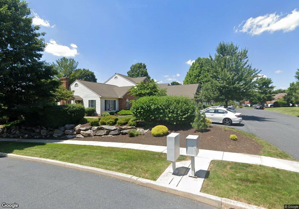
2015C Southpoint Dr Hummelstown, PA 17036
Estimated Value: $297,000 - $345,000
2
Beds
4
Baths
1,963
Sq Ft
$162/Sq Ft
Est. Value
About This Home
This home is located at 2015C Southpoint Dr, Hummelstown, PA 17036 and is currently estimated at $318,551, approximately $162 per square foot. 2015C Southpoint Dr is a home located in Dauphin County with nearby schools including Hershey Elementary School, Hershey Primary Elementary School, and Hershey Middle School.
Ownership History
Date
Name
Owned For
Owner Type
Purchase Details
Closed on
Jan 24, 2015
Sold by
Keagy Jennifer L
Bought by
Keaty Jennifer L
Current Estimated Value
Home Financials for this Owner
Home Financials are based on the most recent Mortgage that was taken out on this home.
Original Mortgage
$136,000
Outstanding Balance
$103,867
Interest Rate
3.84%
Mortgage Type
New Conventional
Estimated Equity
$214,684
Purchase Details
Closed on
Sep 30, 2010
Sold by
Hoffman Michael M
Bought by
Markiewicz Jennifer L
Home Financials for this Owner
Home Financials are based on the most recent Mortgage that was taken out on this home.
Original Mortgage
$131,200
Interest Rate
4.44%
Mortgage Type
New Conventional
Create a Home Valuation Report for This Property
The Home Valuation Report is an in-depth analysis detailing your home's value as well as a comparison with similar homes in the area
Home Values in the Area
Average Home Value in this Area
Purchase History
| Date | Buyer | Sale Price | Title Company |
|---|---|---|---|
| Keaty Jennifer L | -- | -- | |
| Markiewicz Jennifer L | $164,000 | -- |
Source: Public Records
Mortgage History
| Date | Status | Borrower | Loan Amount |
|---|---|---|---|
| Open | Keaty Jennifer L | $136,000 | |
| Previous Owner | Markiewicz Jennifer L | $131,200 |
Source: Public Records
Tax History Compared to Growth
Tax History
| Year | Tax Paid | Tax Assessment Tax Assessment Total Assessment is a certain percentage of the fair market value that is determined by local assessors to be the total taxable value of land and additions on the property. | Land | Improvement |
|---|---|---|---|---|
| 2025 | $3,857 | $123,400 | $25,300 | $98,100 |
| 2024 | $3,625 | $123,400 | $25,300 | $98,100 |
| 2023 | $3,560 | $123,400 | $25,300 | $98,100 |
| 2022 | $3,481 | $123,400 | $25,300 | $98,100 |
| 2021 | $3,481 | $123,400 | $25,300 | $98,100 |
| 2020 | $3,481 | $123,400 | $25,300 | $98,100 |
| 2019 | $3,418 | $123,400 | $25,300 | $98,100 |
| 2018 | $3,328 | $123,400 | $25,300 | $98,100 |
| 2017 | $3,328 | $123,400 | $25,300 | $98,100 |
| 2016 | $0 | $123,400 | $25,300 | $98,100 |
| 2015 | -- | $123,400 | $25,300 | $98,100 |
| 2014 | -- | $123,400 | $25,300 | $98,100 |
Source: Public Records
Map
Nearby Homes
- 2059B Raleigh Rd Unit B
- 1919 Limestone Dr
- 497 Middletown Rd
- 0 W Kaylor Rd
- 1565 Brookline Dr
- 177 Middletown Rd
- 610 Carrington Ct
- 1421 Jill Dr
- 1609 Spring Hill Dr
- 589 Lovell Ct
- 257 Willow St
- 1412 Kaylor Rd
- 1243 Peggy Dr
- 1165 Wicklow Ct
- 579 Roslaire Dr
- 1015 Waltonville Rd
- 609 W High St
- 1382 Fox Glenn Dr
- 235 W 2nd St
- 30 N Walnut St
- 2015F Southpoint Dr
- 2015 Southpoint Dr Unit D
- 2015D Southpoint Dr
- 2015B Southpoint Dr
- 2015E Southpoint Dr
- 2015 E E Southpoint Dr
- 2015A Southpoint Dr
- 2017F Raleigh Rd
- 2017 Raleigh Rd
- 2029C Raleigh Rd
- 2017C Raleigh Rd
- 2029 Raleigh Rd
- 2029B Raleigh Rd
- 2017A Raleigh Rd
- 2033A Raleigh Rd
- 2033B Raleigh Rd
- 2022 Southpoint Dr
- 2033C Raleigh Rd
- 2033d Raleigh Rd
- 2018 Southpoint Dr