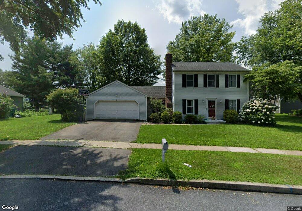
2016 Colonial Way Hummelstown, PA 17036
Estimated Value: $350,000 - $436,000
3
Beds
2
Baths
1,250
Sq Ft
$313/Sq Ft
Est. Value
About This Home
This home is located at 2016 Colonial Way, Hummelstown, PA 17036 and is currently estimated at $391,182, approximately $312 per square foot. 2016 Colonial Way is a home located in Dauphin County with nearby schools including Hershey Elementary School, Hershey Primary Elementary School, and Hershey Middle School.
Ownership History
Date
Name
Owned For
Owner Type
Purchase Details
Closed on
Jun 19, 2010
Sold by
Ball James A
Bought by
Edleman John R
Current Estimated Value
Home Financials for this Owner
Home Financials are based on the most recent Mortgage that was taken out on this home.
Original Mortgage
$193,325
Interest Rate
4.36%
Mortgage Type
FHA
Create a Home Valuation Report for This Property
The Home Valuation Report is an in-depth analysis detailing your home's value as well as a comparison with similar homes in the area
Home Values in the Area
Average Home Value in this Area
Purchase History
| Date | Buyer | Sale Price | Title Company |
|---|---|---|---|
| Edleman John R | $200,000 | -- |
Source: Public Records
Mortgage History
| Date | Status | Borrower | Loan Amount |
|---|---|---|---|
| Previous Owner | Edleman John R | $193,325 |
Source: Public Records
Tax History Compared to Growth
Tax History
| Year | Tax Paid | Tax Assessment Tax Assessment Total Assessment is a certain percentage of the fair market value that is determined by local assessors to be the total taxable value of land and additions on the property. | Land | Improvement |
|---|---|---|---|---|
| 2025 | $4,641 | $148,500 | $38,200 | $110,300 |
| 2024 | $4,362 | $148,500 | $38,200 | $110,300 |
| 2023 | $4,284 | $148,500 | $38,200 | $110,300 |
| 2022 | $4,189 | $148,500 | $38,200 | $110,300 |
| 2021 | $4,189 | $148,500 | $38,200 | $110,300 |
| 2020 | $4,189 | $148,500 | $38,200 | $110,300 |
| 2019 | $4,114 | $148,500 | $38,200 | $110,300 |
| 2018 | $4,004 | $148,500 | $38,200 | $110,300 |
| 2017 | $4,004 | $148,500 | $38,200 | $110,300 |
| 2016 | $0 | $148,500 | $38,200 | $110,300 |
| 2015 | -- | $148,500 | $38,200 | $110,300 |
| 2014 | -- | $148,500 | $38,200 | $110,300 |
Source: Public Records
Map
Nearby Homes
- 2059B Raleigh Rd Unit B
- 1919 Limestone Dr
- 497 Middletown Rd
- 0 W Kaylor Rd
- 1565 Brookline Dr
- 1609 Spring Hill Dr
- 1412 Kaylor Rd
- 1421 Jill Dr
- 177 Middletown Rd
- 589 Lovell Ct
- 1165 Wicklow Ct
- 1015 Waltonville Rd
- 118 S Railroad St
- 1382 Fox Glenn Dr
- 609 W High St
- 579 Roslaire Dr
- 30 N Walnut St
- 235 W 2nd St
- 848 Gregs Dr
- 813 Gregs Dr
- 975 Kings Way W
- 981 Kings Way W
- 2010 Colonial Way
- 2017 Locust Ln
- 2027 Locust Ln
- 2015 Colonial Way
- 2009 Locust Ln
- 955 Kings Way E
- 2009 Colonial Way
- 2035 Locust Ln
- 980 Kings Way W
- 974 Kings Way W
- 988 Kings Way W
- 951 Kings Way E
- 945 Kings Way E
- 2045 Locust Ln
- 2044 Southpoint Dr
- 985 Tucker Cove
- 2010 Locust Ln
- 2040 Southpoint Dr