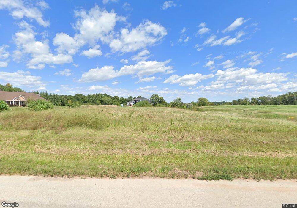
2016 Jen Dr de Pere, WI 54115
Estimated Value: $987,000 - $1,225,069
--
Bed
--
Bath
--
Sq Ft
1.6
Acres
About This Home
This home is located at 2016 Jen Dr, de Pere, WI 54115 and is currently estimated at $1,106,035. 2016 Jen Dr is a home with nearby schools including Westwood Elementary School, West De Pere Middle School, and West De Pere High School.
Ownership History
Date
Name
Owned For
Owner Type
Purchase Details
Closed on
Dec 31, 2020
Sold by
Huth Rodney C and Huth Patricia J
Bought by
Vann Scott J and Vann Tammy L
Current Estimated Value
Home Financials for this Owner
Home Financials are based on the most recent Mortgage that was taken out on this home.
Original Mortgage
$225,000
Outstanding Balance
$200,778
Interest Rate
2.7%
Mortgage Type
Purchase Money Mortgage
Estimated Equity
$905,257
Purchase Details
Closed on
Aug 31, 2009
Sold by
Huth Rodney C
Bought by
Huth Grace M
Create a Home Valuation Report for This Property
The Home Valuation Report is an in-depth analysis detailing your home's value as well as a comparison with similar homes in the area
Home Values in the Area
Average Home Value in this Area
Purchase History
| Date | Buyer | Sale Price | Title Company |
|---|---|---|---|
| Vann Scott J | $250,000 | First American Title | |
| Huth Grace M | -- | None Available |
Source: Public Records
Mortgage History
| Date | Status | Borrower | Loan Amount |
|---|---|---|---|
| Open | Vann Scott J | $225,000 |
Source: Public Records
Tax History Compared to Growth
Tax History
| Year | Tax Paid | Tax Assessment Tax Assessment Total Assessment is a certain percentage of the fair market value that is determined by local assessors to be the total taxable value of land and additions on the property. | Land | Improvement |
|---|---|---|---|---|
| 2024 | $14,492 | $991,600 | $107,600 | $884,000 |
| 2023 | $13,624 | $991,600 | $107,600 | $884,000 |
| 2022 | $3,366 | $245,600 | $245,600 | $0 |
| 2021 | $3,412 | $245,600 | $245,600 | $0 |
| 2020 | $13 | $700 | $700 | $0 |
| 2019 | $13 | $700 | $700 | $0 |
| 2018 | $13 | $700 | $700 | $0 |
| 2017 | $13 | $700 | $700 | $0 |
| 2016 | $15 | $800 | $800 | $0 |
| 2015 | $14 | $800 | $800 | $0 |
| 2014 | $18 | $800 | $800 | $0 |
| 2013 | $18 | $800 | $800 | $0 |
Source: Public Records
Map
Nearby Homes
- 3141 Toad Island Trail
- 3137 Toad Island Trail
- 3128 Toad Island Trail
- 0 Cth Zz
- 726 Tambour Ct
- 726 Tambour Ct Unit 7
- 733 Tambour Ct
- 733 Tambour Ct Unit 10
- 706 Tambour Ct
- 3237 Lost Dauphin Rd
- 3133 Toad Island Trail
- 2835 Tambour Trail
- 3124 Toad Island Trail
- 0 Tambour Trail Unit 50212878
- 0 Tambour Trail Unit 50212876
- 0 Tambour Trail Unit 50212793
- 0 Tambour Trail Unit 50212791
- 0 Tambour Trail Unit 50212783
- 0 Sabal Oak Dr Unit 50212865
- 0 Sabal Oak Dr Unit 50212858
- 2028 Jen Dr
- 2040 Jen Dr
- 2011 Harvest Ct
- 3035 Whistling Wind Dr
- 2019 Harvest Ct
- 2010 Harvest Ct
- 3059 Lost Dauphin Rd
- 2022 Harvest Ct
- 3004 S Whistling Wind Dr
- 3040 S Whistling Wind Dr
- 0 Harvest Ct
- 3071 Lost Dauphin Rd
- 2034 Harvest Ct
- 3022 S Whistling Wind Dr
- 3046 S Whistling Wind Dr
- 3079 Lost Dauphin Rd
- 3016 S Whistling Wind Dr
- 3093 Lost Dauphin Rd
- 3103 Lost Dauphin Rd
- 2926 Lost Dauphin Rd
