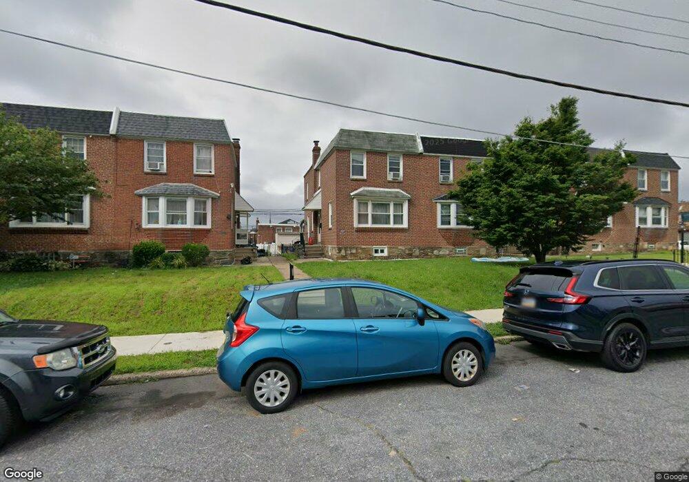
2016 Lansing St Philadelphia, PA 19152
Rhawnhurst NeighborhoodEstimated Value: $309,000 - $330,000
3
Beds
2
Baths
1,306
Sq Ft
$244/Sq Ft
Est. Value
About This Home
This home is located at 2016 Lansing St, Philadelphia, PA 19152 and is currently estimated at $318,451, approximately $243 per square foot. 2016 Lansing St is a home located in Philadelphia County with nearby schools including Rhawnhurst School, Castor Gardens Middle School, and Northeast High School.
Ownership History
Date
Name
Owned For
Owner Type
Purchase Details
Closed on
Dec 28, 2009
Sold by
Salvi Prakash S and Salvi Asha P
Bought by
Mak Elaine and Mak Lisa
Current Estimated Value
Home Financials for this Owner
Home Financials are based on the most recent Mortgage that was taken out on this home.
Original Mortgage
$165,600
Outstanding Balance
$108,726
Interest Rate
4.95%
Mortgage Type
New Conventional
Estimated Equity
$209,725
Purchase Details
Closed on
Aug 16, 1999
Sold by
Sentner Herbert J and Estate Of Theresa C Doody
Bought by
Berdecia Lionel
Create a Home Valuation Report for This Property
The Home Valuation Report is an in-depth analysis detailing your home's value as well as a comparison with similar homes in the area
Home Values in the Area
Average Home Value in this Area
Purchase History
| Date | Buyer | Sale Price | Title Company |
|---|---|---|---|
| Mak Elaine | $184,000 | None Available | |
| Berdecia Lionel | $79,800 | -- |
Source: Public Records
Mortgage History
| Date | Status | Borrower | Loan Amount |
|---|---|---|---|
| Open | Mak Elaine | $165,600 |
Source: Public Records
Tax History Compared to Growth
Tax History
| Year | Tax Paid | Tax Assessment Tax Assessment Total Assessment is a certain percentage of the fair market value that is determined by local assessors to be the total taxable value of land and additions on the property. | Land | Improvement |
|---|---|---|---|---|
| 2025 | $3,343 | $285,400 | $57,080 | $228,320 |
| 2024 | $3,343 | $285,400 | $57,080 | $228,320 |
| 2023 | $3,343 | $238,800 | $47,760 | $191,040 |
| 2022 | $1,953 | $193,800 | $47,760 | $146,040 |
| 2021 | $2,583 | $0 | $0 | $0 |
| 2020 | $2,583 | $0 | $0 | $0 |
| 2019 | $2,352 | $0 | $0 | $0 |
| 2018 | $2,415 | $0 | $0 | $0 |
| 2017 | $2,415 | $0 | $0 | $0 |
| 2016 | $2,415 | $0 | $0 | $0 |
| 2015 | $2,312 | $0 | $0 | $0 |
| 2014 | -- | $172,500 | $39,775 | $132,725 |
| 2012 | -- | $21,696 | $4,169 | $17,527 |
Source: Public Records
Map
Nearby Homes
- 2023 Hartel Ave
- 1919 Lansing St
- 2120 Napfle St
- 1834 Lansing St
- 1826 Hartel Ave
- 7815 Horrocks St
- 7528 Loretto Ave
- 1821 Afton St
- 1824 Afton St
- 1807 Napfle Ave
- 1917 Griffith St
- 7912 14 Loretto Ave
- 1858 Glendale Ave
- 2029 Loney St
- 7414 Castor Ave
- 2123 Loney St
- 1714 Afton St
- 1931 33 Rhawn St
- 7830 Summerdale Ave
- 1719 Loney St
- 2018 Lansing St
- 2020 Lansing St
- 2014 Lansing St
- 2022 Lansing St
- 2024 Lansing St
- 2012 Lansing St
- 2026 Lansing St
- 2010 Lansing St
- 2017 Napfle St
- 2015 Napfle St
- 2028 Lansing St
- 2019 Napfle St
- 2013 Napfle St
- 2021 Napfle St
- 2011 Napfle St
- 2023 Napfle St
- 2030 Lansing St
- 2009 Napfle St
- 2015 Lansing St
- 2025 Napfle St