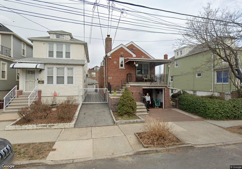
2016 Lurting Ave Bronx, NY 10461
Morris Park NeighborhoodEstimated Value: $704,983 - $977,000
About This Home
This home is located at 2016 Lurting Ave, Bronx, NY 10461 and is currently estimated at $831,996, approximately $521 per square foot. 2016 Lurting Ave is a home located in Bronx County with nearby schools including P.S. 108 Philip J Abinanti, J.H.S. 144 Michelangelo, and St. Clare of Assisi School.
Ownership History
We collect this data history from publicly available records. To have your information removed, we recommend requesting removal directly through your county’s website.
Purchase Details
Home Financials for this Owner
Home Financials are based on the most recent Mortgage that was taken out on this home.Home Values in the Area
Average Home Value in this Area
Purchase History
We collect this data history from publicly available records. To have your information removed, we recommend requesting removal directly through your county’s website.
| Date | Buyer | Sale Price | Title Company |
|---|---|---|---|
| $622,000 | -- |
Mortgage History
We collect this data history from publicly available records. To have your information removed, we recommend requesting removal directly through your county’s website.
| Date | Status | Borrower | Loan Amount |
|---|---|---|---|
| Open | $475,000 |
Tax History
We collect this data history from publicly available records. To have your information removed, we recommend requesting removal directly through your county’s website.
| Year | Tax Paid | Tax Assessment Tax Assessment Total Assessment is a certain percentage of the fair market value that is determined by local assessors to be the total taxable value of land and additions on the property. | Land | Improvement |
|---|---|---|---|---|
| 2026 | $7,392 | $39,014 | $10,103 | $28,911 |
| 2025 | $7,392 | $36,806 | $9,705 | $27,101 |
| 2024 | $7,392 | $36,806 | $8,792 | $28,014 |
| 2023 | $7,309 | $35,990 | $8,810 | $27,180 |
| 2022 | $6,778 | $43,740 | $11,280 | $32,460 |
| 2021 | $6,842 | $40,980 | $11,280 | $29,700 |
| 2020 | $6,492 | $42,060 | $11,280 | $30,780 |
| 2019 | $6,416 | $37,440 | $11,280 | $26,160 |
| 2018 | $6,114 | $29,992 | $8,078 | $21,914 |
| 2017 | $2,238 | $28,296 | $8,471 | $19,825 |
| 2016 | $2,087 | $27,093 | $10,589 | $16,504 |
| 2015 | $1,171 | $25,560 | $12,540 | $13,020 |
| 2014 | $1,171 | $25,560 | $12,540 | $13,020 |
Map
- 2021 Haight Ave
- 1100 Neill Ave
- 1954 Hone Ave
- 1950 Haight Ave
- 1911 Haight Ave
- 1103 Rhinelander Ave
- 986 Neill Ave
- 2042 Bogart Ave
- 1116 Rhinelander Ave
- 2033 Hering Ave
- 2004 Bogart Ave
- 1863 Williamsbridge Rd
- 1183 Neill Ave
- 1925 Radcliff Ave
- 1194 Lydig Ave
- 1844 Tomlinson Ave
- 2129 Muliner Ave
- 1922 Hering Ave
- 1957 Bogart Ave
- 1201 Neill Ave
- 2018 Lurting Ave
- 2012 Lurting Ave
- 2020 Lurting Ave
- 2010 Lurting Ave
- 2022 Lurting Ave
- 2017 Haight Ave
- 2019 Haight Ave
- 2015 Haight Ave
- 2015 Haight Ave Unit 1
- 2003 Haight Ave
- 2026 Lurting Ave
- 1083 Neill Ave
- 2023 Haight Ave
- 2004 Lurting Ave
- 1085 Neill Ave
- 1087 Neill Ave
- 2011 Lurting Ave Unit 3
- 2011 Lurting Ave
- 2028 Lurting Ave
- 1089 Neill Ave
Ask me questions while you tour the home.