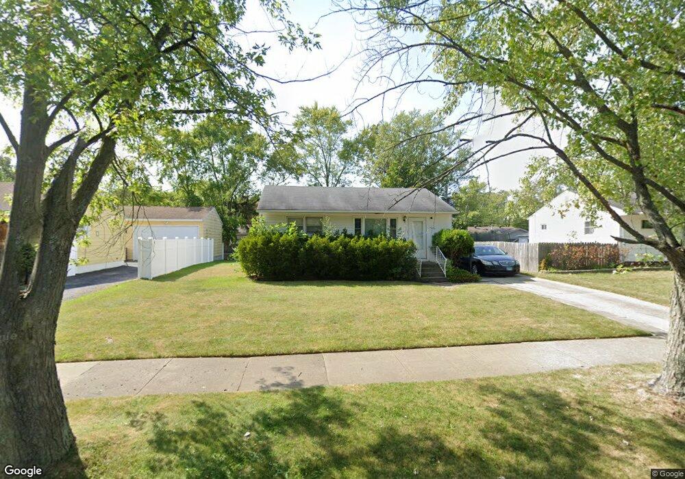
2016 Miami Rd Unit 2 Waukegan, IL 60087
Lake Cogardens NeighborhoodEstimated Value: $187,000 - $217,237
2
Beds
1
Bath
768
Sq Ft
$267/Sq Ft
Est. Value
About This Home
This home is located at 2016 Miami Rd Unit 2, Waukegan, IL 60087 and is currently estimated at $205,309, approximately $267 per square foot. 2016 Miami Rd Unit 2 is a home located in Lake County with nearby schools including Oakdale Elementary School, Miguel Juarez Middle School, and Waukegan High School.
Ownership History
Date
Name
Owned For
Owner Type
Purchase Details
Closed on
Dec 8, 2003
Sold by
Serzynski Robert and Grouley Mark W
Bought by
Serzynski Robert R
Current Estimated Value
Home Financials for this Owner
Home Financials are based on the most recent Mortgage that was taken out on this home.
Original Mortgage
$85,000
Outstanding Balance
$36,592
Interest Rate
4.87%
Mortgage Type
Purchase Money Mortgage
Estimated Equity
$168,717
Purchase Details
Closed on
Sep 21, 1995
Sold by
Knuth Donald R and Knuth Susan M Booker
Bought by
Serzynski Robert P and Gourley Mark W
Home Financials for this Owner
Home Financials are based on the most recent Mortgage that was taken out on this home.
Original Mortgage
$84,560
Interest Rate
7.52%
Mortgage Type
FHA
Create a Home Valuation Report for This Property
The Home Valuation Report is an in-depth analysis detailing your home's value as well as a comparison with similar homes in the area
Home Values in the Area
Average Home Value in this Area
Purchase History
| Date | Buyer | Sale Price | Title Company |
|---|---|---|---|
| Serzynski Robert R | -- | -- | |
| Serzynski Robert P | $85,000 | Attorneys Natl Title Network |
Source: Public Records
Mortgage History
| Date | Status | Borrower | Loan Amount |
|---|---|---|---|
| Open | Serzynski Robert R | $85,000 | |
| Previous Owner | Serzynski Robert P | $84,560 |
Source: Public Records
Tax History Compared to Growth
Tax History
| Year | Tax Paid | Tax Assessment Tax Assessment Total Assessment is a certain percentage of the fair market value that is determined by local assessors to be the total taxable value of land and additions on the property. | Land | Improvement |
|---|---|---|---|---|
| 2024 | $4,255 | $58,810 | $8,366 | $50,444 |
| 2023 | $4,255 | $53,129 | $7,558 | $45,571 |
| 2022 | $3,905 | $45,941 | $7,201 | $38,740 |
| 2021 | $3,561 | $40,159 | $6,234 | $33,925 |
| 2020 | $3,561 | $37,413 | $5,808 | $31,605 |
| 2019 | $3,531 | $34,283 | $5,322 | $28,961 |
| 2018 | $2,734 | $27,526 | $6,780 | $20,746 |
| 2017 | $2,611 | $24,352 | $5,998 | $18,354 |
| 2016 | $2,343 | $21,161 | $5,212 | $15,949 |
| 2015 | $2,186 | $18,940 | $4,665 | $14,275 |
| 2014 | $2,269 | $18,948 | $5,119 | $13,829 |
| 2012 | $2,366 | $21,362 | $5,547 | $15,815 |
Source: Public Records
Map
Nearby Homes
- 2715 W Greenwood Ave
- 2928 W Country Club Ave
- 3000 W Country Club Ave
- 2946 W Country Club Ave
- 2440 W Cheyenne Rd
- 1913 Chippewa Rd
- 2713 Varonen Ave
- 3320 Sunset Ave
- 2705 Dana Ave
- 2810 W Atlantic Ave
- 2708 Dana Ave
- 2207 Williamsburg Dr
- 3032 W Vermont Ave
- 12352 W Atlantic Ave
- 2813 Theresa Ave
- 36955 N Garrick Ave
- 12933 W Polo Ave
- 2008 Harding Ave
- 2009 Harding Ave
- 2350 N Lewis Ave
- 2020 Miami Rd
- 2012 Miami Rd
- 2015 Indian Rd
- 2019 Indian Rd Unit 2
- 2024 Miami Rd
- 2008 Miami Rd
- 2011 Indian Rd
- 2023 Indian Rd
- 2015 Miami Rd
- 2019 Miami Rd
- 2011 Miami Rd
- 2028 Miami Rd
- 2027 Indian Rd
- 2722 Illini Rd
- 2001 Indian Rd
- 2023 Miami Rd
- 2007 Miami Rd
- 2031 Indian Rd
- 2027 Miami Rd
- 2032 Miami Rd Unit 2