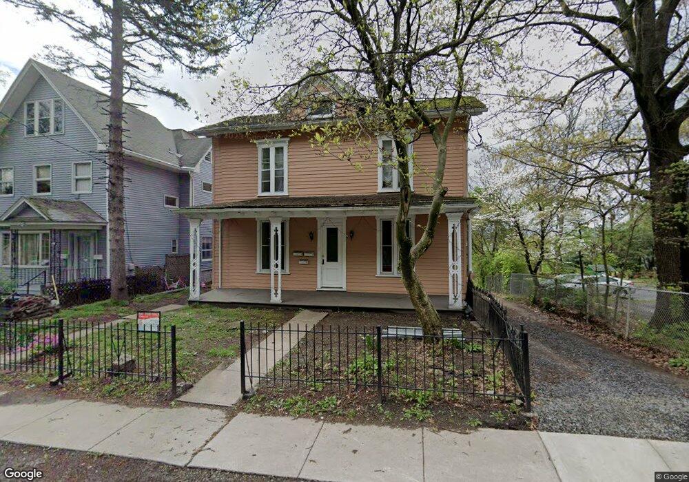
2016 N Main Ave Scranton, PA 18508
Providence NeighborhoodEstimated Value: $183,000 - $308,000
--
Bed
--
Bath
4,206
Sq Ft
$61/Sq Ft
Est. Value
About This Home
This home is located at 2016 N Main Ave, Scranton, PA 18508 and is currently estimated at $256,667, approximately $61 per square foot. 2016 N Main Ave is a home located in Lackawanna County with nearby schools including Neil Armstrong Elementary School, Scranton High School, and St. Paul St. Clare School St. Clare Campus.
Ownership History
Date
Name
Owned For
Owner Type
Purchase Details
Closed on
Jan 26, 2022
Sold by
Cooper Mr
Bought by
Begazo Narciso Richard
Current Estimated Value
Purchase Details
Closed on
Apr 17, 2019
Sold by
Anno Domini
Bought by
Nationstar Mortgage Llc and Mr Cooper
Purchase Details
Closed on
Dec 4, 2009
Sold by
Hundley Gerald C
Bought by
Fair Theodore
Home Financials for this Owner
Home Financials are based on the most recent Mortgage that was taken out on this home.
Original Mortgage
$157,102
Interest Rate
5.01%
Mortgage Type
FHA
Purchase Details
Closed on
Jan 22, 2008
Sold by
Hundley Christine M
Bought by
Hundley Gerald C
Create a Home Valuation Report for This Property
The Home Valuation Report is an in-depth analysis detailing your home's value as well as a comparison with similar homes in the area
Home Values in the Area
Average Home Value in this Area
Purchase History
| Date | Buyer | Sale Price | Title Company |
|---|---|---|---|
| Begazo Narciso Richard | $75,000 | Rosenberg Lpa Llc | |
| Nationstar Mortgage Llc | $1,031 | None Available | |
| Fair Theodore | $160,000 | None Available | |
| Hundley Gerald C | $20,000 | None Available |
Source: Public Records
Mortgage History
| Date | Status | Borrower | Loan Amount |
|---|---|---|---|
| Previous Owner | Fair Theodore | $157,102 |
Source: Public Records
Tax History Compared to Growth
Tax History
| Year | Tax Paid | Tax Assessment Tax Assessment Total Assessment is a certain percentage of the fair market value that is determined by local assessors to be the total taxable value of land and additions on the property. | Land | Improvement |
|---|---|---|---|---|
| 2025 | $5,787 | $16,000 | $5,800 | $10,200 |
| 2024 | $5,331 | $16,000 | $5,800 | $10,200 |
| 2023 | $5,331 | $16,000 | $5,800 | $10,200 |
| 2022 | $5,215 | $16,000 | $5,800 | $10,200 |
| 2021 | $5,215 | $16,000 | $5,800 | $10,200 |
| 2020 | $5,130 | $16,000 | $5,800 | $10,200 |
| 2019 | $4,839 | $16,000 | $5,800 | $10,200 |
| 2018 | $4,839 | $16,000 | $5,800 | $10,200 |
| 2017 | $4,763 | $16,000 | $5,800 | $10,200 |
| 2016 | $1,864 | $16,000 | $5,800 | $10,200 |
| 2015 | $3,690 | $16,000 | $5,800 | $10,200 |
| 2014 | -- | $16,000 | $5,800 | $10,200 |
Source: Public Records
Map
Nearby Homes
- 2040 Margaret Ave Unit 2042
- 2089 N Main Ave
- 2105 Belmont Terrace
- 2113 Golden Ave
- 335 337 Spring
- 1718 Rear Wayne Ave
- 314 W Market St
- 332 Spring St
- 2219 Golden Ave
- 416 Electric St
- 180 Golden Ave Unit 182
- 508 Electric St
- 1711 N Sumner Ave
- 512 Electric St Unit 510-516
- 117 Ferdinand St
- 1729 Wayne Ave
- 193 W Parker St
- 231 Putnam St
- 35 Dean St
- 440 Leggett St
- 2018 N Main Ave
- 1932 N Main Ave Unit 1934
- 2030 N Main Ave
- 2011 N Main Ave
- 2005 N Main Ave
- 1930 N Main Ave
- 2027 2029 N Main Ave
- 2029 N Main Ave
- 1929 N North Main Ave
- 9 E Market St
- 2014 Edna Ave
- 1926 N Main Ave
- 2040 N Main Ave
- 2040 N Main Ave Unit Main-14
- 1929 N Main Ave
- 2010 Edna Ave
- 2012 Edna Ave
- 2006 Edna Ave
- 2039 N Main Ave
- 1924 N Main Ave