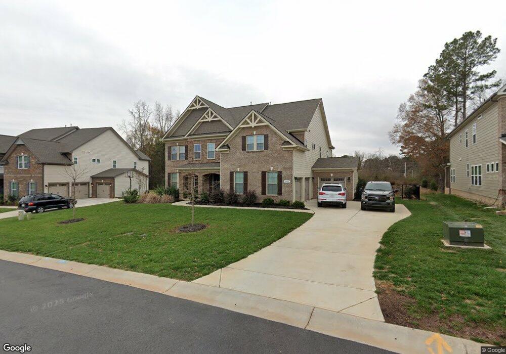
2016 Perry Pond Dr Unit 31 Waxhaw, NC 28173
Estimated Value: $874,000 - $1,229,000
5
Beds
4
Baths
4,276
Sq Ft
$252/Sq Ft
Est. Value
About This Home
This home is located at 2016 Perry Pond Dr Unit 31, Waxhaw, NC 28173 and is currently estimated at $1,077,907, approximately $252 per square foot. 2016 Perry Pond Dr Unit 31 is a home located in Union County with nearby schools including New Town Elementary School, Cuthbertson Middle School, and Cuthbertson High School.
Ownership History
Date
Name
Owned For
Owner Type
Purchase Details
Closed on
Mar 27, 2017
Sold by
Calatlantic Group Inc
Bought by
Jamison Bernita Rae and Jamison Robert Nathaniel
Current Estimated Value
Home Financials for this Owner
Home Financials are based on the most recent Mortgage that was taken out on this home.
Original Mortgage
$384,524
Outstanding Balance
$319,631
Interest Rate
4.17%
Mortgage Type
New Conventional
Estimated Equity
$758,276
Create a Home Valuation Report for This Property
The Home Valuation Report is an in-depth analysis detailing your home's value as well as a comparison with similar homes in the area
Home Values in the Area
Average Home Value in this Area
Purchase History
| Date | Buyer | Sale Price | Title Company |
|---|---|---|---|
| Jamison Bernita Rae | $535,000 | None Available |
Source: Public Records
Mortgage History
| Date | Status | Borrower | Loan Amount |
|---|---|---|---|
| Open | Jamison Bernita Rae | $384,524 |
Source: Public Records
Tax History Compared to Growth
Tax History
| Year | Tax Paid | Tax Assessment Tax Assessment Total Assessment is a certain percentage of the fair market value that is determined by local assessors to be the total taxable value of land and additions on the property. | Land | Improvement |
|---|---|---|---|---|
| 2024 | $4,255 | $677,700 | $98,100 | $579,600 |
| 2023 | $4,239 | $677,700 | $98,100 | $579,600 |
| 2022 | $4,239 | $677,700 | $98,100 | $579,600 |
| 2021 | $4,230 | $677,700 | $98,100 | $579,600 |
| 2020 | $3,824 | $473,330 | $106,430 | $366,900 |
| 2019 | $3,627 | $473,330 | $106,430 | $366,900 |
| 2018 | $3,627 | $473,330 | $106,430 | $366,900 |
| 2017 | $3,835 | $473,300 | $106,400 | $366,900 |
| 2016 | $0 | $0 | $0 | $0 |
| 2015 | -- | $0 | $0 | $0 |
Source: Public Records
Map
Nearby Homes
- 1906 Pensco Pond Ct
- 612 Beauhaven Ln
- 600 Beauhaven Ln
- 602 Sorrell Spring Ct Unit 197
- 804 Crooked River Dr
- 409 Gladelynn Way
- 331 Skyecroft Way
- 909 Baron Rd
- 704 Baron Rd
- 321 Skyecroft Way
- 8100 Skye Knoll Dr Unit 144
- 1005 Piper Meadows Dr Unit 1
- 2261 Lincolnshire Ln
- 509 Chase Prairie Ln
- 304 Skyecroft Way
- 7906 Skye Lochs Dr
- 8021 Skye Lochs Dr
- 422 Deer Brush Ln
- 1521 Deer Meadows Dr
- 2525 Surveyor General Dr
- 2012 Perry Pond Dr Unit 32
- 2020 Perry Pond Dr Unit 30
- 2006 Perry Pond Dr Unit 33
- 2024 Perry Pond Dr Unit 29
- 2017 Perry Pond Dr Unit 38
- 2017 Perry Pond Dr
- 2013 Perry Pond Dr Unit 37
- 7101 New Town Rd
- 2032 Perry Pond Dr
- 7105 New Town Rd
- 4.17 ac adjacent 741 New Town Rd Unit 4.17 THREATT HEIRS
- 1.70 ac adjacent 741 New Town Rd Unit 1.70 Threatt Heirs
- 1.53 ac adjacent 741 New Town Rd Unit 1.53 Alice Threatt
- 5.31-A ac adjacent New Town Rd Unit 7 independent tracts
- 5.31-B ac adjacent 7 New Town Rd Unit 5.31 AC NEWTOWN
- 972 Twelve Mile Creek Rd
- 2036 Perry Pond Dr Unit 26
- 2001 Perry Pond Dr Unit 34
- 7109 New Town Rd
- 7109 New Town Rd Unit 3