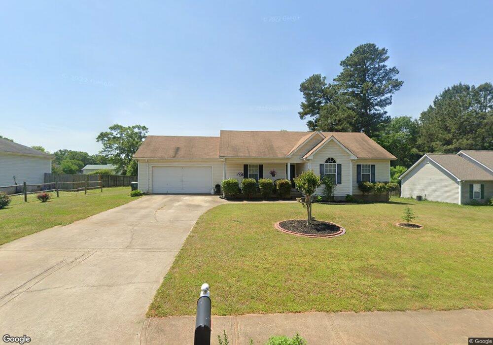
2016 Rachael Dr Unit 2 Statham, GA 30666
Estimated Value: $254,000 - $288,000
3
Beds
2
Baths
1,216
Sq Ft
$224/Sq Ft
Est. Value
About This Home
This home is located at 2016 Rachael Dr Unit 2, Statham, GA 30666 and is currently estimated at $272,634, approximately $224 per square foot. 2016 Rachael Dr Unit 2 is a home located in Barrow County with nearby schools including Statham Elementary School, Bear Creek Middle School, and Winder-Barrow High School.
Ownership History
Date
Name
Owned For
Owner Type
Purchase Details
Closed on
Nov 9, 2006
Sold by
Griffin Melanie A
Bought by
Burgess Earnestine
Current Estimated Value
Home Financials for this Owner
Home Financials are based on the most recent Mortgage that was taken out on this home.
Original Mortgage
$101,760
Outstanding Balance
$60,394
Interest Rate
6.27%
Mortgage Type
New Conventional
Estimated Equity
$212,240
Purchase Details
Closed on
May 28, 1999
Sold by
B & B Properties Llp
Bought by
Barber Matthew R
Home Financials for this Owner
Home Financials are based on the most recent Mortgage that was taken out on this home.
Original Mortgage
$93,200
Interest Rate
6.9%
Mortgage Type
New Conventional
Create a Home Valuation Report for This Property
The Home Valuation Report is an in-depth analysis detailing your home's value as well as a comparison with similar homes in the area
Home Values in the Area
Average Home Value in this Area
Purchase History
| Date | Buyer | Sale Price | Title Company |
|---|---|---|---|
| Burgess Earnestine | $127,200 | -- | |
| Barber Matthew R | $92,300 | -- |
Source: Public Records
Mortgage History
| Date | Status | Borrower | Loan Amount |
|---|---|---|---|
| Open | Burgess Earnestine | $101,760 | |
| Previous Owner | Barber Matthew R | $93,200 |
Source: Public Records
Tax History Compared to Growth
Tax History
| Year | Tax Paid | Tax Assessment Tax Assessment Total Assessment is a certain percentage of the fair market value that is determined by local assessors to be the total taxable value of land and additions on the property. | Land | Improvement |
|---|---|---|---|---|
| 2024 | $734 | $61,977 | $12,000 | $49,977 |
| 2023 | $336 | $61,977 | $12,000 | $49,977 |
| 2022 | $396 | $48,426 | $12,000 | $36,426 |
| 2021 | $439 | $48,426 | $12,000 | $36,426 |
| 2020 | $1,419 | $48,426 | $12,000 | $36,426 |
| 2019 | $1,439 | $48,426 | $12,000 | $36,426 |
| 2018 | $1,238 | $42,422 | $12,000 | $30,422 |
| 2017 | $1,326 | $38,002 | $12,000 | $26,002 |
| 2016 | $1,066 | $37,684 | $12,000 | $25,684 |
| 2015 | $1,077 | $37,978 | $12,000 | $25,978 |
| 2014 | $843 | $32,152 | $5,880 | $26,272 |
| 2013 | -- | $30,614 | $5,880 | $24,734 |
Source: Public Records
Map
Nearby Homes
- 67 Defilippe Dr
- 97 Defilippe Dr
- 129 Purackal Ln
- 2054 Jana Ln
- 619 Graham Campbell Ln
- 341 Graham Campbell Ln
- 564 Peters St
- 1880 Oakley Trail
- 2641 Oakley Trail
- 2661 Oakley Trail
- 2540 Oakley Trail
- 2671 Oakley Trail
- 2665 Oakley Trail
- 139 Goldshore Way
- 227 Dove Field Dr Unit 84
- 247 Dove Field Dr Unit 83
- 267 Dove Field Dr Unit 82
- 287 Dove Field Dr
- 287 Dove Field Dr Unit 81
- 107 Charlotte Place
- 2014 Rachael Dr
- 2018 Rachael Dr
- 2018 Rachael Dr Unit 2
- 450 Callie Ln
- 2020 Rachael Dr Unit 2
- 2020 Rachael Dr
- 2013 Rachael Dr
- 2022 Rachael Dr
- 2010 Rachael Dr
- 2010 Rachael Dr Unit 2
- 2019 Rachael Dr
- 2021 Rachael Dr Unit 2
- 2110 Broad St Unit 1
- 454 Callie Ln Unit 2
- 2118 Broad St Unit 1
- 2106 Broad St Unit 1
- 2009 Rachael Dr
- 2114 Broad St
- 2124 Broad St
- 2008 Rachael Dr