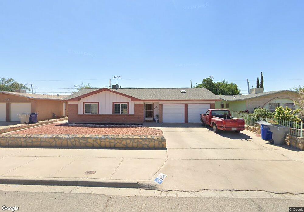
2016 Solano Dr El Paso, TX 79935
Pico Norte NeighborhoodEstimated Value: $208,558 - $246,000
3
Beds
2
Baths
1,578
Sq Ft
$145/Sq Ft
Est. Value
About This Home
This home is located at 2016 Solano Dr, El Paso, TX 79935 and is currently estimated at $229,390, approximately $145 per square foot. 2016 Solano Dr is a home located in El Paso County with nearby schools including Vista Hills Elementary School, J M Hanks High School, and St. Raphael School.
Ownership History
Date
Name
Owned For
Owner Type
Purchase Details
Closed on
Sep 14, 2005
Sold by
Barcelea Carmen M
Bought by
Sanchez Victor
Current Estimated Value
Purchase Details
Closed on
Jul 27, 2000
Sold by
Coughenour Robert L E and Coughenour Janet G
Bought by
Sanchez Victor and Barceleau Carmen M
Home Financials for this Owner
Home Financials are based on the most recent Mortgage that was taken out on this home.
Original Mortgage
$67,433
Interest Rate
8.15%
Mortgage Type
FHA
Create a Home Valuation Report for This Property
The Home Valuation Report is an in-depth analysis detailing your home's value as well as a comparison with similar homes in the area
Home Values in the Area
Average Home Value in this Area
Purchase History
| Date | Buyer | Sale Price | Title Company |
|---|---|---|---|
| Sanchez Victor | -- | -- | |
| Sanchez Victor | -- | -- |
Source: Public Records
Mortgage History
| Date | Status | Borrower | Loan Amount |
|---|---|---|---|
| Previous Owner | Sanchez Victor | $67,433 |
Source: Public Records
Tax History
| Year | Tax Paid | Tax Assessment Tax Assessment Total Assessment is a certain percentage of the fair market value that is determined by local assessors to be the total taxable value of land and additions on the property. | Land | Improvement |
|---|---|---|---|---|
| 2025 | $2,975 | $188,735 | -- | -- |
| 2024 | $2,975 | $171,577 | -- | -- |
| 2023 | $2,723 | $155,979 | $0 | $0 |
| 2022 | $4,403 | $141,799 | $0 | $0 |
| 2021 | $4,190 | $129,157 | $19,226 | $109,931 |
| 2020 | $3,701 | $117,189 | $17,451 | $99,738 |
| 2018 | $3,747 | $120,509 | $17,451 | $103,058 |
| 2017 | $3,404 | $111,348 | $17,451 | $93,897 |
| 2016 | $3,404 | $111,348 | $17,451 | $93,897 |
| 2015 | $2,721 | $111,348 | $17,451 | $93,897 |
| 2014 | $2,721 | $115,192 | $17,451 | $97,741 |
Source: Public Records
Map
Nearby Homes
- 2032 Solano Dr
- 1905 Diciembre Dr
- 2201 Trawood Dr
- 2001 Bobby Jones Dr Unit A
- 10953 Gary Player Dr
- 2205 Villa Plata Dr
- 1901 Bobby Jones Dr
- 1730 Bara Dr
- 11012 Bob Stone Dr
- 2224 Escarpa Dr
- 11013 Bob Stone Dr
- 1644 Lomaland Dr Unit 169
- 1644 Lomaland Dr Unit 151
- 1909 Crow Dr
- 2604 Ed Furgol Ct
- 1657 Lomaland Dr
- 10817 Tony Jacklin Dr
- 2705 Fierro Dr
- 1856 Mike Hill Dr
- 10512 Album Ave
Your Personal Tour Guide
Ask me questions while you tour the home.