Estimated Value: $134,000 - $271,000
3
Beds
1
Bath
1,750
Sq Ft
$111/Sq Ft
Est. Value
About This Home
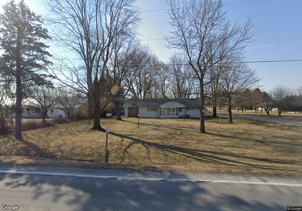
This home is located at 2016 State Route 81, Ada, OH 45810 and is currently estimated at $193,665, approximately $110 per square foot. 2016 State Route 81 is a home located in Hardin County with nearby schools including Ada Elementary School and Ada High School.
Ownership History
Date
Name
Owned For
Owner Type
Purchase Details
Closed on
Aug 9, 2014
Sold by
Fletcher Paul David and Tipple Richard B
Bought by
Fletcher Katherine E and Fletcher Paul D
Current Estimated Value
Home Financials for this Owner
Home Financials are based on the most recent Mortgage that was taken out on this home.
Original Mortgage
$55,000
Outstanding Balance
$41,717
Interest Rate
3.97%
Mortgage Type
Future Advance Clause Open End Mortgage
Estimated Equity
$151,948
Purchase Details
Closed on
Dec 11, 1996
Bought by
Fletcher Paul David
Create a Home Valuation Report for This Property
The Home Valuation Report is an in-depth analysis detailing your home's value as well as a comparison with similar homes in the area
Purchase History
| Date | Buyer | Sale Price | Title Company |
|---|---|---|---|
| Fletcher Katherine E | $71,000 | None Available | |
| Fletcher Paul David | -- | -- |
Source: Public Records
Mortgage History
| Date | Status | Borrower | Loan Amount |
|---|---|---|---|
| Open | Fletcher Katherine E | $55,000 |
Source: Public Records
Tax History
| Year | Tax Paid | Tax Assessment Tax Assessment Total Assessment is a certain percentage of the fair market value that is determined by local assessors to be the total taxable value of land and additions on the property. | Land | Improvement |
|---|---|---|---|---|
| 2024 | $1,431 | $37,140 | $6,830 | $30,310 |
| 2023 | $1,393 | $37,140 | $6,830 | $30,310 |
| 2022 | $1,274 | $29,270 | $3,440 | $25,830 |
| 2021 | $1,401 | $29,270 | $3,440 | $25,830 |
| 2020 | $1,409 | $29,270 | $3,440 | $25,830 |
| 2019 | $1,242 | $26,070 | $3,280 | $22,790 |
| 2018 | $1,204 | $26,070 | $3,280 | $22,790 |
| 2017 | $1,173 | $26,070 | $3,280 | $22,790 |
| 2016 | $1,300 | $30,560 | $2,870 | $27,690 |
| 2015 | $1,274 | $30,560 | $2,870 | $27,690 |
| 2014 | $1,288 | $30,560 | $2,870 | $27,690 |
| 2013 | -- | $30,780 | $2,870 | $27,910 |
Source: Public Records
Map
Nearby Homes
- 602 Conley Ave
- 327 W North Ave
- 128 W North Ave
- 210 N Gilbert St
- 629 N Main St
- 530 N Main St
- 211 S Main St
- 724 N Main St
- 746 N Main St Unit 61
- 746 N Main St Unit 63
- 746 N Main St Unit 74
- 746 N Main St Unit 9
- 746 N Main St Unit 35
- 746 N Main St Unit 5
- 746 N Main St Unit 39
- 442 Edwards St
- 308-310 S Simon St
- 503 E North Ave
- 710 S Main St
- 314 E University Ave
- 2032 State Route 81
- 1970 Sr
- 1970 State Route 81 Unit 35
- 2025 State Route 81
- 2025 State Route 81
- 2098 State Route 81
- 2098 State Route 81
- 3053 Township Road 35
- 3091 Township Road 35
- 2969 Township Road 35
- 2105 State Route 81
- 3108 Township Road 35
- 2105 Sr
- 2134 State Route 81
- 1901 State Route 81
- 2163 State Route 81
- 2172 Ohio 81
- 2172 Ohio 81
- 2172 State Route 81
Your Personal Tour Guide
Ask me questions while you tour the home.