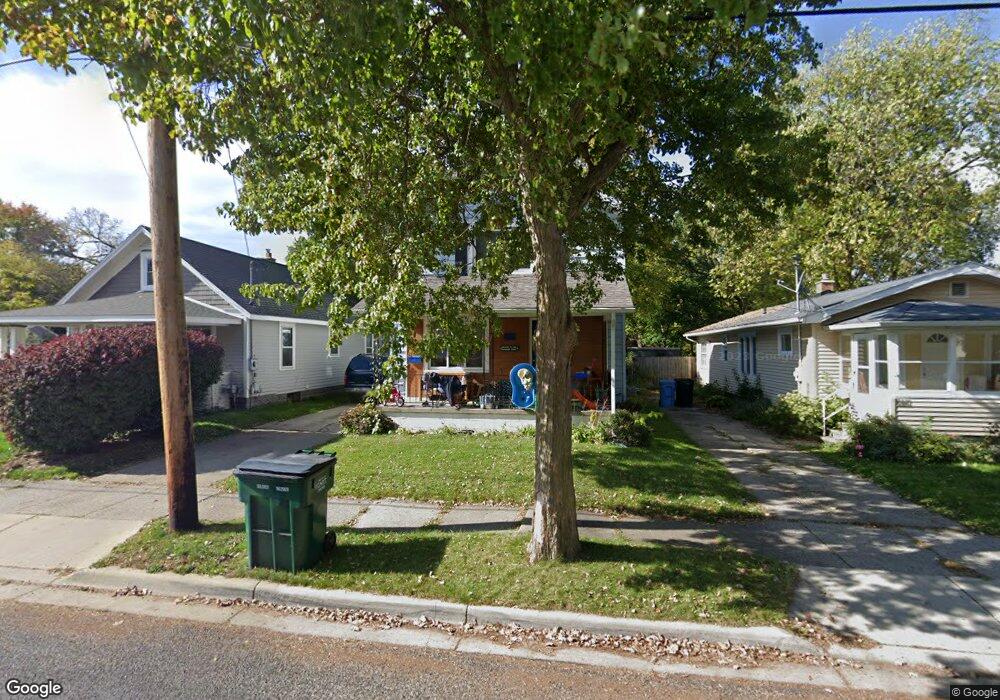
2016 Stirling Ave Lansing, MI 48910
Greencroft Park NeighborhoodEstimated Value: $130,000 - $150,000
--
Bed
--
Bath
1,400
Sq Ft
$101/Sq Ft
Est. Value
About This Home
This home is located at 2016 Stirling Ave, Lansing, MI 48910 and is currently estimated at $141,521, approximately $101 per square foot. 2016 Stirling Ave is a home located in Ingham County with nearby schools including Averill Elementary School, Attwood School, and J.W. Sexton High School.
Ownership History
Date
Name
Owned For
Owner Type
Purchase Details
Closed on
Oct 20, 2000
Sold by
Surgener Brian W and Fry Tara L
Bought by
Vanderski Jennifer J
Current Estimated Value
Home Financials for this Owner
Home Financials are based on the most recent Mortgage that was taken out on this home.
Original Mortgage
$68,964
Interest Rate
7.7%
Mortgage Type
Purchase Money Mortgage
Create a Home Valuation Report for This Property
The Home Valuation Report is an in-depth analysis detailing your home's value as well as a comparison with similar homes in the area
Home Values in the Area
Average Home Value in this Area
Purchase History
| Date | Buyer | Sale Price | Title Company |
|---|---|---|---|
| Vanderski Jennifer J | $69,000 | -- |
Source: Public Records
Mortgage History
| Date | Status | Borrower | Loan Amount |
|---|---|---|---|
| Previous Owner | Vanderski Jennifer J | $68,964 |
Source: Public Records
Tax History Compared to Growth
Tax History
| Year | Tax Paid | Tax Assessment Tax Assessment Total Assessment is a certain percentage of the fair market value that is determined by local assessors to be the total taxable value of land and additions on the property. | Land | Improvement |
|---|---|---|---|---|
| 2025 | $3,234 | $62,600 | $5,400 | $57,200 |
| 2024 | $27 | $56,200 | $5,400 | $50,800 |
| 2023 | $3,043 | $49,000 | $5,400 | $43,600 |
| 2022 | $2,777 | $45,300 | $6,900 | $38,400 |
| 2021 | $2,713 | $42,000 | $6,700 | $35,300 |
| 2020 | $2,694 | $38,100 | $6,700 | $31,400 |
| 2019 | $2,604 | $35,500 | $6,700 | $28,800 |
| 2018 | $2,468 | $33,200 | $6,700 | $26,500 |
| 2017 | $2,376 | $33,200 | $6,700 | $26,500 |
| 2016 | $2,282 | $32,700 | $6,700 | $26,000 |
| 2015 | $2,282 | $31,300 | $13,448 | $17,852 |
| 2014 | $2,282 | $30,400 | $13,448 | $16,952 |
Source: Public Records
Map
Nearby Homes
- 2011 S Martin Luther King jr Blvd
- 2001 S Martin Luther King Junior Blvd
- 1913 Stirling Ave
- 2112 Stirling Ave
- 907 Lenore Ave
- 1114 Goodrich St
- 2310 Stirling Ave
- 712 Lenore Ave
- 1116 George St
- 2118 Marion Ave
- 1312 W Mount Hope Ave
- 1032 Kelsey Ave
- 815 Woodbine Ave
- 1315 Goodrich St
- 2313 S Rundle Ave
- 2421 Stirling Ave
- 1120 Kelsey Ave
- 917 W Barnes Ave
- 1010 W Barnes Ave
- 2515 S Martin Luther King Junior Blvd
- 2012 Stirling Ave
- 2018 Stirling Ave
- 2008 Stirling Ave
- 1012 Cooper Ave
- 2004 Stirling Ave
- 1007 Cooper Ave
- 1016 Cooper Ave
- 1015 Lenore Ave
- 2000 Stirling Ave
- 2017 Stirling Ave
- 2019 Stirling Ave
- 2104 Stirling Ave
- 1020 Cooper Ave
- 1017 Lenore Ave
- 1015 Cooper Ave
- 2013 Stirling Ave
- 2009 Stirling Ave
- 2005 Stirling Ave
- 2108 Stirling Ave
- 1017 Cooper Ave