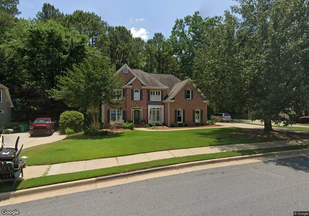
2016 Woodside Park Dr Unit 5A Woodstock, GA 30188
Union Hill NeighborhoodEstimated Value: $633,000 - $638,295
4
Beds
3
Baths
2,814
Sq Ft
$226/Sq Ft
Est. Value
About This Home
This home is located at 2016 Woodside Park Dr Unit 5A, Woodstock, GA 30188 and is currently estimated at $635,648, approximately $225 per square foot. 2016 Woodside Park Dr Unit 5A is a home located in Cherokee County with nearby schools including Hickory Flat Elementary School, Rusk Middle School, and Sequoyah High School.
Ownership History
Date
Name
Owned For
Owner Type
Purchase Details
Closed on
Feb 25, 2000
Sold by
Cronan John F and Cronan Kellee L
Bought by
Snyder Bryon T and Snyder Jennifer
Current Estimated Value
Home Financials for this Owner
Home Financials are based on the most recent Mortgage that was taken out on this home.
Original Mortgage
$172,000
Outstanding Balance
$58,293
Interest Rate
8.29%
Mortgage Type
New Conventional
Estimated Equity
$577,355
Purchase Details
Closed on
Aug 28, 1998
Sold by
Sharp Development Inc
Bought by
Cronan John F and Cronan Kellee
Home Financials for this Owner
Home Financials are based on the most recent Mortgage that was taken out on this home.
Original Mortgage
$152,000
Interest Rate
6.96%
Mortgage Type
New Conventional
Create a Home Valuation Report for This Property
The Home Valuation Report is an in-depth analysis detailing your home's value as well as a comparison with similar homes in the area
Home Values in the Area
Average Home Value in this Area
Purchase History
| Date | Buyer | Sale Price | Title Company |
|---|---|---|---|
| Snyder Bryon T | $215,000 | -- | |
| Cronan John F | $190,000 | -- |
Source: Public Records
Mortgage History
| Date | Status | Borrower | Loan Amount |
|---|---|---|---|
| Open | Snyder Bryon T | $172,000 | |
| Previous Owner | Cronan John F | $152,000 |
Source: Public Records
Tax History Compared to Growth
Tax History
| Year | Tax Paid | Tax Assessment Tax Assessment Total Assessment is a certain percentage of the fair market value that is determined by local assessors to be the total taxable value of land and additions on the property. | Land | Improvement |
|---|---|---|---|---|
| 2024 | $4,905 | $212,000 | $47,200 | $164,800 |
| 2023 | $4,395 | $208,412 | $44,800 | $163,612 |
| 2022 | $3,851 | $159,748 | $36,000 | $123,748 |
| 2021 | $3,566 | $133,680 | $29,000 | $104,680 |
| 2020 | $3,414 | $127,012 | $29,000 | $98,012 |
| 2019 | $3,300 | $122,080 | $27,600 | $94,480 |
| 2018 | $3,189 | $116,600 | $27,600 | $89,000 |
| 2017 | $3,107 | $280,100 | $27,600 | $84,440 |
| 2016 | $3,017 | $267,300 | $23,600 | $83,320 |
| 2015 | $2,963 | $258,400 | $23,600 | $79,760 |
| 2014 | $2,760 | $240,000 | $23,600 | $72,400 |
Source: Public Records
Map
Nearby Homes
- 1010 Avery Creek Dr
- 401 Trotters Run Unit 2
- 2058 Woodside Park Dr Unit 5A
- 1039 Avery Creek Dr
- 1042 Avery Creek Dr
- 2027 Fairway Crossing Dr
- 104 Fairway Overlook
- 4103 Hickory Fairway Dr
- 2065 Fairway Crossing Dr Unit IVA
- 203 Stone Creek Ct
- 528 Wisteria Dr
- 1064 Walnut Creek Dr
- 132 Little Brook Dr
- 1053 Walnut Creek Dr Unit I
- 802 Clubhouse Pointe
- 4592 Waters Rd
- 374 Heritage Overlook
- 2018 Woodside Park Dr
- 2014 Woodside Park Dr Unit 5A
- 2020 Woodside Park Dr
- 2012 Woodside Park Dr Unit 5A
- 2017 Woodside Park Dr Unit 5A
- 2320 E Cherokee Dr
- 2015 Woodside Park Dr
- 2022 Woodside Park Dr
- 2019 Woodside Park Dr
- 2010 Woodside Park Dr
- 2013 Woodside Park Dr
- 2024 Woodside Park Dr
- 2008 Woodside Park Dr
- 102 Newcastle Walk Unit 1
- 102 Woodside Place
- 103 Woodside Place
- 2011 Woodside Park Dr Unit 5A
- 2026 Woodside Park Dr
- 104 Newcastle Walk Unit 1
- 2006 Woodside Park Dr Unit 5A