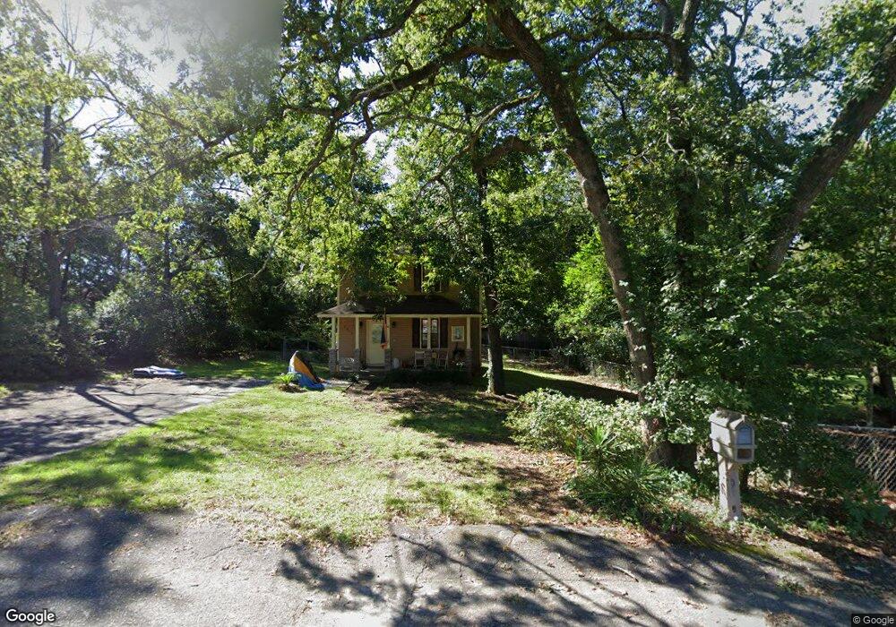
2017 Carroll Dr West Columbia, SC 29169
Estimated Value: $167,000 - $180,671
2
Beds
2
Baths
1,146
Sq Ft
$150/Sq Ft
Est. Value
About This Home
This home is located at 2017 Carroll Dr, West Columbia, SC 29169 and is currently estimated at $171,668, approximately $149 per square foot. 2017 Carroll Dr is a home located in Lexington County with nearby schools including Cayce Elementary, Cyril B. Busbee Creative Arts Academy, and Brookland-Cayce High School.
Ownership History
Date
Name
Owned For
Owner Type
Purchase Details
Closed on
Oct 12, 2018
Sold by
Corley Sean James
Bought by
Dake Melissa D
Current Estimated Value
Home Financials for this Owner
Home Financials are based on the most recent Mortgage that was taken out on this home.
Original Mortgage
$104,080
Outstanding Balance
$90,764
Interest Rate
4.5%
Mortgage Type
FHA
Estimated Equity
$80,904
Purchase Details
Closed on
Oct 30, 2015
Sold by
Paxton John D and Paxton Jeffrey D
Bought by
Corley Sean James
Purchase Details
Closed on
Nov 22, 2006
Sold by
Paxton John D and Paxton Della M
Bought by
Paxton John D and Paxton Della M
Purchase Details
Closed on
Dec 16, 2005
Sold by
Newton Christopher
Bought by
Paxton John D and Paxton Della M
Create a Home Valuation Report for This Property
The Home Valuation Report is an in-depth analysis detailing your home's value as well as a comparison with similar homes in the area
Home Values in the Area
Average Home Value in this Area
Purchase History
| Date | Buyer | Sale Price | Title Company |
|---|---|---|---|
| Dake Melissa D | $106,000 | None Available | |
| Corley Sean James | $89,500 | None Available | |
| Paxton John D | -- | None Available | |
| Paxton John D | $83,000 | -- |
Source: Public Records
Mortgage History
| Date | Status | Borrower | Loan Amount |
|---|---|---|---|
| Open | Dake Melissa D | $104,080 |
Source: Public Records
Tax History Compared to Growth
Tax History
| Year | Tax Paid | Tax Assessment Tax Assessment Total Assessment is a certain percentage of the fair market value that is determined by local assessors to be the total taxable value of land and additions on the property. | Land | Improvement |
|---|---|---|---|---|
| 2024 | $899 | $4,240 | $800 | $3,440 |
| 2023 | $810 | $4,240 | $800 | $3,440 |
| 2022 | $818 | $4,240 | $800 | $3,440 |
| 2020 | $786 | $4,240 | $800 | $3,440 |
| 2019 | $802 | $4,240 | $480 | $3,760 |
| 2018 | $684 | $3,580 | $480 | $3,100 |
| 2017 | $656 | $3,580 | $480 | $3,100 |
| 2016 | $675 | $3,580 | $480 | $3,100 |
| 2015 | $541 | $3,359 | $480 | $2,879 |
| 2014 | $541 | $3,772 | $480 | $3,292 |
| 2013 | -- | $3,770 | $480 | $3,290 |
Source: Public Records
Map
Nearby Homes
- 1210 Decatur St
- 826 Jefferson St
- TBD Woodfield Jupiter & Daisey Track
- 2312 Rainbow Dr
- 706 Westside Dr
- 2405 Rainbow Dr
- 725 Brooks Ave
- 2024 Platt Springs Rd
- 1832 Wadsworth Dr
- 0 Highway 302 Hwy Unit 589442
- 153 Cavendish Dr
- 151 Cavendish Dr
- 157 Cavendish Dr
- 1911 Toole St
- Oak Plan at Faith Hills
- 1800 Dunbar Rd
- 1409 Hazel St
- 1414 Hazel St
- 309 Hammond Ave
- 2032 Pinewood St
- 2021 Carroll Dr
- 2007 Carroll Dr
- 2203 Carroll Dr
- 2008 Carroll Dr
- 1212 Decatur St
- 1208 Decatur St
- 2006 Carroll Dr
- 2204 Carroll Dr
- 2205 Carroll Dr
- 1206 Decatur St
- 1216 Decatur St
- 1204 Decatur St
- 1120 Sox St
- 1218 Decatur St
- 2207 Carroll Dr
- 2005 Carroll Dr
- 1124 Decatur St
- 1114 Sox St
- 1136 Sox St
- 2209 Carroll Dr