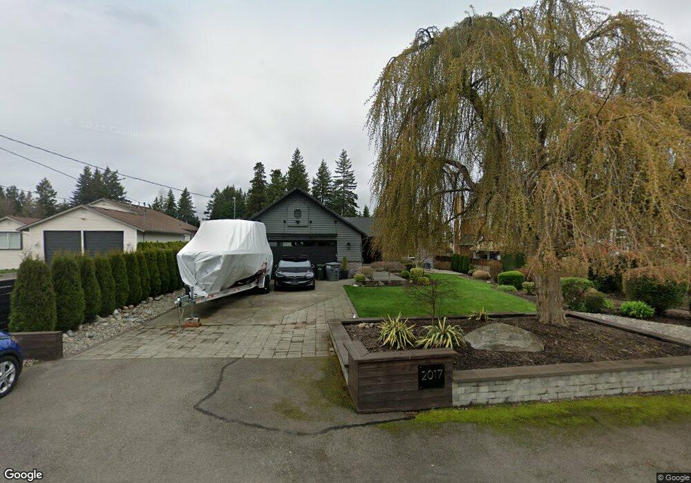
2017 Channel Rd E Lake Tapps, WA 98391
Estimated Value: $1,224,000 - $1,534,000
3
Beds
3
Baths
1,938
Sq Ft
$713/Sq Ft
Est. Value
About This Home
This home is located at 2017 Channel Rd E, Lake Tapps, WA 98391 and is currently estimated at $1,382,445, approximately $713 per square foot. 2017 Channel Rd E is a home located in Pierce County with nearby schools including Dieringer Heights Elementary School, Lake Tapps Elementary School, and North Tapps Middle School.
Ownership History
Date
Name
Owned For
Owner Type
Purchase Details
Closed on
Dec 2, 2005
Sold by
Sobo Joni L
Bought by
Loberg Michael H
Current Estimated Value
Home Financials for this Owner
Home Financials are based on the most recent Mortgage that was taken out on this home.
Original Mortgage
$614,000
Outstanding Balance
$340,059
Interest Rate
6.12%
Mortgage Type
Fannie Mae Freddie Mac
Estimated Equity
$1,042,386
Purchase Details
Closed on
Nov 25, 1998
Sold by
Bradford Enterprises Inc
Bought by
Loberg Michael H and Sobo Joni L
Home Financials for this Owner
Home Financials are based on the most recent Mortgage that was taken out on this home.
Original Mortgage
$327,250
Interest Rate
6.75%
Purchase Details
Closed on
Jul 2, 1997
Sold by
Wicklund Alan C and Wicklund Sherry J
Bought by
Bradford Enterprises Inc
Create a Home Valuation Report for This Property
The Home Valuation Report is an in-depth analysis detailing your home's value as well as a comparison with similar homes in the area
Home Values in the Area
Average Home Value in this Area
Purchase History
| Date | Buyer | Sale Price | Title Company |
|---|---|---|---|
| Loberg Michael H | -- | Trans | |
| Loberg Michael H | $385,000 | Fidelity National Title | |
| Bradford Enterprises Inc | -- | Fidelity National Title |
Source: Public Records
Mortgage History
| Date | Status | Borrower | Loan Amount |
|---|---|---|---|
| Open | Loberg Michael H | $614,000 | |
| Previous Owner | Loberg Michael H | $327,250 |
Source: Public Records
Tax History Compared to Growth
Tax History
| Year | Tax Paid | Tax Assessment Tax Assessment Total Assessment is a certain percentage of the fair market value that is determined by local assessors to be the total taxable value of land and additions on the property. | Land | Improvement |
|---|---|---|---|---|
| 2025 | $13,040 | $1,431,000 | $657,300 | $773,700 |
| 2024 | $13,040 | $1,331,300 | $668,500 | $662,800 |
| 2023 | $13,040 | $1,301,400 | $691,300 | $610,100 |
| 2022 | $10,500 | $1,186,100 | $637,500 | $548,600 |
| 2021 | $10,709 | $812,400 | $453,400 | $359,000 |
| 2019 | $9,377 | $731,400 | $386,100 | $345,300 |
| 2018 | $10,473 | $729,000 | $386,100 | $342,900 |
| 2017 | $9,046 | $669,800 | $355,700 | $314,100 |
| 2016 | $7,532 | $531,100 | $245,700 | $285,400 |
| 2014 | $6,229 | $470,800 | $222,300 | $248,500 |
| 2013 | $6,229 | $429,400 | $196,500 | $232,900 |
Source: Public Records
Map
Nearby Homes
- 2202 Tacoma Point Dr E
- 18107 25th Street Ct E
- 18306 14th Street Ct E
- 2422 179th Ave E
- 17521 25th Street Ct E
- 17612 16th Street Ct E
- 17608 16th Street Ct E
- 2804 179th Ave E
- 17510 16th Street Ct E
- 1827 176th Ave E
- 1828 176th Ave E
- 1024 184th Avenue Ct E
- 923 187th Ave E
- 2517 173rd Avenue Ct E
- 2909 65th St SE
- 1 xxx 179th Ave E
- 2168 69th St SE
- 1618 73rd St SE Unit 16
- 6672 Udall Place SE
- 0 XX 184th Ave E
- 2023 Channel Rd E
- 2011 Channel Rd E
- 2005 Channel Rd E
- 2103 Channel Rd E
- 2018 Channel Rd E
- 2018 Channel Rd E
- 2024 Channel Rd E
- 1925 Channel Rd E
- 2006 Channel Rd E
- 1926 Channel Rd E
- 1919 Channel Rd E
- 1919 Channel Rd E
- 2110 Channel Rd E
- 1920 Channel Rd E
- 1916 186th Ave E
- 1903 Channel Rd E
- 1912 Channel Rd E
- 2008 186th Ave E
- 1912 186th Ave E