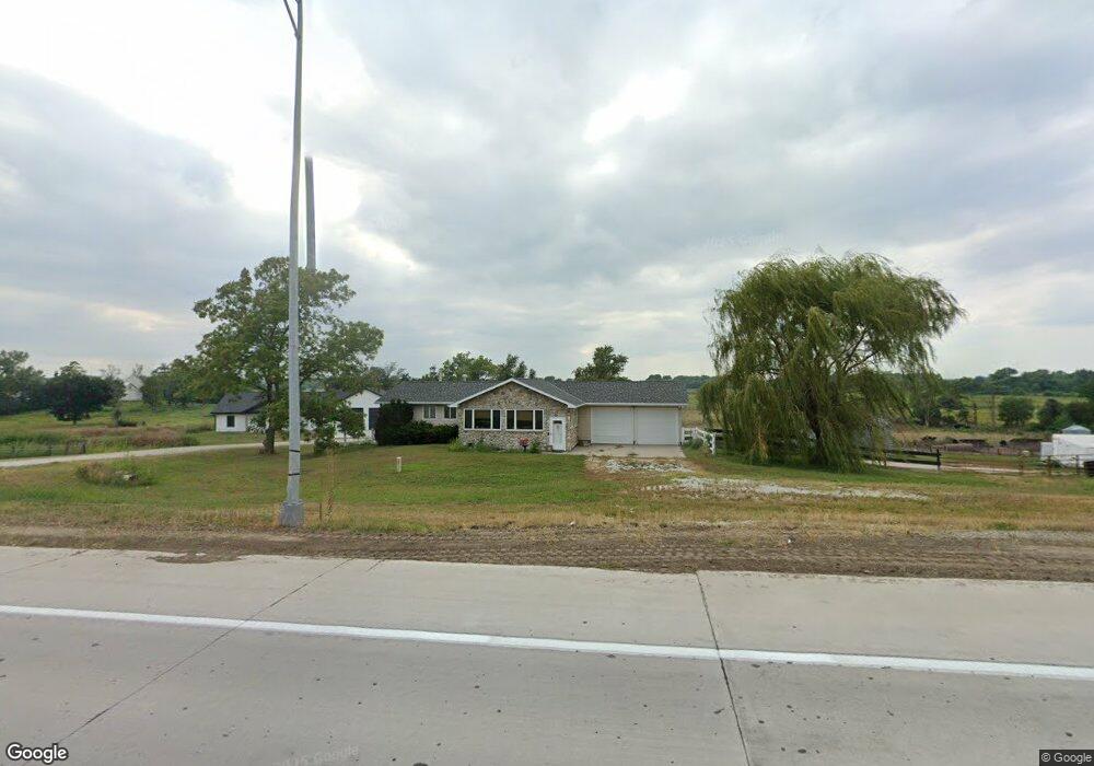
2017 Highway 275 West Point, NE 68788
Estimated Value: $283,000 - $494,000
2
Beds
3
Baths
1,556
Sq Ft
$257/Sq Ft
Est. Value
About This Home
This home is located at 2017 Highway 275, West Point, NE 68788 and is currently estimated at $399,244, approximately $256 per square foot. 2017 Highway 275 is a home located in Cuming County with nearby schools including West Point-Beemer Junior/Senior High School, St. Paul Lutheran School, and Guardian Angels Elementary School.
Create a Home Valuation Report for This Property
The Home Valuation Report is an in-depth analysis detailing your home's value as well as a comparison with similar homes in the area
Home Values in the Area
Average Home Value in this Area
Tax History Compared to Growth
Tax History
| Year | Tax Paid | Tax Assessment Tax Assessment Total Assessment is a certain percentage of the fair market value that is determined by local assessors to be the total taxable value of land and additions on the property. | Land | Improvement |
|---|---|---|---|---|
| 2025 | $2,096 | $505,500 | $178,840 | $326,660 |
| 2024 | $2,096 | $336,100 | $162,450 | $173,650 |
| 2023 | $2,568 | $282,890 | $156,500 | $126,390 |
| 2022 | $2,592 | $257,920 | $115,350 | $142,570 |
| 2021 | $2,420 | $236,260 | $115,350 | $120,910 |
| 2020 | $2,215 | $218,755 | $115,350 | $103,405 |
| 2019 | $2,148 | $207,335 | $115,350 | $91,985 |
| 2018 | $2,112 | $204,530 | $112,350 | $92,180 |
| 2017 | $2,077 | $194,765 | $109,350 | $85,415 |
| 2016 | $2,119 | $188,120 | $109,350 | $78,770 |
| 2015 | $2,018 | $163,420 | $87,315 | $76,105 |
| 2014 | $405 | $150,960 | $79,050 | $71,910 |
| 2013 | $405 | $103,900 | $33,745 | $70,155 |
Source: Public Records
Map
Nearby Homes