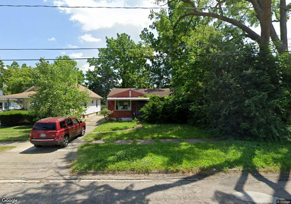
2017 Howard Ave Flint, MI 48503
South Parks NeighborhoodEstimated Value: $38,000 - $62,319
2
Beds
1
Bath
870
Sq Ft
$61/Sq Ft
Est. Value
About This Home
This home is located at 2017 Howard Ave, Flint, MI 48503 and is currently estimated at $53,106, approximately $61 per square foot. 2017 Howard Ave is a home located in Genesee County with nearby schools including Freeman Elementary School, Flint Southwestern Classical Academy, and International Academy of Flint (K-12).
Ownership History
Date
Name
Owned For
Owner Type
Purchase Details
Closed on
Dec 19, 2019
Sold by
Genesee County Treasurer
Bought by
Genesee County Land Bank Authority
Current Estimated Value
Purchase Details
Closed on
Nov 28, 2016
Sold by
Kajal Holding2 Llc
Bought by
Jonson Rhodean D
Purchase Details
Closed on
Oct 28, 2013
Sold by
Fannie Mae
Bought by
Kaja Holdings 2 Llc
Purchase Details
Closed on
Apr 15, 2013
Sold by
Onewest Bank Fsb
Bought by
Fannie Mae and Federal National Mortgage Association
Purchase Details
Closed on
Apr 3, 2013
Sold by
Wells Matthias and Anderson Wells Sheila M
Bought by
Onewest Bank Fsb
Purchase Details
Closed on
Feb 15, 1999
Sold by
Weatherford Lorraine
Bought by
Wells Matthias and Anderson Wells Sheila
Create a Home Valuation Report for This Property
The Home Valuation Report is an in-depth analysis detailing your home's value as well as a comparison with similar homes in the area
Home Values in the Area
Average Home Value in this Area
Purchase History
| Date | Buyer | Sale Price | Title Company |
|---|---|---|---|
| Genesee County Land Bank Authority | -- | None Available | |
| Jonson Rhodean D | $22,500 | None Available | |
| Kaja Holdings 2 Llc | $1,350 | Accommodation | |
| Fannie Mae | -- | None Available | |
| Onewest Bank Fsb | $28,076 | None Available | |
| Wells Matthias | $24,000 | Fidelity National Title Ins |
Source: Public Records
Tax History
| Year | Tax Paid | Tax Assessment Tax Assessment Total Assessment is a certain percentage of the fair market value that is determined by local assessors to be the total taxable value of land and additions on the property. | Land | Improvement |
|---|---|---|---|---|
| 2025 | -- | $0 | $0 | $0 |
| 2024 | -- | $0 | $0 | $0 |
| 2023 | -- | $0 | $0 | $0 |
| 2022 | $0 | $0 | $0 | $0 |
| 2021 | $0 | $0 | $0 | $0 |
| 2020 | $268 | $0 | $0 | $0 |
| 2019 | $717 | $6,900 | $0 | $0 |
| 2018 | $801 | $8,300 | $0 | $0 |
| 2017 | $889 | $0 | $0 | $0 |
| 2016 | $825 | $0 | $0 | $0 |
| 2015 | -- | $0 | $0 | $0 |
| 2014 | -- | $0 | $0 | $0 |
| 2012 | -- | $11,900 | $0 | $0 |
Source: Public Records
Map
Nearby Homes
- 2010 Crocker Ave
- 2029 Winans Ave
- 2050 Ferris Ave
- 2221 Howard Ave
- 2224 Crocker Ave
- 420 Pingree Ave
- 2033 Seymour Ave
- 1720 Park St
- 1851 Seymour Ave
- 1701 Park St
- 149 E Tobias St
- 149 E Linsey Blvd
- 1840 Mcphail St
- 1510 S Franklin Ave
- 1814 Mcphail St
- 1930 Owen St
- 9211 Owen St
- 133 E Oakley St
- 1210 Blanchard Ave
- 915 E 8th St
- 2013 Howard Ave
- 2021 Howard Ave
- 2009 Howard Ave
- 2025 Howard Ave
- 2018 Aitken Ave
- 2014 Aitken Ave
- 2022 Aitken Ave
- 2026 Aitken Ave
- 2010 Aitken Ave
- 2029 Howard Ave
- 2005 Howard Ave
- 2018 Howard Ave
- 2022 Howard Ave
- 2030 Aitken Ave
- 2006 Aitken Ave
- 2010 Howard Ave
- 2001 Howard Ave
- 2033 Howard Ave
- 2026 Howard Ave
- 2000 Aitken Ave
Your Personal Tour Guide
Ask me questions while you tour the home.