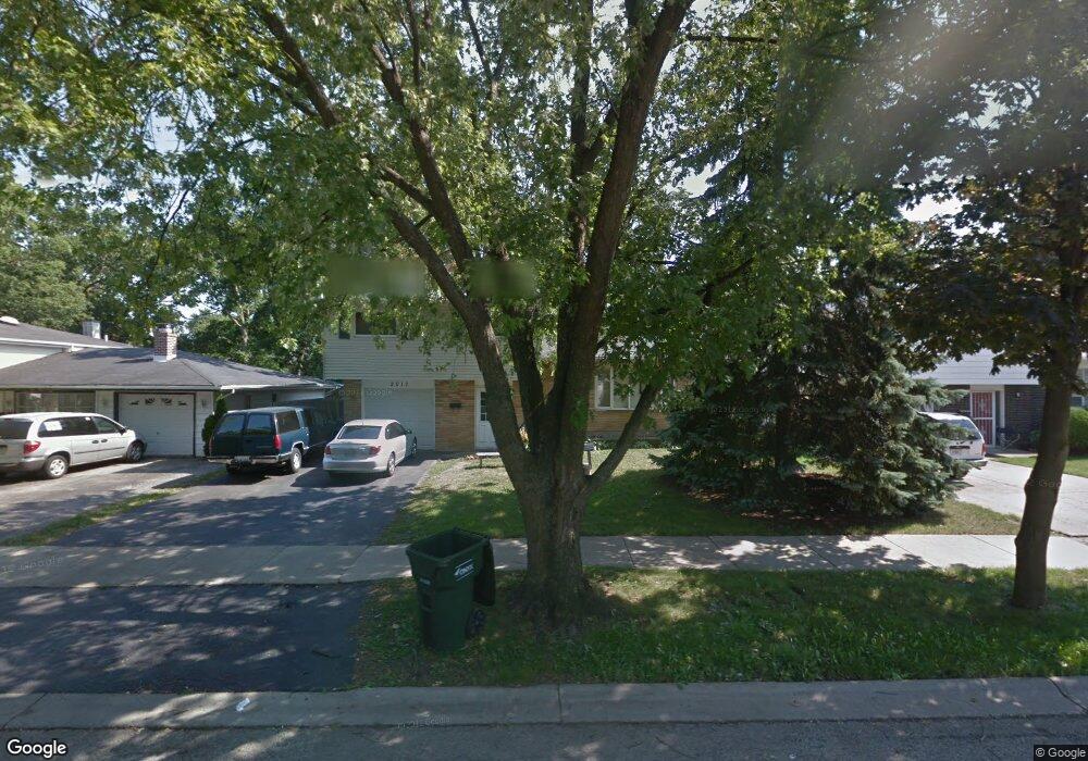
2017 Irving Pkwy Waukegan, IL 60087
Estimated Value: $261,574 - $275,000
3
Beds
2
Baths
1,200
Sq Ft
$224/Sq Ft
Est. Value
About This Home
This home is located at 2017 Irving Pkwy, Waukegan, IL 60087 and is currently estimated at $268,894, approximately $224 per square foot. 2017 Irving Pkwy is a home located in Lake County with nearby schools including H R McCall Elementary School, Jack Benny Middle School, and Waukegan High School.
Ownership History
Date
Name
Owned For
Owner Type
Purchase Details
Closed on
May 21, 1998
Sold by
Cyplick Brian A and Cyplick Diahnn A
Bought by
Kowalski Kenneth J and Kowalski Juli A
Current Estimated Value
Home Financials for this Owner
Home Financials are based on the most recent Mortgage that was taken out on this home.
Original Mortgage
$109,178
Outstanding Balance
$21,649
Interest Rate
7.27%
Mortgage Type
VA
Estimated Equity
$247,245
Purchase Details
Closed on
Sep 23, 1994
Sold by
Estes Diahnn A and Cyplick Diahnn A
Bought by
Cyplick Brian A
Create a Home Valuation Report for This Property
The Home Valuation Report is an in-depth analysis detailing your home's value as well as a comparison with similar homes in the area
Home Values in the Area
Average Home Value in this Area
Purchase History
| Date | Buyer | Sale Price | Title Company |
|---|---|---|---|
| Kowalski Kenneth J | $109,000 | First American Title | |
| Cyplick Brian A | -- | -- |
Source: Public Records
Mortgage History
| Date | Status | Borrower | Loan Amount |
|---|---|---|---|
| Open | Kowalski Kenneth J | $109,178 |
Source: Public Records
Tax History Compared to Growth
Tax History
| Year | Tax Paid | Tax Assessment Tax Assessment Total Assessment is a certain percentage of the fair market value that is determined by local assessors to be the total taxable value of land and additions on the property. | Land | Improvement |
|---|---|---|---|---|
| 2024 | $5,046 | $64,364 | $5,977 | $58,387 |
| 2023 | $4,933 | $62,134 | $5,770 | $56,364 |
| 2022 | $4,933 | $57,069 | $5,637 | $51,432 |
| 2021 | $4,212 | $46,919 | $5,494 | $41,425 |
| 2020 | $4,335 | $44,774 | $5,243 | $39,531 |
| 2019 | $4,490 | $42,480 | $4,974 | $37,506 |
| 2018 | $4,131 | $37,673 | $5,929 | $31,744 |
| 2017 | $4,120 | $35,441 | $5,578 | $29,863 |
| 2016 | $4,211 | $33,740 | $5,310 | $28,430 |
| 2015 | $4,135 | $30,943 | $4,870 | $26,073 |
| 2014 | $4,957 | $36,944 | $9,134 | $27,810 |
| 2012 | $5,727 | $38,392 | $9,492 | $28,900 |
Source: Public Records
Map
Nearby Homes
- 3411 N Lewis Ave
- 37966 N Cornell Rd
- 3211 Rugby Ct
- 1730 W Beach Rd
- 3101 Country Club Ln
- 38127 N Shore Ave
- 38362 N Manor Ave
- 1636 Rice St
- 38697 N Cedar Ave
- 11345 W Carnahan Ave
- 37905 N Loyola Ave
- 11342-11364 W Wadsworth Rd
- 1612 Whitney St
- 2613 N Lewis Ave
- 38859 N Green Bay Rd
- 12312 W Audrey Ave
- 12640 W Wadsworth Rd
- 39113 N Green Bay Rd
- 2708 Dana Ave
- 2350 N Lewis Ave
- 2019 Irving Pkwy
- 2013 Irving Pkwy
- 2025 Irving Pkwy
- 2009 Irving Pkwy
- 2016 Arthur Dr
- 2012 Arthur Dr
- 2020 Arthur Dr
- 2008 Arthur Dr
- 2029 Irving Pkwy
- 2016 Irving Pkwy
- 2005 Irving Pkwy
- 2024 Arthur Dr
- 2020 Irving Pkwy
- 2012 Irving Pkwy
- 2004 Arthur Dr
- 2024 Irving Pkwy
- 2008 Irving Pkwy
- 3505 Rock Pkwy Unit 1
- 2001 Irving Pkwy
- 3511 Rock Pkwy