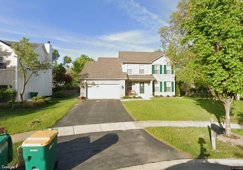
2017 Steward Ln Unit 1 Plainfield, IL 60586
North Minooka NeighborhoodEstimated Value: $383,377 - $416,000
Studio
1
Bath
1,893
Sq Ft
$214/Sq Ft
Est. Value
About This Home
This home is located at 2017 Steward Ln Unit 1, Plainfield, IL 60586 and is currently estimated at $404,844, approximately $213 per square foot. 2017 Steward Ln Unit 1 is a home located in Kendall County with nearby schools including Charles Reed Elementary School, Drauden Point Middle School, and Plainfield South High School.
Ownership History
Date
Name
Owned For
Owner Type
Purchase Details
Closed on
Jul 19, 2024
Sold by
Hamaker Laura A
Bought by
Laura A Hamaker Personal Trust and Hamaker
Current Estimated Value
Purchase Details
Closed on
Sep 20, 2002
Sold by
Richard Smykal Inc
Bought by
Hamaker David G and Hamaker Laura A
Home Financials for this Owner
Home Financials are based on the most recent Mortgage that was taken out on this home.
Original Mortgage
$141,000
Interest Rate
6.39%
Create a Home Valuation Report for This Property
The Home Valuation Report is an in-depth analysis detailing your home's value as well as a comparison with similar homes in the area
Home Values in the Area
Average Home Value in this Area
Purchase History
| Date | Buyer | Sale Price | Title Company |
|---|---|---|---|
| Laura A Hamaker Personal Trust | -- | None Listed On Document | |
| Hamaker David G | $220,000 | -- |
Source: Public Records
Mortgage History
| Date | Status | Borrower | Loan Amount |
|---|---|---|---|
| Previous Owner | Hamaker David G | $141,000 |
Source: Public Records
Tax History
| Year | Tax Paid | Tax Assessment Tax Assessment Total Assessment is a certain percentage of the fair market value that is determined by local assessors to be the total taxable value of land and additions on the property. | Land | Improvement |
|---|---|---|---|---|
| 2024 | $7,974 | $116,270 | $15,008 | $101,262 |
| 2023 | $6,713 | $101,302 | $14,000 | $87,302 |
| 2022 | $6,713 | $90,303 | $13,860 | $76,443 |
| 2021 | $6,615 | $87,276 | $14,071 | $73,205 |
| 2020 | $6,491 | $84,258 | $14,451 | $69,807 |
| 2019 | $6,266 | $80,269 | $13,767 | $66,502 |
| 2018 | $6,440 | $80,269 | $13,767 | $66,502 |
| 2017 | $6,305 | $75,955 | $13,027 | $62,928 |
| 2016 | $2,977 | $70,488 | $12,866 | $57,622 |
| 2015 | $2,997 | $67,732 | $12,210 | $55,522 |
| 2014 | -- | $60,353 | $12,210 | $48,143 |
| 2013 | -- | $60,353 | $12,210 | $48,143 |
Source: Public Records
Map
Nearby Homes
- 2002 Havenhill Dr
- 2031 Havenhill Dr
- 2017 Lilyana Ln
- 7311 Fordham Ln
- 7407 Southworth Cir Unit 6
- 7221 Bradley Dr
- 1811 Cumberland Dr
- 1712 Mandan Village Dr
- 1817 Burshire Ct
- 1812 Overland Dr
- 1816 Overland Dr
- 1817 Overland Dr
- 1803 Overland Dr
- 1800 Overland Dr
- 1809 Overland Dr
- 1802 Overland Dr
- 1801 Overland Dr
- 1810 Overland Dr
- 6708 Buchanan Cir
- 6706 Buchanan Cir
- 2019 Steward Ln
- 2008 Havenhill Dr
- 2006 Havenhill Dr
- 2010 Havenhill Dr
- 2013 Steward Ln
- 2021 Steward Ln
- 2012 Havenhill Dr
- 7212 Steward Ln
- 2014 Havenhill Dr
- 2020 Steward Ln
- 2011 Steward Ln Unit 1
- 2016 Havenhill Dr
- 2018 Steward Ln
- 2018 Havenhill Dr
- 2011 Havenhill Dr
- 2014 Steward Ln
- 2012 Steward Ln
- 2013 Havenhill Dr Unit 2
- 2009 Havenhill Dr
- 2016 Steward Ln Unit 1