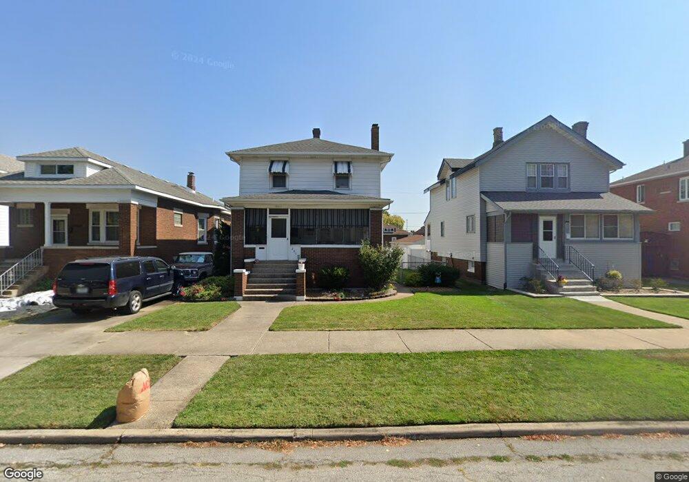
2017 Wespark Ave Whiting, IN 46394
Estimated Value: $237,424 - $338,000
3
Beds
1
Bath
1,700
Sq Ft
$166/Sq Ft
Est. Value
About This Home
This home is located at 2017 Wespark Ave, Whiting, IN 46394 and is currently estimated at $282,356, approximately $166 per square foot. 2017 Wespark Ave is a home located in Lake County with nearby schools including Benjamin Franklin Elementary School, Eggers Middle School, and Hammond High School.
Ownership History
Date
Name
Owned For
Owner Type
Purchase Details
Closed on
Jul 22, 2013
Sold by
Benko Michael and Benko Elizabeth D
Bought by
Bachusz Paul Z and Bachusz Terri L
Current Estimated Value
Home Financials for this Owner
Home Financials are based on the most recent Mortgage that was taken out on this home.
Original Mortgage
$100,000
Outstanding Balance
$21,775
Interest Rate
4.02%
Mortgage Type
New Conventional
Estimated Equity
$260,581
Create a Home Valuation Report for This Property
The Home Valuation Report is an in-depth analysis detailing your home's value as well as a comparison with similar homes in the area
Home Values in the Area
Average Home Value in this Area
Purchase History
| Date | Buyer | Sale Price | Title Company |
|---|---|---|---|
| Bachusz Paul Z | -- | None Available |
Source: Public Records
Mortgage History
| Date | Status | Borrower | Loan Amount |
|---|---|---|---|
| Open | Bachusz Paul Z | $100,000 |
Source: Public Records
Tax History
| Year | Tax Paid | Tax Assessment Tax Assessment Total Assessment is a certain percentage of the fair market value that is determined by local assessors to be the total taxable value of land and additions on the property. | Land | Improvement |
|---|---|---|---|---|
| 2025 | $2,378 | $219,700 | $31,900 | $187,800 |
| 2024 | $8,384 | $208,400 | $31,900 | $176,500 |
| 2023 | $2,218 | $175,400 | $32,300 | $143,100 |
| 2022 | $2,218 | $169,200 | $32,300 | $136,900 |
| 2021 | $2,027 | $154,500 | $21,800 | $132,700 |
| 2020 | $1,921 | $146,400 | $21,800 | $124,600 |
| 2019 | $1,923 | $138,900 | $21,800 | $117,100 |
| 2018 | $2,005 | $134,600 | $21,800 | $112,800 |
| 2017 | $2,234 | $133,400 | $21,800 | $111,600 |
| 2016 | $1,904 | $129,700 | $21,800 | $107,900 |
| 2014 | $2,056 | $137,800 | $21,800 | $116,000 |
| 2013 | $1,784 | $127,200 | $21,800 | $105,400 |
Source: Public Records
Map
Nearby Homes
- 1949 Lake Ave
- 2024 Lake Ave
- 1218 120th St
- 2134 Lincoln Ave
- 1314 121st St
- 1719 Atchison Ave
- 2017 Clark St
- 1944 Warwick Ave
- 1710 Atchison Ave
- 2231 Davis Ave
- 2027 1/2 Davidson Place
- 1806 Brown Ave
- 1704 Central Ave
- 2140 Indianapolis Blvd
- 1631 Cleveland Ave
- 1726 Oliver St
- 1623 Central Ave
- 1539 Myrtle Ave
- 1643 Roberts Ave
- 1811 New York Ave
- 2013 Wespark Ave
- 2019 Wespark Ave
- 2023 Wespark Ave
- 2007 Wespark Ave
- 2018 Superior Ave
- 2027 Wespark Ave
- 2020 Superior Ave
- 2014 Superior Ave
- 2005 Wespark Ave
- 2022 Superior Ave
- 2010 Superior Ave
- 2031 Wespark Ave
- 2008 Wespark Ave
- 2026 Superior Ave
- 2014 Wespark Ave
- 2020 Wespark Ave
- 2033 Wespark Ave
- 2033 Wespark Ave Unit 1
- 2022 Wespark Ave
- 2030 Superior Ave
Your Personal Tour Guide
Ask me questions while you tour the home.