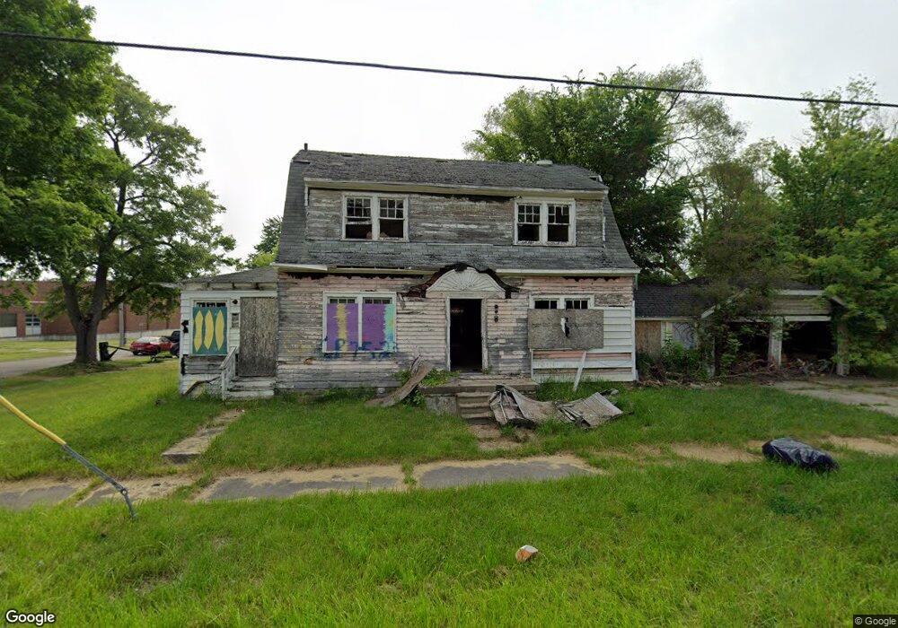
2018 Avenue A Flint, MI 48505
King Avenue Plus NeighborhoodEstimated Value: $28,000 - $60,000
2
Beds
2
Baths
1,790
Sq Ft
$25/Sq Ft
Est. Value
About This Home
This home is located at 2018 Avenue A, Flint, MI 48505 and is currently estimated at $44,000, approximately $24 per square foot. 2018 Avenue A is a home located in Genesee County with nearby schools including Brownell STEM Academy, Flint Cultural Center Academy, and WAY Academy of Flint.
Ownership History
Date
Name
Owned For
Owner Type
Purchase Details
Closed on
Dec 20, 2016
Sold by
Cherry Deborah L
Bought by
Genesee County Land Bank
Current Estimated Value
Purchase Details
Closed on
May 4, 2011
Sold by
Genesee County Land Bank Authority
Bought by
Building Strong Women
Purchase Details
Closed on
Nov 13, 2006
Sold by
Genesee County Land Bank Authority
Bought by
Building Strong Women
Purchase Details
Closed on
Dec 7, 2004
Sold by
Kildee Daniel T and Genesee County Land Reutilizat
Bought by
Genesee County Land Bank Authority
Purchase Details
Closed on
Dec 23, 2002
Sold by
Genesee County Treasurer
Bought by
Genesee County Land Reutilization Counci
Create a Home Valuation Report for This Property
The Home Valuation Report is an in-depth analysis detailing your home's value as well as a comparison with similar homes in the area
Home Values in the Area
Average Home Value in this Area
Purchase History
| Date | Buyer | Sale Price | Title Company |
|---|---|---|---|
| Genesee County Land Bank | -- | None Available | |
| Building Strong Women | $4,000 | None Available | |
| Building Strong Women | $4,000 | None Available | |
| Genesee County Land Bank Authority | -- | -- | |
| Genesee County Land Reutilization Counci | $3,804 | -- |
Source: Public Records
Mortgage History
| Date | Status | Borrower | Loan Amount |
|---|---|---|---|
| Closed | Building Strong Women | $0 |
Source: Public Records
Tax History
| Year | Tax Paid | Tax Assessment Tax Assessment Total Assessment is a certain percentage of the fair market value that is determined by local assessors to be the total taxable value of land and additions on the property. | Land | Improvement |
|---|---|---|---|---|
| 2025 | -- | $0 | $0 | $0 |
| 2024 | -- | $0 | $0 | $0 |
| 2023 | -- | $0 | $0 | $0 |
| 2022 | $0 | $0 | $0 | $0 |
| 2021 | $0 | $0 | $0 | $0 |
| 2020 | $0 | $0 | $0 | $0 |
| 2019 | $221 | $0 | $0 | $0 |
| 2018 | $221 | $0 | $0 | $0 |
| 2017 | $221 | $0 | $0 | $0 |
| 2016 | $221 | $0 | $0 | $0 |
| 2015 | $0 | $0 | $0 | $0 |
| 2014 | -- | $0 | $0 | $0 |
| 2012 | -- | $0 | $0 | $0 |
Source: Public Records
Map
Nearby Homes
- 2217 Francis Ave
- 1710 Wilberforce Cir
- 1706 Wilberforce Cir
- 800 Martin Luther King Ave
- 630 E Dartmouth St
- 1606 Garland St
- 1303 Root St
- 1214 Root St
- 115 W Baker St
- 218 E Jackson Ave
- 1016 Garland St
- 115 E Genesee St
- 501 W Witherbee St
- 506 Green St
- 1645 Seminole St
- 200 W Mcclellan St
- 132 W Jamieson St
- 409 W Genesee St
- 432 W Dartmouth St
- 1273 Broadway Blvd
Your Personal Tour Guide
Ask me questions while you tour the home.