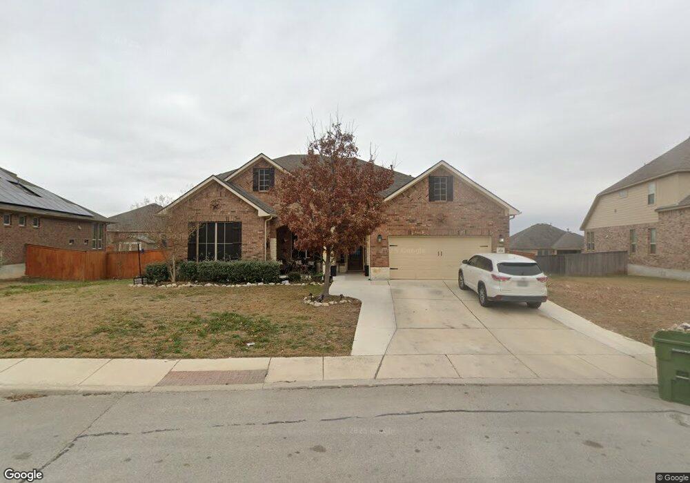
2018 Derussy Rd San Antonio, TX 78253
Westpointe East NeighborhoodEstimated Value: $643,000 - $709,000
5
Beds
5
Baths
3,698
Sq Ft
$182/Sq Ft
Est. Value
About This Home
This home is located at 2018 Derussy Rd, San Antonio, TX 78253 and is currently estimated at $671,963, approximately $181 per square foot. 2018 Derussy Rd is a home with nearby schools including Cole Elementary School, Briscoe Middle School, and Brennan High School.
Ownership History
Date
Name
Owned For
Owner Type
Purchase Details
Closed on
Oct 19, 2017
Sold by
M I Homes Of San Antonio Llc
Bought by
Santos Edgar and Santos Eunice
Current Estimated Value
Home Financials for this Owner
Home Financials are based on the most recent Mortgage that was taken out on this home.
Original Mortgage
$400,451
Outstanding Balance
$276,746
Interest Rate
3.78%
Mortgage Type
New Conventional
Estimated Equity
$395,217
Purchase Details
Closed on
Apr 26, 2017
Sold by
Woe Ventures Llc
Bought by
Mi Homes Of San Antonio Llc
Create a Home Valuation Report for This Property
The Home Valuation Report is an in-depth analysis detailing your home's value as well as a comparison with similar homes in the area
Home Values in the Area
Average Home Value in this Area
Purchase History
| Date | Buyer | Sale Price | Title Company |
|---|---|---|---|
| Santos Edgar | -- | None Available | |
| Mi Homes Of San Antonio Llc | -- | None Available |
Source: Public Records
Mortgage History
| Date | Status | Borrower | Loan Amount |
|---|---|---|---|
| Open | Santos Edgar | $400,451 |
Source: Public Records
Tax History Compared to Growth
Tax History
| Year | Tax Paid | Tax Assessment Tax Assessment Total Assessment is a certain percentage of the fair market value that is determined by local assessors to be the total taxable value of land and additions on the property. | Land | Improvement |
|---|---|---|---|---|
| 2025 | $10,270 | $668,000 | $113,680 | $554,320 |
| 2024 | $10,270 | $656,000 | $113,680 | $542,320 |
| 2023 | $10,270 | $606,573 | $113,680 | $547,320 |
| 2022 | $11,148 | $551,430 | $94,770 | $537,230 |
| 2021 | $9,989 | $475,250 | $86,060 | $389,190 |
| 2020 | $9,702 | $451,140 | $84,000 | $367,140 |
| 2019 | $9,859 | $443,980 | $84,000 | $359,980 |
| 2018 | $9,904 | $445,667 | $84,000 | $361,667 |
| 2017 | $1,062 | $47,700 | $47,700 | $0 |
Source: Public Records
Map
Nearby Homes
- 2114 Derussy Rd
- 12323 Merritt Villa
- 12211 Upton Park
- 1817 Delafield Rd
- 2042 Buckner Pass
- 1731 Doubleday Ln
- 11910 Wilby Creek
- 11935 Devin Chase
- 12019 Bailey Hills
- 2130 Knippa
- 1822 Knippa
- 1514 Knippa
- 1412 Hallettsville
- 1510 Knippa
- 1506 Knippa
- 12517 Liberty Hill
- 12433 Pottsboro
- 12433 Redwater
- 2102 Dalhart Pass
- 2130 Dalhart
- 2102 Derussy Rd
- 2014 Derussy Rd
- 2031 Bailey Forest
- 2027 Bailey Forest
- 2101 Bailey Forest
- 2106 Derussy Rd
- 2010 Derussy Rd
- 2003 Upton Hill
- 2105 Bailey Forest
- 2019 Bailey Forest
- 2110 Derussy Rd
- 2107 Derussy Rd
- 2109 Bailey Forest
- 2007 Upton Hill
- 2015 Bailey Forest
- 1926 Sladen Hills
- 1922 Sladen Hills
- 2115 Derussy Rd
- 2113 Bailey Forest
- 2030 Bailey Forest