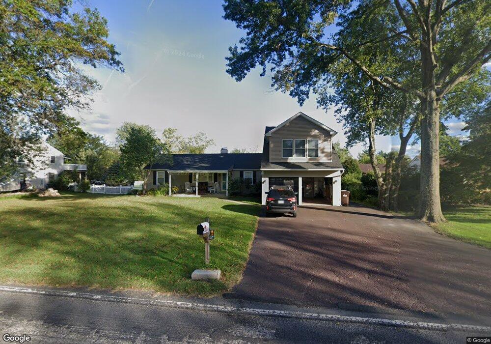
2018 N Trooper Rd Norristown, PA 19403
East Norriton Township NeighborhoodEstimated Value: $480,000 - $555,000
4
Beds
2
Baths
2,396
Sq Ft
$220/Sq Ft
Est. Value
About This Home
This home is located at 2018 N Trooper Rd, Norristown, PA 19403 and is currently estimated at $527,413, approximately $220 per square foot. 2018 N Trooper Rd is a home located in Montgomery County with nearby schools including Paul V Fly Elementary School, East Norriton Middle School, and Charles Blockson Middle School.
Ownership History
Date
Name
Owned For
Owner Type
Purchase Details
Closed on
Sep 25, 2000
Sold by
Gorman Lorraine
Bought by
Kraus Adam R and Kraus Nicole M
Current Estimated Value
Purchase Details
Closed on
May 10, 1999
Sold by
Gorman Lorraine and Earl Lorraine
Bought by
Gorman Lorraine
Purchase Details
Closed on
Mar 28, 1996
Sold by
Earl Lorraine
Bought by
Earl Lorraine
Purchase Details
Closed on
Oct 19, 1995
Sold by
Nafzgar Lorraine E and Nafzgar George C
Bought by
Nafzgar Lorraine E
Create a Home Valuation Report for This Property
The Home Valuation Report is an in-depth analysis detailing your home's value as well as a comparison with similar homes in the area
Home Values in the Area
Average Home Value in this Area
Purchase History
| Date | Buyer | Sale Price | Title Company |
|---|---|---|---|
| Kraus Adam R | $156,500 | -- | |
| Gorman Lorraine | -- | -- | |
| Earl Lorraine | -- | -- | |
| Nafzgar Lorraine E | -- | -- |
Source: Public Records
Tax History Compared to Growth
Tax History
| Year | Tax Paid | Tax Assessment Tax Assessment Total Assessment is a certain percentage of the fair market value that is determined by local assessors to be the total taxable value of land and additions on the property. | Land | Improvement |
|---|---|---|---|---|
| 2025 | $7,891 | $167,510 | -- | -- |
| 2024 | $7,891 | $167,510 | -- | -- |
| 2023 | $7,799 | $167,510 | $0 | $0 |
| 2022 | $7,746 | $167,510 | $0 | $0 |
| 2021 | $7,698 | $167,510 | $0 | $0 |
| 2020 | $7,459 | $167,510 | $0 | $0 |
| 2019 | $7,286 | $167,510 | $0 | $0 |
| 2018 | $7,285 | $167,510 | $0 | $0 |
| 2017 | $6,862 | $167,510 | $0 | $0 |
| 2016 | $6,797 | $149,430 | $42,730 | $106,700 |
| 2015 | $5,745 | $149,430 | $42,730 | $106,700 |
| 2014 | $5,745 | $149,430 | $42,730 | $106,700 |
Source: Public Records
Map
Nearby Homes
- 2967 Township Line Rd
- 1534 N Trooper Rd
- 1507 Potshop Rd
- 3023 Eisenhower Rd
- 1241 & 1243 Valley Forge Rd
- 1600 Potshop Rd
- 906 N Trooper Rd
- 3103 Hayes Rd
- 1103 Arden Dr Unit METHACTON SCHOOL
- 1716 Landis Rd
- LOT 1 Wanda
- LOT 28 Heebner Rd
- 0 Windy Hill Rd Unit METHACTON SD
- 643 Barbara Dr
- 550 Burnside Ave
- 2939 W Germantown Pike
- 805 Sandra Ln
- 2624 Hawthorn Dr
- 515 Faith Dr
- 3235 Heebner Rd
- 2016 N Trooper Rd
- 2020 N Trooper Rd
- 2014 N Trooper Rd
- 2022 N Trooper Rd
- 1447 N Trooper Rd
- 1453 N Trooper Rd
- 2012 N Trooper Rd
- 1441 N Trooper Rd
- 1461 N Trooper Rd
- 2024R N Trooper Rd
- 2024 N Trooper Rd
- 1241 Township Line Rd
- 1467 N Trooper Rd
- 2010 N Trooper Rd
- 1239 Township Line Rd
- 1427 N Trooper Rd
- 1237 Township Line Rd
- 2910 Township Line Rd
- 1410 Reiner Rd
- 1412 Reiner Rd