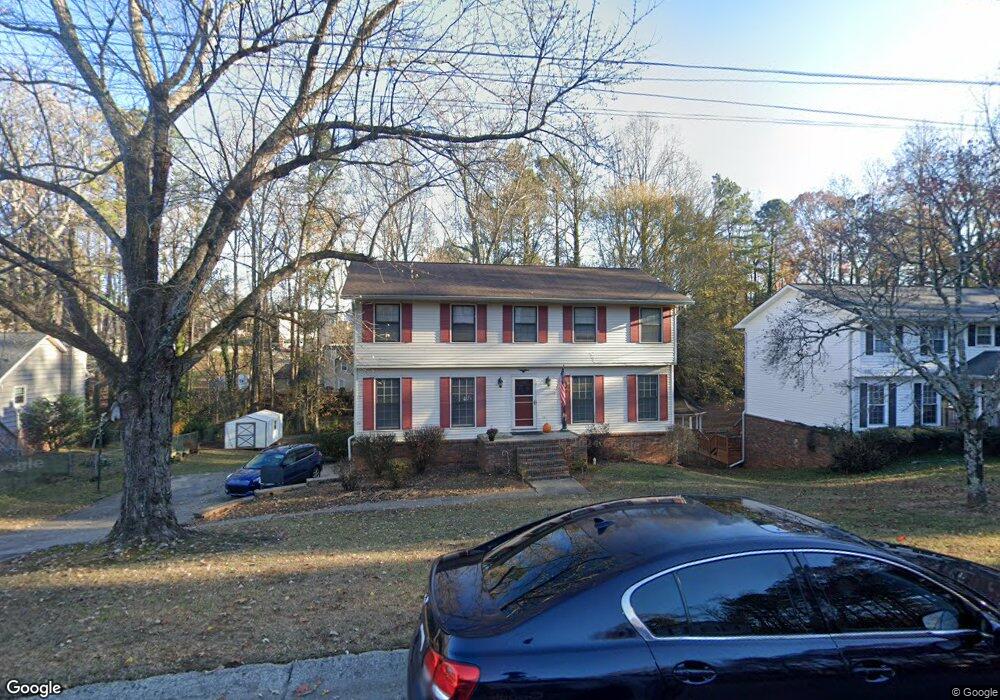
2018 Rock Creek Rd Unit 1 Buford, GA 30519
Estimated Value: $386,737 - $452,000
4
Beds
3
Baths
2,142
Sq Ft
$195/Sq Ft
Est. Value
About This Home
This home is located at 2018 Rock Creek Rd Unit 1, Buford, GA 30519 and is currently estimated at $417,684, approximately $194 per square foot. 2018 Rock Creek Rd Unit 1 is a home located in Gwinnett County with nearby schools including Buford Elementary School, Buford Senior Academy, and Buford Academy.
Ownership History
Date
Name
Owned For
Owner Type
Purchase Details
Closed on
Feb 22, 2019
Sold by
Hale Billy Earl
Bought by
Mccall Shawntell M
Current Estimated Value
Home Financials for this Owner
Home Financials are based on the most recent Mortgage that was taken out on this home.
Original Mortgage
$62,000
Outstanding Balance
$39,707
Interest Rate
4.4%
Mortgage Type
New Conventional
Estimated Equity
$377,977
Purchase Details
Closed on
Jun 26, 1996
Sold by
Mccall Howard D Marcia D
Bought by
Hale Billy E and Mccall Shauntell M
Create a Home Valuation Report for This Property
The Home Valuation Report is an in-depth analysis detailing your home's value as well as a comparison with similar homes in the area
Home Values in the Area
Average Home Value in this Area
Purchase History
| Date | Buyer | Sale Price | Title Company |
|---|---|---|---|
| Mccall Shawntell M | -- | -- | |
| Hale Billy E | $112,900 | -- |
Source: Public Records
Mortgage History
| Date | Status | Borrower | Loan Amount |
|---|---|---|---|
| Open | Mccall Shawntell M | $62,000 | |
| Closed | Hale Billy E | $0 |
Source: Public Records
Tax History Compared to Growth
Tax History
| Year | Tax Paid | Tax Assessment Tax Assessment Total Assessment is a certain percentage of the fair market value that is determined by local assessors to be the total taxable value of land and additions on the property. | Land | Improvement |
|---|---|---|---|---|
| 2024 | $1,820 | $126,800 | $24,000 | $102,800 |
| 2023 | $1,820 | $146,840 | $24,000 | $122,840 |
| 2022 | $1,977 | $137,760 | $18,000 | $119,760 |
| 2021 | $1,230 | $85,680 | $12,000 | $73,680 |
| 2020 | $1,230 | $85,680 | $12,000 | $73,680 |
| 2019 | $543 | $67,040 | $10,000 | $57,040 |
| 2018 | $543 | $67,040 | $10,000 | $57,040 |
| 2016 | $412 | $41,760 | $8,400 | $33,360 |
| 2015 | $427 | $41,760 | $8,400 | $33,360 |
| 2014 | $434 | $41,760 | $8,400 | $33,360 |
Source: Public Records
Map
Nearby Homes
- 2040 Harvest Ridge Cir
- 2040 Harvest Ridge Cir NE
- 3684 Heritage Crest Pkwy
- 2140 Harvest Ridge Cir
- 3476 Harvest Ridge Ln
- 3560 Hanover Dr
- 1970 Sturbridge Ln Unit 1
- 2183 Ivy Crest Dr
- 3600 Devenwood Way
- 1781 Plunketts Rd
- 3410 Coles Creek Dr
- 3534 Fallen Oak Ln
- 3573 Fallen Oak Dr
- 3570 Knoll Crest Trail
- 2361 Black Bear Ct Unit 2
- 3962 Adler Cir Unit 7
- 4152 Adler Cir Unit 42
- 4202 Adler Cir
- 3962 Adler Cir
- 4152 Adler Cir
- 2010 Rock Creek Rd
- 2026 Rock Creek Rd
- 3669 Aspen Ct
- 2034 Rock Creek Rd
- 3668 Aspen Ct
- 2077 Rock Creek Rd
- 2009 Rock Creek Rd
- 3663 Aspen Ct
- 33 Rock Creek Rd
- 3664 Aspen Ct
- 2025 Rock Creek Rd Unit 1
- 3653 Aspen Ct
- 3702 Ridge Dr
- 2050 Rock Creek Rd
- 3634 Aspen Ct
- 2033 Rock Creek Rd Unit 1
- 2058 Rock Creek Rd
- 3643 Aspen Ct
- 3719 Ridge Dr
- 3708 Ridge Dr