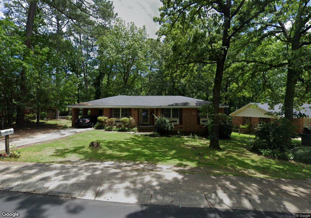
2018 Rolling Hills Rd Columbia, SC 29210
Saint Andrews NeighborhoodEstimated Value: $190,000 - $215,000
3
Beds
2
Baths
1,612
Sq Ft
$126/Sq Ft
Est. Value
About This Home
This home is located at 2018 Rolling Hills Rd, Columbia, SC 29210 and is currently estimated at $203,794, approximately $126 per square foot. 2018 Rolling Hills Rd is a home located in Richland County with nearby schools including Sandel Elementary School, St. Andrews Middle School, and Columbia High School.
Ownership History
Date
Name
Owned For
Owner Type
Purchase Details
Closed on
Jan 17, 2007
Sold by
Green Curtis B and Green Tracy L
Bought by
Collins Stanford
Current Estimated Value
Home Financials for this Owner
Home Financials are based on the most recent Mortgage that was taken out on this home.
Original Mortgage
$106,200
Outstanding Balance
$72,077
Interest Rate
8.8%
Mortgage Type
Purchase Money Mortgage
Estimated Equity
$131,717
Purchase Details
Closed on
Jul 12, 2006
Sold by
Household Finance Corp Ii
Bought by
Green Curtis B and Green Tracy L
Purchase Details
Closed on
Nov 30, 2005
Sold by
Hutchinson Gail Yolanda
Bought by
Household Finance Corp Ii
Create a Home Valuation Report for This Property
The Home Valuation Report is an in-depth analysis detailing your home's value as well as a comparison with similar homes in the area
Home Values in the Area
Average Home Value in this Area
Purchase History
| Date | Buyer | Sale Price | Title Company |
|---|---|---|---|
| Collins Stanford | $118,000 | None Available | |
| Green Curtis B | $88,500 | None Available | |
| Household Finance Corp Ii | $75,000 | None Available |
Source: Public Records
Mortgage History
| Date | Status | Borrower | Loan Amount |
|---|---|---|---|
| Open | Collins Stanford | $106,200 |
Source: Public Records
Tax History Compared to Growth
Tax History
| Year | Tax Paid | Tax Assessment Tax Assessment Total Assessment is a certain percentage of the fair market value that is determined by local assessors to be the total taxable value of land and additions on the property. | Land | Improvement |
|---|---|---|---|---|
| 2024 | $1,136 | $119,100 | $0 | $0 |
| 2023 | $1,136 | $4,144 | $0 | $0 |
| 2022 | $1,031 | $103,600 | $12,800 | $90,800 |
| 2021 | $1,025 | $4,140 | $0 | $0 |
| 2020 | $1,040 | $4,140 | $0 | $0 |
| 2019 | $1,013 | $4,140 | $0 | $0 |
| 2018 | $916 | $3,710 | $0 | $0 |
| 2017 | $897 | $3,710 | $0 | $0 |
| 2016 | $894 | $3,710 | $0 | $0 |
| 2015 | $872 | $3,710 | $0 | $0 |
| 2014 | $848 | $92,800 | $0 | $0 |
| 2013 | -- | $3,710 | $0 | $0 |
Source: Public Records
Map
Nearby Homes
- 2126 Rolling Hills Rd
- 2305 Apple Valley Rd
- 1830 Saint Michaels Rd
- 1900 Rolling Hills Rd
- 1810 Saint Michaels Rd
- 2225 Hertford Dr
- 2229 Hertford Dr
- 1932 Greenwyche Ave
- 1605 Kathleen Dr
- 1917 Kathleen Dr
- 1618 van Lingle Ave
- 1917 Chandler Ave
- 1533 Westchester Dr
- 2006 Mary Hill Dr
- 2116 Chandler Ave
- 1604 Nunamaker Dr
- 0 Marley Dr Unit 598776
- 1904 Elise Dr
- 1204 Old Manor Rd
- 1101 Menlo Dr
- 2012 Rolling Hills Rd
- 1883 Cunningham Rd
- 2036 Rolling Hills Rd
- 2008 Rolling Hills Rd
- 1879 Cunningham Rd
- 2019 Rolling Hills Rd
- 2025 Rolling Hills Rd
- 2037 Rolling Hills Rd
- 1909 Cunningham Rd
- 2013 Rolling Hills Rd
- 1866 Saint Michaels Rd
- 1884 Cunningham Rd
- 1862 Saint Michaels Rd
- 2000 Rolling Hills Rd
- 1878 Cunningham Rd
- 2007 Rolling Hills Rd
- 1867 Cunningham Rd
- 1858 Saint Michaels Rd
- 2001 Rolling Hills Rd
- 2110 Rolling Hills Rd