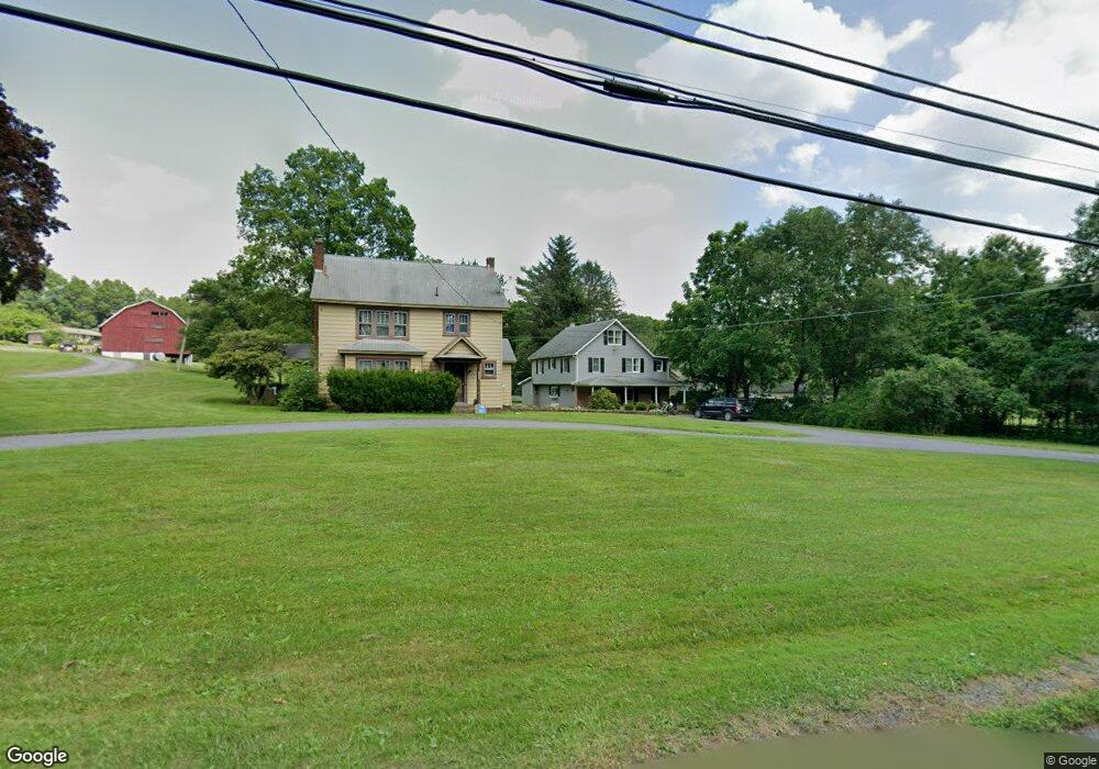
2018 Route 715 Stroudsburg, PA 18360
Estimated Value: $295,000 - $395,000
3
Beds
2
Baths
1,930
Sq Ft
$176/Sq Ft
Est. Value
About This Home
This home is located at 2018 Route 715, Stroudsburg, PA 18360 and is currently estimated at $338,724, approximately $175 per square foot. 2018 Route 715 is a home with nearby schools including Swiftwater Interm School, Swiftwater Elementary Center, and Pocono Mountain East Junior High School.
Ownership History
Date
Name
Owned For
Owner Type
Purchase Details
Closed on
Nov 5, 2024
Sold by
Johnson Randy S and Johnson Dale R
Bought by
Johnson Dale R and Johnson Rusty L
Current Estimated Value
Home Financials for this Owner
Home Financials are based on the most recent Mortgage that was taken out on this home.
Original Mortgage
$280,000
Outstanding Balance
$277,192
Interest Rate
6.08%
Mortgage Type
New Conventional
Estimated Equity
$61,532
Purchase Details
Closed on
Feb 16, 2012
Sold by
Johnson Mary E
Bought by
Johnson Dale R and Johnson Rusty L
Create a Home Valuation Report for This Property
The Home Valuation Report is an in-depth analysis detailing your home's value as well as a comparison with similar homes in the area
Home Values in the Area
Average Home Value in this Area
Purchase History
| Date | Buyer | Sale Price | Title Company |
|---|---|---|---|
| Johnson Dale R | $76,667 | None Listed On Document | |
| Johnson Dale R | -- | None Available |
Source: Public Records
Mortgage History
| Date | Status | Borrower | Loan Amount |
|---|---|---|---|
| Open | Johnson Dale R | $280,000 |
Source: Public Records
Tax History Compared to Growth
Tax History
| Year | Tax Paid | Tax Assessment Tax Assessment Total Assessment is a certain percentage of the fair market value that is determined by local assessors to be the total taxable value of land and additions on the property. | Land | Improvement |
|---|---|---|---|---|
| 2025 | $1,115 | $152,400 | $14,100 | $138,300 |
| 2024 | $886 | $152,400 | $14,100 | $138,300 |
| 2023 | $3,825 | $152,400 | $14,100 | $138,300 |
| 2022 | $3,757 | $152,400 | $14,100 | $138,300 |
| 2021 | $3,757 | $152,400 | $14,100 | $138,300 |
| 2020 | $3,803 | $152,400 | $14,100 | $138,300 |
| 2019 | $3,336 | $20,140 | $1,710 | $18,430 |
| 2018 | $3,336 | $20,140 | $1,710 | $18,430 |
| 2017 | $3,376 | $20,140 | $1,710 | $18,430 |
| 2016 | $631 | $20,140 | $1,710 | $18,430 |
| 2015 | -- | $20,140 | $1,710 | $18,430 |
| 2014 | -- | $20,140 | $1,710 | $18,430 |
Source: Public Records
Map
Nearby Homes
- 0 Center Road T 481 Unit PM-135523
- 3038 Hemlock Rd
- 3043 Hemlock Rd
- 0 Doll Rd
- 45022 Lr (Mountain Road)
- 6236 Neola Rd
- 133 Acorn Ln
- 408 Sassafrass Way
- 476 Sassafrass Way
- 228 Victory Ln
- 427 Lakefield Terrace
- 204 Deibert Dr
- 0 Balson Rd
- 509 Highpoint Dr
- 619 Rimrock Rd
- Lot 218 Brookdale Rd
- 117 Rinker Rd
- 19 Princess Ln
- 652 Rimrock Rd
- 2291 Mountain Rd
- 2020 Route 715
- 481 Center Rd
- 2029 Route 715
- 2036 Pennsylvania 715
- 1520 Dales Way
- 1519 Dales Way
- 306 Center Rd
- 315 Center Rd
- 1988 Route 715
- 2044 Route 715
- 111 van Ams Way
- 1 van Ams Way
- 1108 Walnut Ln
- 9 van Ams Way
- 119 van Ams Way
- 110 van Ams Way
- 127 van Ams Way
- 2057 Route 715
- 116 van Ams Way
- 150 Hay Rd