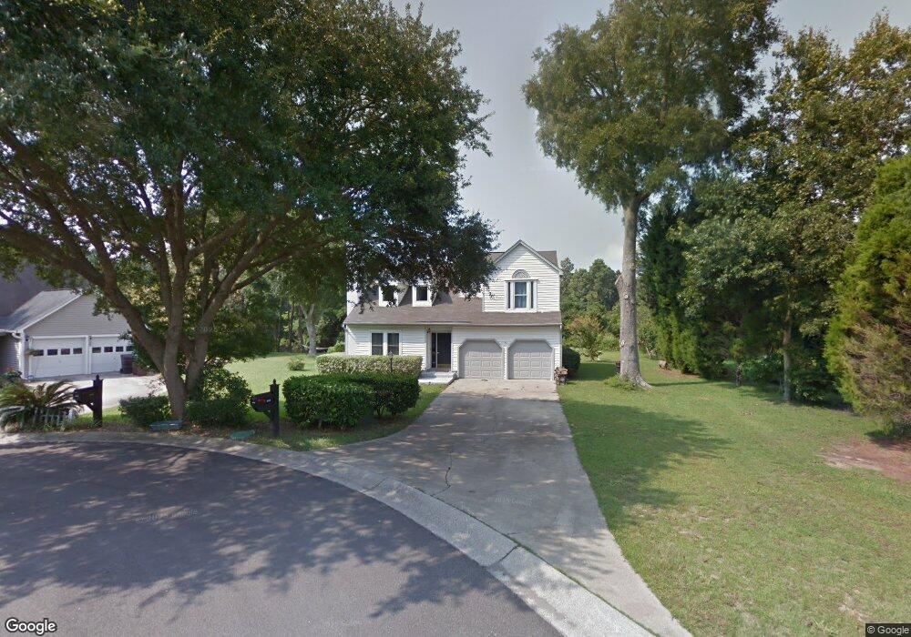
2018 Saphire Ct Mount Pleasant, SC 29466
Oyster Point NeighborhoodEstimated Value: $784,000 - $856,305
3
Beds
3
Baths
1,747
Sq Ft
$467/Sq Ft
Est. Value
About This Home
This home is located at 2018 Saphire Ct, Mount Pleasant, SC 29466 and is currently estimated at $815,326, approximately $466 per square foot. 2018 Saphire Ct is a home located in Charleston County with nearby schools including Mamie Whitesides Elementary School, Moultrie Middle School, and Wando High School.
Ownership History
Date
Name
Owned For
Owner Type
Purchase Details
Closed on
Aug 10, 2010
Sold by
Massey Thomas E
Bought by
Massey Thomas E and Massey Kathleen A
Current Estimated Value
Home Financials for this Owner
Home Financials are based on the most recent Mortgage that was taken out on this home.
Original Mortgage
$157,500
Outstanding Balance
$53,007
Interest Rate
4.61%
Mortgage Type
New Conventional
Estimated Equity
$762,319
Purchase Details
Closed on
Dec 27, 2001
Sold by
Thomas Linda J
Bought by
Massey Thomas E
Create a Home Valuation Report for This Property
The Home Valuation Report is an in-depth analysis detailing your home's value as well as a comparison with similar homes in the area
Home Values in the Area
Average Home Value in this Area
Purchase History
| Date | Buyer | Sale Price | Title Company |
|---|---|---|---|
| Massey Thomas E | -- | -- | |
| Massey Thomas E | -- | -- |
Source: Public Records
Mortgage History
| Date | Status | Borrower | Loan Amount |
|---|---|---|---|
| Open | Massey Thomas E | $157,500 | |
| Closed | Massey Thomas E | $40,000 |
Source: Public Records
Tax History Compared to Growth
Tax History
| Year | Tax Paid | Tax Assessment Tax Assessment Total Assessment is a certain percentage of the fair market value that is determined by local assessors to be the total taxable value of land and additions on the property. | Land | Improvement |
|---|---|---|---|---|
| 2024 | $1,747 | $17,000 | $0 | $0 |
| 2023 | $1,747 | $17,000 | $0 | $0 |
| 2022 | $1,331 | $13,860 | $0 | $0 |
| 2021 | $1,458 | $13,860 | $0 | $0 |
| 2020 | $1,506 | $13,860 | $0 | $0 |
| 2019 | $1,319 | $12,050 | $0 | $0 |
| 2017 | $1,301 | $12,050 | $0 | $0 |
| 2016 | $1,241 | $12,050 | $0 | $0 |
| 2015 | $1,295 | $12,050 | $0 | $0 |
| 2014 | $1,104 | $0 | $0 | $0 |
| 2011 | -- | $0 | $0 | $0 |
Source: Public Records
Map
Nearby Homes
- 1486 Diamond Blvd
- 1478 Diamond Blvd
- 1784 Omni Blvd
- 2010 Armory Dr
- 1600 Long Grove Dr Unit 913
- 1600 Long Grove Dr Unit 1226
- 1600 Long Grove Dr Unit 1115
- 1600 Long Grove Dr Unit 914
- 1304 Cadet Ct
- 2130 Oyster Reef Ln
- 1941 Oak Tree Ln
- 1901 Oak Tree Ln
- 1509 Fig Vine Ct
- 1974 Armory Dr
- 1536 Keshi Pearl Dr
- 1991 Armory Dr
- 1928 Oak Tree Ln
- 1529 Sea Palms Crescent
- 1813 Rifle Range Rd
- 1573 Red Tide Rd
- 2014 Saphire Ct
- 1518 Diamond Blvd
- 2013 Saphire Ct
- 1522 Diamond Blvd
- 1514 Diamond Blvd
- 1515 Diamond Blvd
- 1526 Diamond Blvd
- 1511 Diamond Blvd
- 1529 Diamond Blvd
- 1510 Diamond Blvd
- 1537 Diamond Blvd
- 1507 Diamond Blvd
- 1530 Diamond Blvd
- 1506 Diamond Blvd
- 1856 Omni Blvd
- 1534 Diamond Blvd
- 1497 Diamond Blvd
- 1502 Diamond Blvd
- 1846 Omni Blvd
- 1538 Diamond Blvd